Category:Japanese-language maps of South Korea
Jump to navigation
Jump to search
한국어: 대한민국의 지도 (일본어)
日本語:韓国の地図(日本語)。
中文(繁體):日語韓國地圖
中文(简体):日语韩国地图
Media in category "Japanese-language maps of South Korea"
The following 16 files are in this category, out of 16 total.
-
 01-22-seocho-ja.svg 597 × 640; 266 KB
-
 01-25-gangdong-ja.svg 597 × 648; 238 KB
-
 2016 20대 총선 지역구 ja.svg 1,477 × 1,443; 586 KB
-
 Battle of Kyongju (ja).jpg 1,020 × 916; 353 KB
-
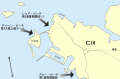 Inchon landing map (ja).svg 702 × 462; 126 KB
-
 Korea Straight topographic map ja.svg 347 × 235; 4.62 MB
-
 Korea-8provinces (ja).svg 800 × 1,245; 279 KB
-
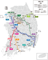 KTX linemap jp.svg 596 × 742; 576 KB
-
 Map of kara (Version Japanese characters).png 300 × 233; 121 KB
-
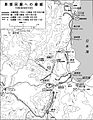
 Naktong Defense (ja).jpg 587 × 945; 284 KB
-
 P'ohang-dong Map 1 (ja).jpg 600 × 772; 216 KB
-
 Pusan Perimeter (ja).jpg 350 × 572; 102 KB
-
 Tsushima and Korea straits-ja.png 720 × 508; 82 KB
-
 Tsushima battle map-ja.svg 899 × 634; 201 KB
-
 Tsushima island ja.png 540 × 540; 59 KB
-


.jpg)
.svg)

.svg)

.png)
.jpg)
.jpg)
.jpg)
_-_btv1b530701876_(1_of_2).jpg)