Category:Japanese-language SVG maps showing history
Jump to navigation
Jump to search
Media in category "Japanese-language SVG maps showing history"
The following 26 files are in this category, out of 26 total.
-
 1025AD-ja.svg 3,338 × 1,198; 46 KB
-
 Agilulf's Italy(JP).svg 588 × 702; 67 KB
-
 Aistulf's Italy(JP).svg 604 × 682; 68 KB
-
 Battle of minatogawa-ja.svg 878 × 309; 129 KB
-
 Construction of the Yamanote Line ja.svg 392 × 383; 68 KB
-
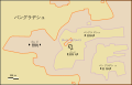 Dahala Khagrabari ja.svg 695 × 444; 6 KB
-
 Deportation of Jews by Assyrians.svg 600 × 423; 126 KB
-
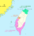 Dutch and Spanish Taiwan jp.svg 669 × 720; 215 KB
-
 Début guerre de cent ans-ja.svg 423 × 518; 65 KB
-
 Inchon landing map (ja).svg 702 × 462; 126 KB
-
 Korea-8provinces (ja).svg 800 × 1,245; 279 KB
-
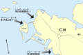
 Land boundary agreement map ja.svg 778 × 539; 76 KB
-

-
 Map Greece expansion 1832-1947 ja.svg 2,000 × 2,621; 3.37 MB
-
 Map of Lydia ancient times-ja.svg 400 × 277; 48 KB
-
 Reconquête Charles V-ja.svg 1,000 × 1,247; 234 KB
-
 Ten-goMap-ja.svg 714 × 654; 170 KB
-
 Treaty of Troyes-ja.svg 425 × 519; 37 KB
-
 Tsushima battle map-ja.svg 899 × 634; 201 KB
-
 アイヌの勢力範囲の拡大.svg 1,500 × 801; 129 KB
-
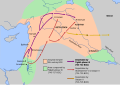
 イスラエル王国とユダ王国.svg 713 × 858; 51 KB
-
 博多「流」現代地図.svg.20240314.svg 780 × 800; 4.81 MB
-
 博多古地図20240306.png 3,088 × 2,713; 2.41 MB
-
 博多古地図20240306.svg 2,471 × 2,171; 3.55 MB
-
 哈密1436 ja.svg 2,320 × 1,551; 99 KB
-
 紀元前830年代のレバント地方の勢力図.svg 512 × 616; 56 KB
.svg)
.svg)


.svg)
.svg)


