Category:January 2020 in the East Riding of Yorkshire
Jump to navigation
Jump to search
Ceremonial counties of England: Bedfordshire · Berkshire · Buckinghamshire · Cambridgeshire · Cheshire · Cornwall · Derbyshire · Devon · Dorset · East Riding of Yorkshire · Essex · Greater London · Greater Manchester · Hampshire · Herefordshire · Hertfordshire · Kent · Lancashire · Leicestershire · Lincolnshire · Merseyside · Norfolk · North Yorkshire · Northumberland · Nottinghamshire · Oxfordshire · Somerset · South Yorkshire · Staffordshire · Suffolk · Surrey · Tyne and Wear · West Midlands · West Sussex · West Yorkshire · Wiltshire ·
City-counties: Bristol ·
Former historic counties:
Other former counties:
City-counties: Bristol ·
Former historic counties:
Other former counties:
Deutsch: Bilder, die im Januar 2020 in the East Riding of Yorkshire aufgenommen worden sind. Bitte beachten Sie, dass dies weder das Datum des Uploads noch das Datum des Scannens eines Fotos ist.
English: Images/pictures taken in the East Riding of Yorkshire during January 2020. Note this is not the date of the upload, nor the date a photo was scanned.
Español: Fotografías o imágenes tomadas en the East Riding of Yorkshire durante enero 2020. No es la fecha de subida ni escaneo, sino la fecha en que las fotografías o imágenes se crearon.
Esperanto: Bildoj faritaj en the East Riding of Yorkshire en januaro 2020. Tio ne estas la dato, kiam la bildoj estis alŝutitaj aŭ skanitaj.
Français : Photographies ou images prises en the East Riding of Yorkshire durant janvier 2020. Ce n'est pas la date du téléchargement ou du scan.
Galego: Fotografías ou imaxes tomadas en the East Riding of Yorkshire durante xaneiro 2020. Non é a data de subida nin escaneamento, senón a data na que se crearon as fotografías ou imaxes.
Italiano: Fotografie o immagini scattate a the East Riding of Yorkshire nel gennaio 2020. Nota bene: la data non si riferisce né a quella di upload né a quella in cui la foto è stata digitalizzata.
Norsk bokmål: Bilder tatt i the East Riding of Yorkshire i løpet av januar 2020. Merk at dette ikke er datoen for opplasting, eller når et bilde har blitt skannet.
Norsk nynorsk: Bilete teke i the East Riding of Yorkshire i løpet av januar 2020. Merk at dette ikkje er datoen for opplasting, eller når eit bilete har vorte skanna.
Русский: Изображения, сделанные в the East Riding of Yorkshire в течение январь 2020 (не дата загрузки изображения).
Українська: Зображення, зроблені в the East Riding of Yorkshire протягом січень 2020. Зауважте, що це не дата завантаження чи дата сканування фотографії.
| January 2019 | ← | January 2020 | → | January 2021 | |||||||
| Jan | Feb | Mar | Apr | May | Jun | Jul | Aug | Sep | Oct | Nov | Dec |
| 171 | 19 | 30 | 77 | 119 | 166 | 30 | 34 | 25 | 19 | 22 | 2 |
|---|---|---|---|---|---|---|---|---|---|---|---|
Subcategories
This category has only the following subcategory.
Media in category "January 2020 in the East Riding of Yorkshire"
The following 170 files are in this category, out of 170 total.
-
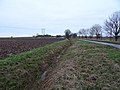
 Arthur Street (B1242), Withernsea (geograph 6375110).jpg 800 × 619; 106 KB
-
 Base of dismantled holiday chalet, Withernsea (geograph 6374811).jpg 800 × 556; 78 KB
-
 Beach and groynes, Withernsea (geograph 6375107).jpg 800 × 600; 72 KB
-
 Beach and groynes, Withernsea (geograph 6375108).jpg 640 × 480; 53 KB
-
 Beach at Withernsea (geograph 6382363).jpg 800 × 600; 61 KB
-
 Beach at Withernsea (geograph 6382364).jpg 800 × 600; 41 KB
-
 Beach at Withernsea (geograph 6382369).jpg 800 × 600; 54 KB
-
 Beach at Withernsea (geograph 6382378).jpg 800 × 600; 77 KB
-
 Beach at Withernsea (geograph 6382379).jpg 800 × 600; 47 KB
-
 Beach fishing, Withernsea (geograph 6382374).jpg 800 × 561; 56 KB
-
 Bend in Hull Road (geograph 6362831).jpg 640 × 480; 59 KB
-
 Bend in Skeffling Road (B1445), Weeton (geograph 6376387).jpg 5,184 × 3,888; 6.03 MB
-
 Beverley Road towards Whitedale (geograph 6362564).jpg 800 × 600; 91 KB
-
 Beverley Road, Whitedale (geograph 6362174).jpg 4,398 × 3,135; 2.88 MB
-
 Beverley Road, Whitedale (geograph 6362175).jpg 3,902 × 2,899; 2.72 MB
-
 Black Mill Farm and windmill (geograph 6379079).jpg 800 × 600; 98 KB
-
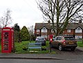
 Burstwick Village Store and Post Office (geograph 6366652).jpg 640 × 448; 57 KB
-

-

-

-
 Captain Williams restaurant, Withernsea (geograph 6382370).jpg 800 × 549; 78 KB
-
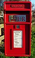
 Close up, Elizabeth II postbox on Beverley Road, Whitedale (geograph 6362171).jpg 2,447 × 4,086; 3.17 MB
-
 Cowden Lane (geograph 6362864).jpg 800 × 600; 96 KB
-
 Crop field near Park Farm (geograph 6362563).jpg 800 × 600; 145 KB
-
 Crop field near Weeton (geograph 6376391).jpg 800 × 600; 95 KB
-
 Crop field off Welwick Road (geograph 6379076).jpg 800 × 600; 92 KB
-
 Crop field, Rysome Garth (geograph 6376368).jpg 800 × 600; 107 KB
-
 Defibrillator in K6 telephone box on Main Street, Withernwick (geograph 6362853).jpg 2,303 × 4,044; 2.6 MB
-
 Drain and field off Cowden Lane (geograph 6362857).jpg 800 × 541; 125 KB
-
 Drain beside Holmpton Road (geograph 6376298).jpg 800 × 600; 128 KB
-
 Drain beside Northfield Lane (geograph 6376307).jpg 800 × 600; 109 KB
-
 Drain beside Welwick Road (B1445) (geograph 6378436).jpg 800 × 600; 99 KB
-
 Drive to Withernwick Hall (geograph 6362845).jpg 800 × 600; 192 KB
-
 East Yorkshire bus on Hariff Lane, Burstwick (geograph 6367133).jpg 800 × 681; 99 KB
-

-

-
 Eastfield House Farm (geograph 6376301).jpg 800 × 600; 91 KB
-
 Ebor House, Bridlington (geograph 6358069).jpg 3,924 × 3,210; 2.53 MB
-

-
 Elizabeth II postbox and telephone box on Main Street, Welwick (geograph 6376416).jpg 4,408 × 3,355; 3.68 MB
-
 Elizabeth II postbox on Beverley Road, Whitedale (geograph 6362168).jpg 640 × 545; 166 KB
-
-
 Elizabeth II postbox on Hull Road, Withernsea (geograph 6373500).jpg 351 × 640; 63 KB
-
 Elizabeth II postbox on Main Street, Welwick (geograph 6376414).jpg 2,056 × 4,033; 1.43 MB
-

-

-

-
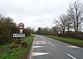
 Entering Weeton (geograph 6378151).jpg 800 × 591; 71 KB
-
 Entering Welwick (geograph 6378158).jpg 800 × 568; 112 KB
-
 Entering Withernsea (geograph 6374809).jpg 640 × 480; 65 KB
-

-
 Field entrance off the B1445 (geograph 6378153).jpg 800 × 600; 109 KB
-
 Field margin off the B1445 (geograph 6378435).jpg 800 × 600; 118 KB
-
 Field near Withernwick Grange (geograph 6362833).jpg 800 × 600; 161 KB
-
 Field off Withernwick Lane (geograph 6362957).jpg 800 × 600; 103 KB
-
 Foresters Hall, Withernwick (geograph 6362856).jpg 800 × 526; 105 KB
-
 Former Whitedale Station (geograph 6362572).jpg 800 × 606; 152 KB
-
 Former Whitedale Station House (geograph 6362575).jpg 800 × 653; 155 KB
-

-
 George V postbox on Main Street, Withernwick (geograph 6362406).jpg 1,956 × 3,601; 1.59 MB
-
 George VI postbox on North Road, Withernsea (geograph 6373520).jpg 305 × 640; 50 KB
-

-
 Grassland off Hull Road (geograph 6362830).jpg 5,184 × 3,888; 7.93 MB
-
 Gunpowder plot sculpture (geograph 6378434).jpg 800 × 636; 180 KB
-
 Hairdressers on Queen Street, Withernsea (geograph 6372854).jpg 4,629 × 2,900; 2.37 MB
-
 Hariff Lane, Burstwick (geograph 6366653).jpg 4,245 × 3,765; 3.1 MB
-
 Heywood Farm (geograph 6364092).jpg 800 × 600; 142 KB
-
 Holiday chalets, Withernsea (geograph 6374812).jpg 800 × 600; 106 KB
-
 Holiday chalets, Withernsea (geograph 6374813).jpg 640 × 384; 52 KB
-
 Holmpton Road, Withernsea (geograph 6373549).jpg 640 × 480; 106 KB
-
 Holmpton Road, Withernsea (geograph 6373550).jpg 4,644 × 3,397; 4.55 MB
-
 House on Holmpton Road, Withernsea (geograph 6373548).jpg 4,797 × 3,022; 2.51 MB
-
 House on Main Street, Welwick (geograph 6378428).jpg 800 × 600; 101 KB
-
 House on Main Street, Welwick (geograph 6378430).jpg 640 × 480; 63 KB
-
 House on Queen Street North, Withernsea (geograph 6372889).jpg 4,262 × 2,976; 1.86 MB
-
 House on Skeffling Road, Weeton (geograph 6376427).jpg 5,184 × 3,888; 5.83 MB
-
 Houses on Hull Road, Withernsea (geograph 6373502).jpg 3,971 × 2,808; 1.97 MB
-
 Houses on Main Street, Burstwick (geograph 6367454).jpg 640 × 417; 69 KB
-
 Houses on North Promenade, Withernsea (geograph 6382375).jpg 640 × 431; 63 KB
-
 Houses on Queen Street North, Withernsea (geograph 6373540).jpg 4,753 × 3,318; 2.59 MB
-
 Houses on Queen Street, Withernsea (geograph 6372901).jpg 4,705 × 2,821; 2.53 MB
-
 Houses on Queen Street, Withernsea (geograph 6374818).jpg 800 × 594; 99 KB
-
 Houses on Queen Street, Withernsea (geograph 6375105).jpg 800 × 562; 77 KB
-
 Hull Road (B1362), Withernsea (geograph 6373505).jpg 800 × 615; 86 KB
-
 Hull Road (B1362), Withernsea (geograph 6373506).jpg 4,091 × 2,945; 1.94 MB
-
 Industrial unit on Beverley Road, Whitedale (geograph 6362173).jpg 3,987 × 3,003; 3.67 MB
-
 K6 telephone box on Main Street, Welwick (geograph 6378163).jpg 480 × 640; 84 KB
-
 K6 telephone box on Main Street, Withernwick (geograph 6362852).jpg 800 × 558; 163 KB
-
 Main Street (B1445), Welwick (geograph 6376419).jpg 640 × 403; 51 KB
-
 Main Street (B1445), Welwick (geograph 6376421).jpg 4,341 × 3,190; 3.76 MB
-
 Main Street, Burstwick (geograph 6367455).jpg 4,770 × 3,491; 3.72 MB
-
 Memorial Gardens, Withernsea (geograph 6382384).jpg 800 × 600; 76 KB
-
 North Cliff (geograph 6365628).jpg 1,024 × 768; 124 KB
-
 North edge of the golf course (geograph 6365670).jpg 1,024 × 768; 146 KB
-
 North Promenade, Withernsea (geograph 6365690).jpg 1,024 × 768; 103 KB
-
 North Road (B1242), Withernsea (geograph 6373524).jpg 4,699 × 3,190; 2.52 MB
-
 North Road (B1242), Withernsea (geograph 6373525).jpg 5,184 × 3,888; 4.63 MB
-
 North Road (B1242), Withernsea (geograph 6375109).jpg 800 × 600; 88 KB
-
 Park Farm (geograph 6362562).jpg 640 × 480; 103 KB
-
 Path above the beach, Withernsea (geograph 6382366).jpg 800 × 600; 70 KB
-
 Platform, former Whitedale Station (geograph 6362586).jpg 800 × 600; 223 KB
-
 Post Office on Main Street, Withernwick (geograph 6362409).jpg 800 × 548; 131 KB
-
 Post Office on Main Street, Withernwick (geograph 6362410).jpg 4,935 × 3,552; 3.89 MB
-
 Post Office on Queen Street, Withernsea (geograph 6372860).jpg 3,748 × 2,780; 1.67 MB
-
 Post Office on Queen Street, Withernsea (geograph 6372861).jpg 4,399 × 3,046; 2.44 MB
-
 Power lines over crop field (geograph 6376373).jpg 800 × 566; 54 KB
-
 Princes Avenue, Withernsea (geograph 6372856).jpg 640 × 407; 69 KB
-
 Queen Street (A1033), Withernsea (geograph 6372863).jpg 4,080 × 3,014; 2.68 MB
-
 Queen Street North, Withernsea (geograph 6372890).jpg 4,487 × 3,342; 2.93 MB
-
 Queen Street North, Withernsea (geograph 6373541).jpg 5,184 × 3,888; 3.44 MB
-
 Queen Street North, Withernsea (geograph 6373542).jpg 4,002 × 2,778; 2.41 MB
-
 Queen Street, Withernsea (geograph 6372904).jpg 480 × 640; 57 KB
-
 Queen Victoria Jubilee Lamp, Withernsea (geograph 6374819).jpg 800 × 600; 109 KB
-
 Queen Victoria Jubilee Lamp, Withernsea (geograph 6374820).jpg 600 × 800; 104 KB
-
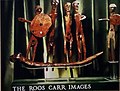 Reconstuction of Roos Carr figures from Museum poster.jpg 3,419 × 2,592; 1.02 MB
-
 Red House Farm, Weeton (geograph 6376374).jpg 800 × 557; 70 KB
-
 Red House on Holmpton Road (geograph 6374808).jpg 800 × 600; 115 KB
-
 Roos Carr figurines not mounted on boat, with shields.jpg 2,592 × 2,761; 322 KB
-
 Route 1033 Bar & Grill, Withernsea (geograph 6374821).jpg 671 × 800; 127 KB
-
 Seafront, Owthorne (geograph 6365626).jpg 1,024 × 768; 159 KB
-
 Service station on Hollym Road, Withernsea (geograph 6372907).jpg 5,166 × 3,021; 2.76 MB
-
 Sign for the Alma, Withernsea (geograph 6375104).jpg 540 × 640; 56 KB
-
 Sign for the Butterfly public house, Withernsea (geograph 6374837).jpg 641 × 800; 103 KB
-
 Sign for the Coach & Horses, Welwick (geograph 6378166).jpg 800 × 775; 132 KB
-
 Sign for the Commercial, Withernsea (geograph 6382372).jpg 640 × 800; 94 KB
-
 Sign for the Duke of York, Skirlaugh - geograph.org.uk - 6364115.jpg 591 × 800; 105 KB
-
 Sign for the Old Boatshed Bar, Withernsea (geograph 6375023).jpg 554 × 800; 80 KB
-
 Sign for the Pier Hotel, Withernsea (geograph 6375019).jpg 564 × 800; 86 KB
-

-
 Skeffling Road (B1445), Weeton (geograph 6376429).jpg 640 × 395; 72 KB
-
 Skeffling Road (geograph 6378155).jpg 800 × 600; 133 KB
-
 St Helen's Church Kilnsea (Geograph 6378130).jpg 800 × 600; 126 KB
-
 St Mary's Church, Welwick (geograph 6378167).jpg 800 × 600; 118 KB
-
 St Mary's Church, Welwick (geograph 6378168).jpg 800 × 608; 121 KB
-
 St Matthews Church, Withernsea (geograph 6375013).jpg 800 × 478; 68 KB
-
 Supermarket, Withernsea (geograph 6374814).jpg 800 × 600; 71 KB
-
 Terraced housing on Queen Street, Withernsea (geograph 6375106).jpg 800 × 600; 89 KB
-
 The Alma, Withernsea (geograph 6375102).jpg 800 × 472; 77 KB
-
 The Alma, Withernsea (geograph 6375103).jpg 800 × 478; 69 KB
-
 The Butterfly public house, Withernsea (geograph 6374836).jpg 800 × 655; 100 KB
-
 The Coach & Horses, Welwick (geograph 6378165).jpg 800 × 556; 74 KB
-
 The Commercial public house, Withernsea (geograph 6374823).jpg 800 × 536; 80 KB
-
 The Falcon, Withernwick (geograph 6362849).jpg 800 × 600; 130 KB
-
 The Falcon, Withernwick (geograph 6362851).jpg 800 × 600; 101 KB
-
 The footpath is marked on this side of the hedge (geograph 6365654).jpg 1,024 × 768; 211 KB
-
 The Old Boatshed Bar, Withernsea (geograph 6375020).jpg 800 × 600; 85 KB
-
 The Pier Hotel, Withernsea (geograph 6375017).jpg 640 × 439; 50 KB
-
-
 The Spread Eagle public house, Withernsea (geograph 6375006).jpg 800 × 499; 81 KB
-
 Trans Pennine Trail near Castle Hill (geograph 6369360).jpg 800 × 533; 121 KB
-
 United Reformed Church, Withernsea (geograph 6374817).jpg 800 × 487; 89 KB
-
 Wakefield Lane towards Holmpton (geograph 6376303).jpg 800 × 600; 68 KB
-
 War Memorial and gardens, Withernsea (geograph 6382380).jpg 640 × 480; 59 KB
-
 War Memorial, Welwick (geograph 6378159).jpg 800 × 600; 198 KB
-
 War Memorial, Welwick (geograph 6378161).jpg 600 × 800; 187 KB
-
 Weeton North Lane (geograph 6376366).jpg 800 × 600; 144 KB
-
 Weeton North Lane (geograph 6376370).jpg 800 × 600; 82 KB
-
 Welwick Road (B1445) (geograph 6379077).jpg 800 × 600; 104 KB
-
 Wesleyan Sabbath School, Withernwick (geograph 6362854).jpg 800 × 600; 91 KB
-
 Where east meets west (geograph 6379081).jpg 800 × 600; 135 KB
-
 Whitedale Cottages (geograph 6362566).jpg 800 × 600; 105 KB
-
 Wind turbines north of Cowden Lane (geograph 6362861).jpg 715 × 800; 92 KB
-
 Wind turbines off Cowden Lane (geograph 6362860).jpg 800 × 607; 67 KB
-
 Winter field off Wakefield Lane (geograph 6376302).jpg 800 × 600; 107 KB
-
 Withernsea Golf Club (geograph 6365688).jpg 1,024 × 768; 148 KB
-
 Withernsea High School (geograph 6375011).jpg 800 × 600; 107 KB
-
 Withernsea Lighthouse (geograph 6375014).jpg 600 × 800; 67 KB
-
 Withernsea Pier towers (geograph 6382376).jpg 800 × 600; 83 KB
-
 Withernwick Lane towards Cowden (geograph 6362960).jpg 800 × 600; 89 KB
-
 Withernwick Road (geograph 6362846).jpg 800 × 527; 116 KB
,_Withernsea_(geograph_6375110).jpg)
.jpg)
.jpg)
.jpg)
.jpg)
.jpg)
.jpg)
.jpg)
.jpg)
.jpg)
.jpg)
,_Weeton_(geograph_6376387).jpg)
.jpg)
.jpg)
.jpg)
.jpg)
.jpg)
_-_geograph.org.uk_-_6368146.jpg)
.jpg)
.jpg)
.jpg)
.jpg)
.jpg)
.jpg)
.jpg)
.jpg)
.jpg)
.jpg)
.jpg)
.jpg)
.jpg)
_(geograph_6378436).jpg)
.jpg)
.jpg)
.jpg)
,_Hollym_-_geograph.org.uk_-_6374800.jpg)
.jpg)
.jpg)
.jpg)
.jpg)
.jpg)
.jpg)
.jpg)
.jpg)
.jpg)
.jpg)
.jpg)
.jpg)
.jpg)
.jpg)
.jpg)
.jpg)
.jpg)
.jpg)
.jpg)
.jpg)
.jpg)
.jpg)
.jpg)
.jpg)
.jpg)
.jpg)
.jpg)
.jpg)
.jpg)
.jpg)
.jpg)
.jpg)
.jpg)
.jpg)
.jpg)
.jpg)
.jpg)
.jpg)
.jpg)
.jpg)
.jpg)
.jpg)
.jpg)
.jpg)
.jpg)
.jpg)
.jpg)
,_Withernsea_(geograph_6373505).jpg)
,_Withernsea_(geograph_6373506).jpg)
.jpg)
.jpg)
.jpg)
,_Welwick_(geograph_6376419).jpg)
,_Welwick_(geograph_6376421).jpg)
.jpg)
.jpg)
.jpg)
.jpg)
.jpg)
,_Withernsea_(geograph_6373524).jpg)
,_Withernsea_(geograph_6373525).jpg)
,_Withernsea_(geograph_6375109).jpg)
.jpg)
.jpg)
.jpg)
.jpg)
.jpg)
.jpg)
.jpg)
.jpg)
.jpg)
,_Withernsea_(geograph_6372863).jpg)
.jpg)
.jpg)
.jpg)
.jpg)
.jpg)
.jpg)

.jpg)
.jpg)

.jpg)
.jpg)
.jpg)
.jpg)
.jpg)
.jpg)
.jpg)

.jpg)
.jpg)
.jpg)
,_Weeton_(geograph_6376429).jpg)
.jpg)
.jpg)
.jpg)
.jpg)
.jpg)
.jpg)
.jpg)
.jpg)
.jpg)
.jpg)
.jpg)
.jpg)
.jpg)
.jpg)
.jpg)
.jpg)
.jpg)
.jpg)
.jpg)
.jpg)
.jpg)
.jpg)
.jpg)
.jpg)
.jpg)
.jpg)
_(geograph_6379077).jpg)
.jpg)
.jpg)
.jpg)
.jpg)
.jpg)
.jpg)
.jpg)
.jpg)
.jpg)
.jpg)
.jpg)
.jpg)
.jpg)