Category:January 2008 Ireland photographs
Jump to navigation
Jump to search
Countries of Europe: Albania · Andorra · Armenia‡ · Austria · Azerbaijan‡ · Belarus · Belgium · Bosnia and Herzegovina · Bulgaria · Croatia · Czech Republic · Denmark · Estonia · Finland · France‡ · Georgia‡ · Germany · Greece · Hungary · Iceland · Republic of Ireland · Italy · Latvia · Lithuania · Malta · Netherlands‡ · Norway · Poland · Portugal‡ · Romania · Russia‡ · Serbia · Slovakia · Slovenia · Spain‡ · Sweden · Switzerland · Turkey‡ · Ukraine · United Kingdom · Vatican City
Specific status: Isle of Man · Jersey – Limited recognition: Kosovo
‡: partly located in Europe
Specific status: Isle of Man · Jersey – Limited recognition: Kosovo
‡: partly located in Europe
English: Images taken in Ireland during this month of 2008 (not the date of the upload). With CatScan, this allows one to browse any Ireland-related category by year or month. Images should be placed directly in this category, not in subcategories. Note: Images from 2008 should be also added into the appropriate province, territory or city category of Category:2008 photographs of Ireland.
| Jan | Feb | Mar | Apr | May | Jun | Jul | Aug | Sep | Oct | Nov | Dec | ||
| ← | 61 | 129 | 107 | 117 | 406 | 98 | 328 | 929 | 120 | 127 | 55 | 92 | → |
|---|
Media in category "January 2008 Ireland photographs"
The following 61 files are in this category, out of 61 total.
-
 'A Day In The Bog' - geograph.org.uk - 665950.jpg 640 × 427; 57 KB
-
 Pawnbroker, Queen Street - geograph.org.uk - 664817.jpg 640 × 480; 77 KB
-
 Trinity College Football Dublin Ireland.JPG 2,592 × 1,944; 1.97 MB
-
 Trinity College Kunstwerk Dublin Ireland.JPG 2,592 × 1,944; 2.07 MB
-
 Trinity College Sportterrein Dublin Ireland.JPG 2,592 × 1,944; 2.14 MB
-
 Glendalough4259.JPG 3,888 × 2,592; 2.38 MB
-
 Busaras.jpg 2,904 × 1,297; 1.57 MB
-
 Alkill - geograph.org.uk - 673227.jpg 640 × 479; 67 KB
-
 Alkill Townland - geograph.org.uk - 673211.jpg 640 × 479; 47 KB
-
 Alkill Townland - geograph.org.uk - 673225.jpg 640 × 479; 54 KB
-
 Annacramp Townland - geograph.org.uk - 673231.jpg 640 × 479; 70 KB
-
 Annacramp Townland - geograph.org.uk - 673233.jpg 640 × 479; 82 KB
-
 Annacramp Townland - geograph.org.uk - 673239.jpg 640 × 479; 112 KB
-
 Ardgonnell Townland - geograph.org.uk - 673268.jpg 640 × 268; 37 KB
-
 Arless4311.jpg 3,888 × 2,592; 2.74 MB
-
 Arless4315.jpg 3,888 × 2,592; 3.28 MB
-
 Ballintemple village.jpg 3,072 × 2,304; 2.82 MB
-
 Ballyseedy memorial.JPG 2,859 × 1,904; 2.57 MB
-
 Bessmount Townland - geograph.org.uk - 673361.jpg 640 × 479; 52 KB
-

-
 Broadmeadow estuary sunset.jpg 640 × 480; 63 KB
-
 Camlagh Townland - geograph.org.uk - 663823.jpg 640 × 479; 67 KB
-
 Camlagh Townland - geograph.org.uk - 663830.jpg 640 × 479; 85 KB
-
 Camlagh Townland - geograph.org.uk - 663832.jpg 640 × 479; 74 KB
-
 Cavanaregh Townland - geograph.org.uk - 673346.jpg 640 × 479; 41 KB
-
 Cavanreagh Townland - geograph.org.uk - 133749.jpg 640 × 479; 126 KB
-
 Cork Airport at Night - geograph.org.uk - 666001.jpg 640 × 480; 54 KB
-
 Cottage at Crumlin - geograph.org.uk - 673354.jpg 640 × 262; 39 KB
-
 Donegal Town Hardware - geograph.org.uk - 663289.jpg 640 × 480; 73 KB
-
 Dublin Trinity College Henry Moore.jpg 3,888 × 2,592; 8.79 MB
-
 Dunamase23.JPG 3,888 × 2,592; 2.71 MB
-
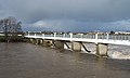
 Flooded River Nore - geograph.org.uk - 680514.jpg 600 × 400; 116 KB
-
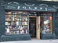 Foley's Off Licence, Sligo.JPG 2,848 × 2,136; 1.24 MB
-
 Garran Townland - geograph.org.uk - 673246.jpg 640 × 479; 69 KB
-
 Grange Road Esso Station - geograph.org.uk - 666445.jpg 640 × 480; 66 KB
-
 Heading east to Bessmount - geograph.org.uk - 673358.jpg 640 × 479; 48 KB
-
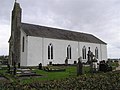 Killyneill RC Church - geograph.org.uk - 673303.jpg 640 × 479; 49 KB
-
 LeavingMountrath4328.jpg 3,137 × 2,141; 1.11 MB
-
 Picnic spot in the Barnes Gap - geograph.org.uk - 662181.jpg 640 × 480; 90 KB
-
 Race Course Footbridge, Listowel - geograph.org.uk - 665971.jpg 640 × 386; 52 KB
-
 Road at Alkill - geograph.org.uk - 673221.jpg 640 × 479; 57 KB
-
 Road at Annacramp - geograph.org.uk - 673238.jpg 640 × 264; 51 KB
-
 Road at Camlagh - geograph.org.uk - 663825.jpg 640 × 479; 45 KB
-
 Road at Cavanreagh - geograph.org.uk - 673257.jpg 640 × 479; 50 KB
-
 Road at Crumlin - geograph.org.uk - 673356.jpg 640 × 479; 69 KB
-
 Road at Drumgool - geograph.org.uk - 673330.jpg 640 × 479; 50 KB
-
 Road at Drumnagelvin - geograph.org.uk - 673292.jpg 640 × 479; 54 KB
-
 Road at Knockacunnier - geograph.org.uk - 673319.jpg 640 × 479; 58 KB
-
 Road near Cavanreagh - geograph.org.uk - 673348.jpg 640 × 479; 47 KB
-
 Roadside Cottage - geograph.org.uk - 680488.jpg 640 × 427; 77 KB
-
 RockDunmase22.jpg 3,888 × 2,592; 2.48 MB
-
 RoscR361.jpg 3,509 × 2,050; 6.77 MB
-
 Rough Island - geograph.org.uk - 652763.jpg 640 × 480; 44 KB
-
 Statoil Filling Station - geograph.org.uk - 673264.jpg 640 × 479; 52 KB
-
 Tawnydorragh Townland - geograph.org.uk - 663634.jpg 640 × 479; 63 KB
-
 Termon River - geograph.org.uk - 663323.jpg 640 × 479; 83 KB
-
 The Bridge, Inishcarra, County Cork - geograph.org.uk - 731377.jpg 640 × 480; 171 KB
-
 The Lowerymore river - geograph.org.uk - 662188.jpg 640 × 480; 129 KB
-
 Touching Down - geograph.org.uk - 667538.jpg 640 × 480; 42 KB
-
 ViewFromDunamase.JPG 3,888 × 2,592; 2.17 MB
-
 Yeats by Rowan Gillespie.jpg 397 × 611; 338 KB


