Category:August 2008 Ireland photographs
Jump to navigation
Jump to search
English: Images taken in Ireland during this month of 2008 (not the date of the upload). With CatScan, this allows one to browse any Ireland-related category by year or month. Images should be placed directly in this category, not in subcategories. Note: Images from 2008 should be also added into the appropriate province, territory or city category of Category:2008 photographs of Ireland.
| Jan | Feb | Mar | Apr | May | Jun | Jul | Aug | Sep | Oct | Nov | Dec | ||
| ← | 62 | 128 | 105 | 118 | 408 | 99 | 328 | 125 | 119 | 128 | 56 | 88 | → |
|---|
Subcategories
This category has only the following subcategory.
Media in category "August 2008 Ireland photographs"
The following 124 files are in this category, out of 124 total.
-
 Main Street Blessington - geograph.org.uk - 930140.jpg 640 × 480; 83 KB
-

-
 Austin Clarke 1896-1974.jpg 2,304 × 1,728; 1.88 MB
-
 Eilis Dillon 1920-1994.jpg 2,304 × 1,728; 1.86 MB
-
 Sean OCasey 1880-1964.jpg 2,304 × 1,728; 1.93 MB
-
 Richmond Penitentiary St Brendan's Mental Hospital Richmond Lunatic Asylum Grangegorman.jpg 3,264 × 2,448; 2.69 MB
-
 Whitworth Hospital.jpg 2,448 × 3,264; 4.46 MB
-
 NewYam-IgboFestival-Dublin.jpg 1,024 × 747; 544 KB
-
 Shelbourne,-Dublin.jpg 2,924 × 2,764; 4.91 MB
-
 Achill Sound Library - geograph.org.uk - 919853.jpg 640 × 480; 53 KB
-
 Ahascragh.JPG 3,888 × 2,592; 4.77 MB
-
 Amazing Monkey Puzzle Tree, Copany - geograph.org.uk - 944885.jpg 480 × 640; 148 KB
-
-
 Anascaul Lake - geograph.org.uk - 913414.jpg 640 × 426; 62 KB
-
 Ancient wall of The Ring - geograph.org.uk - 908224.jpg 640 × 480; 142 KB
-
 Apartments Tullamore Co.Offaly - geograph.org.uk - 1365260.jpg 640 × 457; 343 KB
-
 Apprentice 2008.jpg 1,600 × 1,200; 499 KB
-
 Approach to Kilbarron Castle - geograph.org.uk - 943154.jpg 640 × 480; 116 KB
-
 Ardmore Beach, Waterford, Ireland.jpg 1,600 × 1,200; 726 KB
-
 Art and Tourist Shop, Doogort - geograph.org.uk - 919290.jpg 640 × 480; 59 KB
-
 Ballycowan Castle, Co. Offaly - geograph.org.uk - 942610.jpg 640 × 480; 63 KB
-
 BallymacedwardPO.JPG 3,413 × 1,969; 4.39 MB
-
 Belle's Island - geograph.org.uk - 914349.jpg 640 × 480; 43 KB
-
 Birr Castle gardens - geograph.org.uk - 1362087.jpg 640 × 457; 460 KB
-
 Bridge Centre Tullamore Co.Offaly - geograph.org.uk - 1365266.jpg 640 × 457; 258 KB
-
 Bridge House Hotel Tullamore Co.Offaly - geograph.org.uk - 1365279.jpg 640 × 457; 267 KB
-
 Bridge Street Tullamore Co.Offaly - geograph.org.uk - 1365235.jpg 640 × 457; 467 KB
-
 Bridge Street Tullamore Co.Offaly - geograph.org.uk - 1365243.jpg 640 × 457; 315 KB
-
 Bridge Street Tullamore Co.Offaly - geograph.org.uk - 1365272.jpg 640 × 457; 325 KB
-
 Camcor river - geograph.org.uk - 1361955.jpg 640 × 457; 437 KB
-
 Camcor river - geograph.org.uk - 1361958.jpg 640 × 457; 388 KB
-
 Camcor river - geograph.org.uk - 1364530.jpg 640 × 457; 420 KB
-
 Car park Tullamore Co.Offaly - geograph.org.uk - 1365252.jpg 640 × 457; 339 KB
-
 Carraroe Banner.jpg 3,029 × 433; 272 KB
-
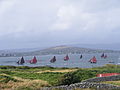 Carraroe boats.jpg 3,072 × 2,304; 1.32 MB
-
 Castle at Ballymacaward - geograph.org.uk - 943274.jpg 640 × 480; 77 KB
-
 Church of Ireland, Ballintra - geograph.org.uk - 913408.jpg 640 × 480; 80 KB
-
 Clonmacnoise landing stage - geograph.org.uk - 1349079.jpg 640 × 457; 312 KB
-
 Clonmacnoise landing stage - geograph.org.uk - 1349081.jpg 640 × 457; 326 KB
-
 Clonmacnoise landing stage - geograph.org.uk - 1349091.jpg 640 × 457; 290 KB
-
 Collumcillie Street Tullamore Co.Offaly - geograph.org.uk - 1365228.jpg 640 × 457; 302 KB
-
 Collumcillie Street Tullamore Co.Offaly - geograph.org.uk - 1365230.jpg 640 × 457; 295 KB
-
 Collumcillie Street Tullamore Co.Offaly - geograph.org.uk - 1365231.jpg 640 × 457; 332 KB
-
 Donegal Harbour - geograph.org.uk - 914686.jpg 640 × 480; 67 KB
-
 Doogort Pier - geograph.org.uk - 919339.jpg 640 × 480; 64 KB
-
 Doogort Sewerage Scheme - geograph.org.uk - 919344.jpg 640 × 480; 80 KB
-
 Doogort Shop - geograph.org.uk - 919282.jpg 640 × 480; 54 KB
-
 Door to The Ring - geograph.org.uk - 908183.jpg 640 × 480; 120 KB
-
 Dromod Garda Station - geograph.org.uk - 918939.jpg 640 × 480; 66 KB
-
 Drummenny Bridge - geograph.org.uk - 935266.jpg 480 × 640; 131 KB
-
 Dublin airport.jpg 3,584 × 2,016; 2.92 MB
-
 EnniscorthyCastle.jpg 2,048 × 1,536; 1.04 MB
-
 Four apostles sculpture - geograph.org.uk - 1365139.jpg 480 × 640; 357 KB
-
 Garda headquarters Tullamore Co.Offaly - geograph.org.uk - 1365303.jpg 640 × 457; 270 KB
-
 Glencairn0808.JPG 3,614 × 2,392; 2.03 MB
-

-

-

-

-
 Hartley Bridge - geograph.org.uk - 918953.jpg 640 × 480; 71 KB
-
 Heading out St. John's Point Peninsula - geograph.org.uk - 920787.jpg 640 × 480; 118 KB
-
 Holiday Homes in Doogort - geograph.org.uk - 919298.jpg 640 × 480; 65 KB
-
 Homes in Drumkeelan - geograph.org.uk - 916191.jpg 480 × 640; 103 KB
-
 Kilbride Street Tullamore Co.Offaly - geograph.org.uk - 1365339.jpg 640 × 457; 282 KB
-
 Kings River - geograph.org.uk - 932680.jpg 640 × 480; 48 KB
-
 Kings River Valley and Beyond - geograph.org.uk - 932685.jpg 640 × 480; 61 KB
-
 Lake Assaroe in the Rain - geograph.org.uk - 943744.jpg 640 × 480; 87 KB
-
 Lough Currane.jpg 1,600 × 1,200; 401 KB
-
 Lough Glencoagh - geograph.org.uk - 916202.jpg 480 × 640; 112 KB
-
 M8 M-F scheme, August 2008.jpg 1,024 × 1,280; 264 KB
-
 M8 tie-in, August 2008 .jpg 1,024 × 1,067; 226 KB
-
 Marina on the River Shannon - geograph.org.uk - 919082.jpg 640 × 480; 56 KB
-
 Martin hayes.jpg 217 × 270; 59 KB
-
 Medieval hospital at Newtown Trim - geograph.org.uk - 942583.jpg 640 × 480; 61 KB
-
 Minor Road through Doogort - geograph.org.uk - 919296.jpg 640 × 480; 55 KB
-
 Mulroy bay - geograph.org.uk - 910829.jpg 640 × 480; 78 KB
-
 N21 near Castelisland - geograph.org.uk - 1359241.jpg 640 × 457; 277 KB
-
 N21 near Castelisland - geograph.org.uk - 1359247.jpg 640 × 457; 283 KB
-
 Near Bury Quai Tullamore Co.Offaly - geograph.org.uk - 1365123.jpg 640 × 457; 357 KB
-
 NearWoodlawnGalway.JPG 3,126 × 1,930; 1.05 MB
-

-
 Oxmanton bridge - geograph.org.uk - 1364738.jpg 640 × 457; 355 KB
-
 Parnell Street Tullamore Co.Offaly - geograph.org.uk - 1365326.jpg 640 × 457; 268 KB
-
 Parnell Street Tullamore Co.Offaly - geograph.org.uk - 1365337.jpg 640 × 457; 254 KB
-

-
 Polestar at Port Bridge - geograph.org.uk - 910693.jpg 640 × 480; 56 KB
-
 R348roadIreland.JPG 2,436 × 2,231; 744 KB
-
 R350road.jpg 3,844 × 2,310; 5.57 MB
-
 R359 past Woodlawn.JPG 3,056 × 2,224; 1.42 MB
-
 R359roadGalway.JPG 3,888 × 2,592; 1.53 MB
-
 River Shannon flood meadows - geograph.org.uk - 1349092.jpg 640 × 457; 297 KB
-
 River Shannon flood meadows - geograph.org.uk - 1349094.jpg 640 × 457; 292 KB
-
 River Shannon flood meadows - geograph.org.uk - 1349096.jpg 640 × 457; 315 KB
-
 Road from Rossnakill to Kerrykeel - geograph.org.uk - 910846.jpg 640 × 480; 73 KB
-
 Road to Drumkeelan from Mountcharles - geograph.org.uk - 916214.jpg 480 × 640; 128 KB
-
 Road to Lough Salt - geograph.org.uk - 400047.jpg 640 × 480; 61 KB
-
 Road to Rossnakill from Kerrykeel - geograph.org.uk - 910856.jpg 609 × 458; 65 KB
-
 Rory Gallagher Corner Dublin.JPG 1,024 × 768; 343 KB
-
 Rough Island, Mulroy bay - geograph.org.uk - 910838.jpg 640 × 480; 59 KB
-
 Shopping Centre Tullamore Co.Offaly - geograph.org.uk - 1365246.jpg 640 × 457; 305 KB
-
 Sisters of Mercy Church, Achill Sound - geograph.org.uk - 919861.jpg 640 × 480; 64 KB
-
 Slieve Russell Hotel and Golf Course - geograph.org.uk - 910359.jpg 640 × 469; 109 KB
-
 Sneem Ring of Kerry - geograph.org.uk - 1361414.jpg 640 × 457; 340 KB
-
 Sneem Ring of Kerry - geograph.org.uk - 1361428.jpg 640 × 457; 326 KB
-
 Sneem river - geograph.org.uk - 1361399.jpg 640 × 457; 425 KB
-
 Square and Rectangle Rocks - geograph.org.uk - 943172.jpg 640 × 480; 113 KB
-
 St. Ernan's Island - geograph.org.uk - 914354.jpg 640 × 390; 50 KB
-
 St. Thomas Church, Doogort - geograph.org.uk - 919304.jpg 640 × 480; 64 KB
-
 Stone wall near Leghawny - geograph.org.uk - 908133.jpg 480 × 640; 111 KB
-
 Supermarket and petrol station - geograph.org.uk - 1360027.jpg 640 × 457; 258 KB
-

-
 The Cottage Coffee Shop, Doogort - geograph.org.uk - 919289.jpg 640 × 480; 62 KB
-
 The Michael Davitt Bridge - geograph.org.uk - 919852.jpg 640 × 480; 76 KB
-
 The Mouth of the Swilly - geograph.org.uk - 937001.jpg 640 × 480; 29 KB
-
 The Ring wall - geograph.org.uk - 908216.jpg 480 × 640; 125 KB
-
 The Ring, Leghawny - geograph.org.uk - 908163.jpg 640 × 480; 114 KB
-
 The Ring, Leghawny - geograph.org.uk - 908171.jpg 640 × 480; 73 KB
-
 The Shilling Hill, Kerrykeel - geograph.org.uk - 910863.jpg 640 × 480; 64 KB
-
 Town Council Tullamore Co.Offaly - geograph.org.uk - 1365288.jpg 640 × 457; 334 KB
-
 Tralee Ship Canal, Blennerville - geograph.org.uk - 521348.jpg 640 × 480; 81 KB
-
 Trathnona, Ba Dhun na nGall - geograph.org.uk - 939325.jpg 425 × 640; 31 KB
-
 Tumbled wall of The Ring - geograph.org.uk - 908195.jpg 480 × 640; 77 KB
-

-
 WoodlawnRailwayStn.JPG 3,648 × 2,545; 1.41 MB


_-_geograph.org.uk_-_1027457.jpg)


_-_geograph.org.uk_-_1027469.jpg)


