Category:Islands of Michigan
Jump to navigation
Jump to search
States of the United States: Alabama · Alaska · Arizona · Arkansas · California · Colorado · Connecticut · Florida · Georgia · Hawaii · Idaho · Illinois · Indiana · Louisiana · Maine · Maryland · Massachusetts · Michigan · Minnesota · Mississippi · Missouri · Montana · Nebraska · Nevada · New Hampshire · New Jersey · New York · North Carolina · Ohio · Oregon · Pennsylvania · Rhode Island · South Carolina · South Dakota · Tennessee · Texas · Utah · Vermont · Virginia · Washington · West Virginia · Wisconsin · Wyoming – District of Columbia: Washington, D.C.
American Samoa · Northern Mariana Islands · Puerto Rico · United States Virgin Islands – United States Minor Outlying Islands
American Samoa · Northern Mariana Islands · Puerto Rico · United States Virgin Islands – United States Minor Outlying Islands
Wikimedia category | |||||
| Upload media | |||||
| Instance of | |||||
|---|---|---|---|---|---|
| Category combines topics | |||||
| Michigan | |||||
state of the United States of America | |||||
| Pronunciation audio | |||||
| Instance of | |||||
| Part of | |||||
| Named after | |||||
| Location |
| ||||
| Located in or next to body of water | |||||
| Capital | |||||
| Legislative body | |||||
| Executive body | |||||
| Highest judicial authority |
| ||||
| Anthem |
| ||||
| Head of government |
| ||||
| Headquarters location | |||||
| Has part(s) |
| ||||
| Inception |
| ||||
| Coastline |
| ||||
| Highest point | |||||
| Population |
| ||||
| Area |
| ||||
| Elevation above sea level |
| ||||
| Different from | |||||
| Maximum temperature record |
| ||||
| Minimum temperature record |
| ||||
| official website | |||||
 | |||||
Subcategories
This category has the following 10 subcategories, out of 10 total.
Media in category "Islands of Michigan"
The following 55 files are in this category, out of 55 total.
-
Calf island coastline at detroit river international wildlife refug.jpg 2,108 × 1,408; 276 KB
-
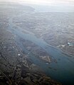
Detroit River and US side, Grosse Ile north to Zug Island.png 5,500 × 14,500; 73.73 MB
-
East Bass Lake - Abandoned Shack.jpg 4,032 × 3,024; 3.35 MB
-
Grand River islet (6928438328).jpg 1,534 × 952; 1.05 MB
-
Grand-Lake-River.png 2,000 × 1,356; 211 KB
-
GrassyIslandDetroitRiverLocation.png 363 × 480; 323 KB
-
Grosse Ile and other islands of Detroit River (7074519183).jpg 2,900 × 3,337; 7.26 MB
-
Grosse Ile Michigan aerial Jan2016.jpg 2,285 × 1,557; 1.91 MB
-
Holy Island (Lake Charlevoix).jpg 5,179 × 2,913; 2.79 MB
-
Ileauxgalets.JPG 471 × 363; 33 KB
-
Indian & Gard Islands in North Maumee Bay map.png 1,213 × 641; 32 KB
-
Lone Susan Island.jpg 2,592 × 1,936; 660 KB
-
MamajudaIslandLocation.png 426 × 580; 510 KB
-
NASA Worldwind, USGS imagery map, Calf Island, Michigan.png 300 × 300; 64 KB
-
NASA Worldwind, USGS imagery map, Celeron Island, Michigan.png 1,000 × 1,000; 860 KB
-
NASA Worldwind, USGS imagery map, Cherry Island, Michigan.png 650 × 650; 705 KB
-
NASA Worldwind, USGS imagery map, Foleys Island, Michigan.png 1,000 × 1,000; 1.16 MB
-
NASA Worldwind, USGS imagery map, Fordson Island, Michigan.png 300 × 300; 176 KB
-
NASA Worldwind, USGS imagery map, Fox Island, Michigan.png 300 × 300; 107 KB
-
NASA Worldwind, USGS imagery map, Gard Island, Michigan.png 1,000 × 1,001; 408 KB
-
NASA Worldwind, USGS imagery map, Grassy Island, Michigan.png 500 × 700; 406 KB
-
NASA Worldwind, USGS imagery map, Hickory Island, Michigan.png 500 × 500; 423 KB
-
NASA Worldwind, USGS imagery map, Indian Island, Michigan.png 700 × 701; 208 KB
-
NASA Worldwind, USGS imagery map, Iyopawa Island, Michigan.png 1,776 × 1,776; 4.59 MB
-
NASA Worldwind, USGS imagery map, Kauslers Island, Michigan.png 1,500 × 1,500; 2.43 MB
-
NASA Worldwind, USGS imagery map, Millman Island, Michigan.png 777 × 777; 827 KB
-
NASA Worldwind, USGS imagery map, Mud Island, Michigan.png 600 × 600; 461 KB
-
NASA Worldwind, USGS imagery map, Powder House Island, Michigan.png 300 × 300; 84 KB
-
NASA Worldwind, USGS imagery map, Round Island, Michigan.png 700 × 700; 754 KB
-
NASA Worldwind, USGS imagery map, Sisters Island, Michigan.png 700 × 700; 826 KB
-
NASA Worldwind, USGS imagery map, Smiths Island, Michigan.png 1,300 × 1,300; 1.8 MB
-
NASA Worldwind, USGS imagery map, Sterling Island, Michigan.png 500 × 500; 322 KB
-
NASA Worldwind, USGS imagery map, Stony Island, Michigan.png 600 × 1,500; 965 KB
-
NASA Worldwind, USGS imagery map, Strong Island, Michigan.png 600 × 400; 306 KB
-
NASA Worldwind, USGS imagery map, Sturgeon Bar, Michigan.png 600 × 600; 328 KB
-
NASA Worldwind, USGS imagery map, Sugar Island, Michigan.png 600 × 600; 485 KB
-
NASA Worldwind, USGS imagery map, Swan Island, Michigan.png 550 × 550; 483 KB
-
NASA Worldwind, USGS imagery map, Zug Island, Michigan.png 900 × 900; 1.32 MB
-
Pointe Mouillee.jpg 1,500 × 1,202; 548 KB
-
Powder House Island and Fox Island, 2005-12.png 1,503 × 1,203; 1.9 MB
-
Powder House Island, Michigan, 1993-04.png 500 × 500; 225 KB
-
Powder House Island, Michigan, 1999-03.png 500 × 500; 175 KB
-
Powder House Island, Michigan, 2005-03.png 500 × 500; 722 KB
-
Powder House Island, Michigan, 2005-08.png 500 × 500; 291 KB
-
Powder House Island, Michigan, 2005-12.png 500 × 500; 300 KB
-
Powder House Island, Michigan, 2006-08.png 500 × 500; 108 KB
-
Powder House Island, Michigan, 2011-06.png 500 × 500; 297 KB
-
Radio Island in St. Joseph, MI (6908453414).jpg 1,238 × 704; 824 KB
-
Sleeping Bear Dunes + S Manitou Is.jpg 1,602 × 1,068; 240 KB
-
StMarys-River.png 2,000 × 1,356; 208 KB
-
Windmill Island Holland Michigan.jpg 1,500 × 1,198; 793 KB
-
Indian wigwam, Ste. Marie Rapids, by Childs, B. F..jpg 2,737 × 1,409; 1.6 MB
-
Indian wigwam, Ste. Marie Rapids, by Childs, B. F..png 2,737 × 1,409; 5.08 MB
-
Ste. Marie Rapids, Chiefs Island, by Childs, B. F..jpg 2,737 × 1,398; 1.46 MB
-
Ste. Marie Rapids, Chiefs Island, by Childs, B. F..png 2,737 × 1,398; 4.65 MB


