Category:Inaccurate maps of ethnic groups in Iran
Jump to navigation
Jump to search
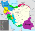
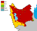
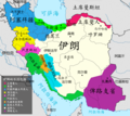
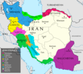
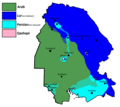
![]() These maps of ethnic groups in Iran, are inaccurate and their use and cross-categorization should generally be avoided in other projects prior to corrected versions being uploaded. (Note that this category is not for historic maps, which may be outdated.) For maps that are backed by known sources see Category:Maps of ethnic groups in Iran with a source.
These maps of ethnic groups in Iran, are inaccurate and their use and cross-categorization should generally be avoided in other projects prior to corrected versions being uploaded. (Note that this category is not for historic maps, which may be outdated.) For maps that are backed by known sources see Category:Maps of ethnic groups in Iran with a source.
Media in category "Inaccurate maps of ethnic groups in Iran"
The following 70 files are in this category, out of 70 total.
-
Ahwaz Ethnic.png 3,064 × 4,184; 5.02 MB
-
Ahwaz Ethnics.png 5,704 × 4,184; 8.72 MB
-
Alborz Province Ethnic Map.png 720 × 412; 20 KB
-
Ar Iranethnics.png 2,295 × 2,048; 4.47 MB
-
Ardabil Province Ethnic Map.png 967 × 1,325; 47 KB
-
Azerbaijan Ethnic Map.png 2,397 × 2,119; 105 KB
-
Azerbaijanians in Caucasus.jpg 550 × 590; 49 KB
-
Azerbajaniethnicity-Iranethnicmap.PNG 895 × 823; 41 KB
-
Bushehr Province Ethnic Map.png 2,720 × 1,600; 162 KB
-
Ch Iranethnics.png 2,295 × 2,048; 4.68 MB
-
Chaharmahal and Bakhtiari Province Ethnic Map.png 762 × 776; 26 KB
-
Distribution map of Iranian ethnic groups (2023).svg 512 × 343; 246 KB
-
DistributionOfAzerbaijanisInCaucasusAndME.png 1,594 × 1,409; 297 KB
-
East Azerbaijan Province Ethnic Map.png 1,430 × 1,495; 42 KB
-
Ethnic Map of Iran.png 3,200 × 1,800; 518 KB
-
Ethnicity - Persian Republics.PNG 771 × 484; 33 KB
-
Etnicheskaya karta Irana.png 3,595 × 2,048; 457 KB
-
Fars Province Ethnic Map.png 2,170 × 2,020; 101 KB
-
Gilan Province Ethnic Map.png 757 × 881; 45 KB
-
Golestan Province Ethnic Map.png 1,300 × 780; 64 KB
-
Hamadan Province Ethnic Map.png 1,100 × 947; 37 KB
-
Hormozgan Province Ethnic Map.png 2,400 × 1,100; 96 KB
-
Ilam Province Ethnic Map.png 1,200 × 930; 41 KB
-
Iran Azeripeoples.jpg 618 × 887; 95 KB
-
Iran cultures and people diversity.svg 6,877 × 3,573; 665 KB
-
Iran Ethnic Groups.png 2,295 × 2,048; 4.38 MB
-
Iran-Ethnic map.PNG 895 × 823; 55 KB
-
Iran-Ethnicity-2022.png 894 × 822; 69 KB
-
Iranian-ethno-languages-map eo.png 1,214 × 822; 62 KB
-
Iranian-ethno-languages-map hy.png 1,139 × 771; 149 KB
-
Iranian-ethno-languages-map.png 1,214 × 822; 63 KB
-
IranianKurdistan.png 200 × 185; 15 KB
-
Isfahan Province Ethnic Map.png 2,500 × 1,760; 115 KB
-
Kerman Province Ethnic Map.png 2,240 × 1,200; 107 KB
-
Kermanshah Province Ethnic Map.png 1,400 × 740; 61 KB
-
Khuzestan ethnic.png 3,064 × 4,184; 5.02 MB
-
Khuzestan Province Ethnic Map.png 1,550 × 1,386; 62 KB
-
Khuzistan Ethnics.png 5,704 × 4,184; 8.71 MB
-
Kohgiluyeh and Boyer-Ahmad Province Ethnic Map.png 1,000 × 700; 19 KB
-
Kopia Iran-Narody.gif 316 × 373; 8 KB
-
Kurdistan Province Ethnic Map.png 1,317 × 802; 39 KB
-
Lorestan Province Ethnic Map.png 1,650 × 1,000; 40 KB
-
Map of Iranian Kurdistan.png 723 × 599; 130 KB
-
Markazi Province Ethnic Map.png 1,250 × 988; 43 KB
-
Mazandaran Province Ethnic Map.png 1,650 × 570; 45 KB
-
Negar 24042019 121340.jpg 1,080 × 731; 213 KB
-
North Khorasan Ethnic Map.png 1,160 × 778; 41 KB
-
Paveh County in Kurdish Areas.jpg 5,000 × 3,536; 3.02 MB
-
Qashqai tribe map in Iran (2023).svg 512 × 483; 132 KB
-
Qashqai-map.png 879 × 813; 45 KB
-
Qashqai.png 879 × 813; 32 KB
-
Qazvin Province Ethnic Map.png 1,141 × 671; 35 KB
-
Qom Province Ethnic Map.png 965 × 527; 21 KB
-
Razavi Khorasan Province Ethnic Map.png 2,175 × 1,878; 84 KB
-
Ru Iran ethnics.png 2,295 × 2,048; 4.61 MB
-
Semnan Province Ethnic Map.png 2,310 × 1,412; 102 KB
-
Sian tribe Kurd.jpg 774 × 626; 370 KB
-
Sistan and Baluchestan Province Ethnic Map.png 2,040 × 1,260; 97 KB
-
South Khorasan Province Ethnic Map.png 2,175 × 2,057; 74 KB
-
Talysh language.png 1,920 × 3,322; 2 MB
-
Tat people of Iran.PNG 934 × 641; 28 KB
-
Tehran Province Ethnic Map.png 1,161 × 585; 24 KB
-
The ethnic composition of Iran.png.jpg 569 × 320; 126 KB
-
Turkic people in Iran.jpg 2,200 × 1,700; 1.32 MB
-
Yazd Province Ethnic Map.png 1,800 × 1,950; 70 KB
-
Zanjan Province Ethnic Map.png 1,088 × 776; 31 KB
-
لکستان ایران.jpg 750 × 750; 84 KB
-
نقشه زبان های رایج-ar.png 1,121 × 444; 119 KB
-
نقشه زبانها.png 1,214 × 822; 45 KB
-
نقشه زبانهای رایج.png 1,214 × 449; 44 KB


