Category:Maps of ethnic groups in Iran with a source
Jump to navigation
Jump to search
English: Maps in this category have a source for boundaries showing ethnic groups. These maps may or may not be accurate.
Subcategories
This category has the following 2 subcategories, out of 2 total.
Media in category "Maps of ethnic groups in Iran with a source"
The following 7 files are in this category, out of 7 total.
-
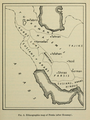
 Ethnographic map of Persia in circa 1939 by The Field Museum.jpg 750 × 750; 78 KB
-
 Ethnographic map of Persia in circa 1939 by The Field Museum.png 685 × 911; 685 KB
-

-
 Map of Azeris in Iran in 2005 per Hafeznia et al.jpg 1,100 × 850; 430 KB
-
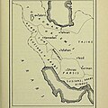
 Map of Bakhtiari tribes.jpg 1,536 × 1,077; 330 KB
-
 Map of counties of Iran with Bakhtiari nomad presence.jpg 1,536 × 1,053; 341 KB
-
 Turkish populated villages by counties and districts in Iran.png 2,236 × 2,176; 839 KB


