Category:Images from the Norman B. Leventhal Map Center
Jump to navigation
Jump to search
Subcategories
This category has the following 2 subcategories, out of 2 total.
Media in category "Images from the Norman B. Leventhal Map Center"
The following 16 files are in this category, out of 16 total.
-

-
 2005 significant U.S. hurricane strikes (34791551050).jpg 2,000 × 1,815; 3.95 MB
-
 An elevation, plan, and history, of the Royal Exchange of London (14962169355).jpg 1,379 × 2,000; 2.6 MB
-
 Jerusalem. Herman Moll. The Turkish Empire in Europe, Asia and Africa. 1752 (cropped).jpg 6,106 × 1,213; 7.81 MB
-
 London (14783516940).jpg 2,000 × 732; 1.51 MB
-
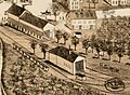 Mattapan station and yard on 1890 bird's eye view map.jpg 1,071 × 781; 244 KB
-
 Mattapan station on 1890 bird's eye view map.jpg 463 × 346; 51 KB
-
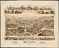 Mattapan, Massachusetts, 1890 (2674951197).jpg 9,576 × 7,856; 13.16 MB
-
 Rugby (2674696263).jpg 7,340 × 5,533; 5.07 MB
-

-
 The Bear Garden, the Globe Theatre (28004025415).jpg 2,000 × 1,174; 2.58 MB
-

-

-

-
-
 Yggdrasill, the mundane tree (26938965955).jpg 1,305 × 2,000; 1.86 MB

.jpg)
.jpg)


.jpg)
.jpg)
.jpg)
.jpg)
.jpg)
.Herman_Moll._The_Turkish_Empire_in_Europe,_Asia_and_Africa._1752_(cropped).jpg)
.jpg)
.jpg)
.jpg)
.jpg)
.jpg)