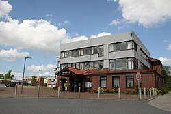
Category:Ihlow (Ostfriesland)
Appearance
Landkreis Aurich  Aurich · Baltrum · Berumbur · Dornum · Großefehn · Großheide · Hage · Hagermarsch · Halbemond · Hinte · Ihlow (Ostfriesland) · Juist · Krummhörn · Leezdorf · Lütetsburg · Marienhafe · Norden · Norderney · Osteel · Rechtsupweg · Südbrookmerland · Upgant-Schott · Wiesmoor · Wirdum (Landkreis Aurich) · Unincorporated area: Memmert ·
municipality in Lower Saxony state, Germany | |||||
| Upload media | |||||
| Instance of |
| ||||
|---|---|---|---|---|---|
| Location | Aurich, Lower Saxony, Germany | ||||
| Legislative body | |||||
| Population |
| ||||
| Area |
| ||||
| Elevation above sea level |
| ||||
| Different from | |||||
| official website | |||||
 | |||||
Subcategories
This category has the following 15 subcategories, out of 15 total.
B
F
- Fahne bridge (3 F)
- Fluttermühle Riepe (1 F)
K
- Kloster Ihlow (60 F)
- Kokermühle Riepe (1 F)
M
- Mühle Berta (2 F)
O
S
- Sandwater (Ihlow) (3 F)
V
W
- Wappen von Ihlow (ship) (9 F)
- Windmühle Simonswolde (1 F)
- Wrantepotter Dreschmühle (2 F)
Media in category "Ihlow (Ostfriesland)"
The following 33 files are in this category, out of 33 total.
-
DEU Ihlow (Ostfriesland) COA.svg 512 × 598; 12 KB
-
Flagge Ihlow.svg 500 × 300; 15 KB
-
2013-05-03 Fotoflug Leer Papenburg DSCF7228.jpg 2,500 × 1,673; 3.23 MB
-
2013-05-03 Fotoflug Leer Papenburg DSCF7229.jpg 2,500 × 1,673; 3.29 MB
-
2013-05-03 Fotoflug Nordholz Papenburg HP 2795.JPG 5,760 × 3,840; 7.15 MB
-
2013-05-03 Fotoflug Nordholz Papenburg HP 2796.JPG 5,760 × 3,840; 7.16 MB
-
2013-05-03 Fotoflug Nordholz Papenburg HP 2797.JPG 5,760 × 3,840; 6.91 MB
-
2013-05-03 Fotoflug Nordholz Papenburg HP 2798.JPG 5,760 × 3,840; 7.03 MB
-
Friesische Freiheit Ihlow.jpg 3,888 × 2,592; 5.37 MB
-
Ihlow in AUR.svg 1,740 × 1,209; 616 KB
-
Ihlowerfehn, 26632 Ihlow, Germany - panoramio.jpg 5,472 × 3,648; 3.25 MB
-
IhlowerfehnKanal.jpg 3,072 × 2,048; 3 MB
-
Karte Mittelpunkt Ostfriesland.jpg 3,024 × 4,032; 3.67 MB
-
Kokermuehle msu736.jpg 4,752 × 3,168; 750 KB
-
Luftaufnahmen Nordseekueste 2013 05 by-RaBoe 310.jpg 2,600 × 1,727; 2.88 MB
-
Luftaufnahmen Nordseekueste 2013 05 by-RaBoe 311.jpg 2,600 × 1,727; 2.7 MB
-
Mittelpunkt Ostfriesland.jpg 3,024 × 4,032; 6.18 MB
-
Müehle Ihlow (Ostfriesland)39.jpg 4,752 × 3,168; 5.18 MB
-
NiederungsgebietMGI.JPG 3,072 × 2,048; 2.63 MB
-
Rathaus Ihlow44.jpg 4,752 × 3,168; 4.74 MB
-
Raum der Spurensuche Ihlow msu12.jpg 4,631 × 2,989; 3.18 MB
-
Raum der Spurensuche Ihlow msu6.jpg 4,752 × 3,168; 4.27 MB
-
Riepsterhammrich.JPG 2,048 × 1,536; 685 KB
-
Wappen ihlow (Ostfriesland).png 525 × 594; 353 KB
-
Westerende Ringkanal.JPG 1,024 × 768; 138 KB
-
Westerende-Kirchloog - altes landwirtschaftliches Gerät.jpg 4,000 × 3,000; 1.42 MB
-
Westerende-kirchloog-Ortsschild.jpg 4,000 × 3,000; 1.43 MB
-
Willkommen schild ihlow.jpg 3,000 × 4,000; 890 KB
-
Windmühle Ihlowerfehn33.jpg 4,752 × 3,168; 7.04 MB
-
WindparkIhlow.JPG 3,072 × 2,048; 2.76 MB
-
Wst-kl bruecke.jpg 4,000 × 3,000; 1.28 MB
-
Wst-kl ringkanal 1.jpg 4,000 × 3,000; 1 MB
-
Wst-kl ringkanal 2.jpg 4,000 × 3,000; 922 KB


