Category:Hage
Jump to navigation
Jump to search
Landkreis Aurich  Aurich · Baltrum · Berumbur · Dornum · Großefehn · Großheide · Hage · Hagermarsch · Halbemond · Hinte · Ihlow (Ostfriesland) · Juist · Krummhörn · Leezdorf · Lütetsburg · Marienhafe · Norden · Norderney · Osteel · Rechtsupweg · Südbrookmerland · Upgant-Schott · Wiesmoor · Wirdum (Landkreis Aurich) · Unincorporated area: Memmert ·
municipality of Germany -msu-7272-.jpg)    | |||||
| Upload media | |||||
| Instance of |
| ||||
|---|---|---|---|---|---|
| Location | |||||
| Population |
| ||||
| Area |
| ||||
| Elevation above sea level |
| ||||
| Different from | |||||
| official website | |||||
 | |||||
Subcategories
This category has the following 5 subcategories, out of 5 total.
Media in category "Hage"
The following 24 files are in this category, out of 24 total.
-
 Coat of arms of Hage.png 184 × 198; 48 KB
-
 DEU Hage COA.png 673 × 800; 581 KB
-
 DEU Hage COA.svg 590 × 700; 36 KB
-
 378 Im Wald bei Hage.jpg 6,936 × 9,248; 19.01 MB
-
 Bahnhof Hage (Ostfriesland).jpg 3,648 × 2,736; 2.21 MB
-
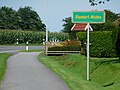 Blandorf-Wichte Ortseingang (2).jpg 3,264 × 2,448; 3.13 MB
-
 Blandorf-Wichte.jpg 136 × 150; 8 KB
-
 Bokashistrø2.jpg 1,008 × 1,009; 420 KB
-
 Ehemalige Hilgenrieder Bucht vom Blandorfer Geestrand.jpg 3,188 × 2,344; 4.47 MB
-
 Flagge Hage.svg 2,000 × 1,192; 44 KB
-
 Hage AltesRathaus.jpg 1,124 × 766; 335 KB
-
 Hage Gesamt01.jpg 872 × 556; 245 KB
-
 Hage Gesamt02.jpg 1,728 × 1,196; 819 KB
-
 Hage HagerTief01.jpg 751 × 483; 143 KB
-
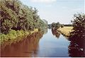 Hage HagerTief02.jpg 1,508 × 1,026; 514 KB
-
 Hage in AUR.svg 1,740 × 1,209; 616 KB
-
 Hage UdoBacker.jpg 856 × 1,291; 235 KB
-

-
 KGS Hage.JPG 2,304 × 1,728; 1.52 MB
-
 Magda Heyken Haus Hage01.JPG 1,600 × 1,200; 425 KB
-
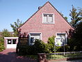 Magda Heyken Haus Hage02.JPG 1,600 × 1,200; 424 KB
-
 Magda Heyken Haus Hage03.JPG 1,600 × 1,200; 427 KB
-
 Magda Heyken Haus Hage04.JPG 1,600 × 1,200; 429 KB
-
 Magda Heyken.jpg 1,164 × 1,198; 223 KB


.jpg)
.jpg)


.jpg)


