Category:Hydrological maps
Jump to navigation
Jump to search
Subcategories
This category has the following 5 subcategories, out of 5 total.
Media in category "Hydrological maps"
The following 7 files are in this category, out of 7 total.
-
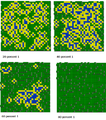
30x30fiveLevelWaterRetention.png 772 × 873; 510 KB
-
Figure 1. Tamanrasset River. Hydrological context of Africa.jpg 926 × 630; 120 KB
-
Hlukhania mire survey hydrology.jpg 1,554 × 1,240; 2.46 MB
-
Mapa Retencji.png 796 × 758; 118 KB
-
MSHtoutleareaedit.jpg 6,342 × 3,576; 17.8 MB


