Category:Hound Point
Jump to navigation
Jump to search
English: Hound Point, site of an oil terminal in the Firth of Forth, Scotland
human settlement in Fife, Scotland, UK  | |||||
| Upload media | |||||
| Instance of | |||||
|---|---|---|---|---|---|
| Location | Fife, Scotland | ||||
 | |||||
Media in category "Hound Point"
The following 101 files are in this category, out of 101 total.
-
 'Eeklo' at Braefoot Terminal - geograph.org.uk - 3589098.jpg 3,264 × 2,448; 3.12 MB
-
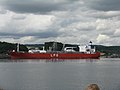
 'Nave Quasar' at Hound Point - geograph.org.uk - 6226513.jpg 3,264 × 2,448; 3.46 MB
-

-
 Braefoot Bay Gas Terminal - geograph.org.uk - 1900218.jpg 1,365 × 1,024; 304 KB
-
 Braefoot Bay Gas Terminal - geograph.org.uk - 1900221.jpg 1,365 × 1,024; 380 KB
-
 Braefoot Bay Marine Gas Terminal - geograph.org.uk - 1919339.jpg 1,600 × 1,200; 372 KB
-
 Braefoot gas terminal - geograph.org.uk - 3558353.jpg 3,264 × 2,448; 3.2 MB
-
 Braefoot Oil Terminal from Hawkcraig Point - geograph.org.uk - 2831980.jpg 3,264 × 2,448; 4.17 MB
-
 Braefoot Terminal - geograph.org.uk - 3562041.jpg 640 × 423; 329 KB
-
 British Kestrel at Hound Point oil terminal - geograph.org.uk - 5100424.jpg 2,206 × 1,648; 1.13 MB
-
 Car Craig - geograph.org.uk - 3093153.jpg 640 × 405; 238 KB
-
 Car Craig, near Inchcolm - geograph.org.uk - 5357883.jpg 1,024 × 682; 73 KB
-
 Cloudscape above Haystack, near Inchcolm - geograph.org.uk - 5357880.jpg 1,024 × 682; 108 KB
-
 Dead to the world - geograph.org.uk - 3708255.jpg 640 × 480; 118 KB
-
 Edinburgh from Inchcolm - geograph.org.uk - 3708360.jpg 640 × 360; 26 KB
-
 Fidra - geograph.org.uk - 3309941.jpg 640 × 360; 67 KB
-
 Filling station at Hound Point - geograph.org.uk - 3588995.jpg 3,264 × 2,448; 3.33 MB
-

-
 Gas terminal, Braefoot Point - geograph.org.uk - 3708687.jpg 640 × 337; 36 KB
-
 Glimpse of Arthur's Seat - geograph.org.uk - 2591653.jpg 1,500 × 2,000; 409 KB
-

-

-

-

-
 Hawkcraig Point, Aberdour, from near Inchcolm - geograph.org.uk - 5357926.jpg 1,024 × 682; 161 KB
-
 Haystack - geograph.org.uk - 3562370.jpg 640 × 268; 186 KB
-
 Haystack, near Inchcolm - geograph.org.uk - 5357868.jpg 1,024 × 683; 127 KB
-
 Haystacks, in the Firth of Forth - geograph.org.uk - 5475283.jpg 4,000 × 2,250; 2.1 MB
-
 Hound Point - geograph.org.uk - 1346245.jpg 640 × 479; 59 KB
-
 Hound Point - geograph.org.uk - 15549.jpg 640 × 301; 32 KB
-
 Hound Point - geograph.org.uk - 340624.jpg 640 × 480; 127 KB
-
 Hound Point - geograph.org.uk - 34602.jpg 640 × 480; 94 KB
-
 Hound Point - geograph.org.uk - 768270.jpg 640 × 480; 54 KB
-
 Hound Point 2 - geograph.org.uk - 3588999.jpg 3,264 × 2,448; 1.98 MB
-
 Hound Point from just east of Cramond Island - geograph.org.uk - 2102740.jpg 2,048 × 1,536; 1.05 MB
-
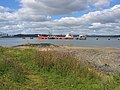
 Hound Point Marine Terminal - geograph.org.uk - 3117858.jpg 1,024 × 768; 139 KB
-
 Hound Point Marine Terminal - geograph.org.uk - 3513331.jpg 1,024 × 768; 266 KB
-
 Hound Point Marine Terminal - geograph.org.uk - 4452629.jpg 2,445 × 1,373; 1.14 MB
-
 Hound Point Marine Terminal - geograph.org.uk - 4679557.jpg 1,004 × 659; 98 KB
-
 Hound Point marine terminal.JPG 1,600 × 1,200; 380 KB
-
 Hound Point oil terminal - geograph.org.uk - 253322.jpg 640 × 480; 38 KB
-
 Hound Point Oil Terminal - geograph.org.uk - 5336649.jpg 1,024 × 682; 128 KB
-
 Hound Point Oil Terminal - geograph.org.uk - 5339484.jpg 1,024 × 682; 125 KB
-
 Hound Point Oil Terminal - geograph.org.uk - 5359102.jpg 1,024 × 682; 165 KB
-
 Hound Point Oil Terminal - geograph.org.uk - 5359122.jpg 1,024 × 682; 119 KB
-

-
 Hound Point Tanker Berth - geograph.org.uk - 2929283.jpg 3,264 × 2,448; 3.77 MB
-
 Hound Point Tanker Berth - geograph.org.uk - 5426854.jpg 640 × 481; 318 KB
-
 Hound Point tanker berths - geograph.org.uk - 3589026.jpg 3,264 × 2,448; 2.5 MB
-
 Hound Point Tanker Berths - geograph.org.uk - 5757259.jpg 640 × 480; 71 KB
-
 Hound Point tanker terminal - geograph.org.uk - 1346228.jpg 640 × 479; 58 KB
-
 Hound Point Tanker Terminal - geograph.org.uk - 1899734.jpg 1,536 × 1,024; 275 KB
-
 Hound Point Tanker terminal - geograph.org.uk - 1899743.jpg 1,536 × 1,024; 288 KB
-
 Hound Point Tanker Terminal - geograph.org.uk - 1919360.jpg 1,600 × 1,200; 328 KB
-
 Hound Point tanker terminal - geograph.org.uk - 3588982.jpg 3,264 × 2,448; 1.82 MB
-
 Hound Point Tanker Terminal - geograph.org.uk - 3588985.jpg 3,264 × 2,448; 3.3 MB
-

-
 Hound Point terminal - geograph.org.uk - 15562.jpg 640 × 409; 32 KB
-
 Hound Point Terminal - geograph.org.uk - 3561083.jpg 640 × 281; 201 KB
-
 Hound Point Terminal - geograph.org.uk - 3562386.jpg 640 × 263; 209 KB
-
 Hound Point Terminal - geograph.org.uk - 3562388.jpg 640 × 355; 272 KB
-
 Hound Point Terminal - geograph.org.uk - 3562397.jpg 640 × 416; 341 KB
-
 Hound Point Terminal - geograph.org.uk - 3562403.jpg 500 × 640; 391 KB
-
 Hound Point Terminal - geograph.org.uk - 3562408.jpg 640 × 315; 252 KB
-
 Hound Point Terminal - geograph.org.uk - 3562413.jpg 640 × 282; 226 KB
-
 Hound Point terminal. - geograph.org.uk - 34604.jpg 640 × 480; 86 KB
-

-
 Inchmickery from Inchcolm - geograph.org.uk - 5358948.jpg 1,024 × 682; 124 KB
-
 Long Craig, off Dalgety Bay, from the sea - geograph.org.uk - 5357875.jpg 1,024 × 682; 105 KB
-
 LPG tanker at Braefoot Terminal - geograph.org.uk - 3589112.jpg 3,264 × 2,448; 2.04 MB
-
 Maersk Producer at Hound Point (geograph 2942251).jpg 640 × 480; 247 KB
-
 Mortimer's Deep - geograph.org.uk - 2707711.jpg 640 × 360; 227 KB
-
 Oil tanker berths at Hound Point - geograph.org.uk - 3588993.jpg 3,264 × 2,448; 3.33 MB
-
 Oil tanker Cosrich Lake at the Hound Point terminal - geograph.org.uk - 5475310.jpg 4,000 × 3,000; 2.92 MB
-
 Oil Tanker Terminal, Hound Point - geograph.org.uk - 340622.jpg 640 × 480; 111 KB
-
 Oil terminal jetty, as viewed from Inchcolm - geograph.org.uk - 5475274.jpg 3,961 × 2,971; 5.41 MB
-
 On the fiddle - geograph.org.uk - 3708569.jpg 474 × 640; 96 KB
-
 Oxcars Lighthouse from Inchcolm - geograph.org.uk - 5358940.jpg 1,024 × 682; 113 KB
-
 Peatdraught Bay and Hound Point Tanker berth - geograph.org.uk - 2931431.jpg 3,264 × 2,448; 5.46 MB
-
 Pier at Braefoot Gas Terminal - geograph.org.uk - 5357894.jpg 1,024 × 682; 117 KB
-

-
 Small boat at Braefoot Terminal pier - geograph.org.uk - 5357887.jpg 1,024 × 682; 105 KB
-
 Tanker at Braefoot Terminal - geograph.org.uk - 3309937.jpg 640 × 360; 71 KB
-
 Tanker at Hound point - geograph.org.uk - 5422849.jpg 640 × 427; 330 KB
-
 Tanker Berth - geograph.org.uk - 2626542.jpg 640 × 413; 301 KB
-
 Tanker berth at Hound Point - geograph.org.uk - 3589002.jpg 3,264 × 2,448; 1.86 MB
-
 Tanker berth at Hound Point - geograph.org.uk - 3708738.jpg 640 × 317; 29 KB
-
 Tanker berth off Hound Point - geograph.org.uk - 3708101.jpg 640 × 360; 24 KB
-
 Tanker berths at Hound Point - geograph.org.uk - 4668514.jpg 1,024 × 682; 102 KB
-
 Tanker terminal - geograph.org.uk - 327285.jpg 640 × 424; 56 KB
-

-

-
 The Fife Coast between Aberdour and Dalgety Bay - geograph.org.uk - 3009918.jpg 3,264 × 2,448; 2.93 MB
-
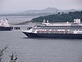
 The QE2 - geograph.org.uk - 1002195.jpg 640 × 494; 42 KB
-
 Tug, LPG tanker and Braefoot Terminal - geograph.org.uk - 3589110.jpg 3,264 × 2,448; 2.11 MB
-
 Tugs at Hound Point - geograph.org.uk - 5004033.jpg 1,024 × 683; 164 KB
-
 Tugs, Hound Point - geograph.org.uk - 15566.jpg 640 × 325; 32 KB
-
 View NE from Forth Rail Bridge - geograph.org.uk - 774319.jpg 640 × 480; 74 KB
-

-

-
 You're being watched - geograph.org.uk - 3708239.jpg 640 × 480; 72 KB


_on_Haystack,_near_Inchcolm_-_geograph.org.uk_-_5357855.jpg)
_on_Haystack,_near_Inchcolm_-_geograph.org.uk_-_5357860.jpg)
_on_Haystack,_near_Inchcolm_-_geograph.org.uk_-_5357872.jpg)
_on_Haystack,_near_Inchcolm_-_geograph.org.uk_-_5357845.jpg)


.jpg)


