Category:Firth of Forth
Jump to navigation
Jump to search
estuary of Scotland's River Forth  | |||||
| Upload media | |||||
| Instance of | |||||
|---|---|---|---|---|---|
| Location | Scotland | ||||
| Inflows |
| ||||
| Basin country | |||||
 | |||||
Subcategories
This category has the following 15 subcategories, out of 15 total.
+
B
- Blackness Bay, Falkirk (11 F)
G
- Gullane Bay (24 F)
H
- Hound Point (102 F)
I
K
L
- Loganair Flight 670A (2 F)
M
- Mouth of River Almond (45 F)
N
Q
S
- Ships in the Firth of Forth (14 F)
W
- Firth of Forth in World War II (21 F)
Media in category "Firth of Forth"
The following 200 files are in this category, out of 287 total.
(previous page) (next page)-
 'Blackrock Gate' RMG PW1772.jpg 1,280 × 914; 999 KB
-
 'MV Britannia' tenders - geograph.org.uk - 4561964.jpg 3,264 × 2,448; 3.4 MB
-
 Wfm firth of forth.jpg 1,280 × 948; 289 KB
-
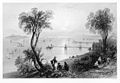
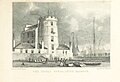 MA(1829) p.045 - The Signal Tower, Leith Harbour - Thomas Hosmer Shepherd.jpg 2,118 × 1,441; 941 KB
-
 3inch20cwtAAGunHMASAustraliaDecember1918.jpeg 450 × 323; 55 KB
-
 A line of buoys, Firth of Forth - geograph.org.uk - 2701789.jpg 640 × 360; 172 KB
-
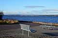 A seat by the Forth, Granton - geograph.org.uk - 3242367.jpg 800 × 530; 90 KB
-
 A view across the Forth - geograph.org.uk - 767973.jpg 640 × 426; 35 KB
-
 Abandoned Iron Work on Eastern Craigs - geograph.org.uk - 513594.jpg 640 × 480; 118 KB
-
 Aberdour to Edinburgh - geograph.org.uk - 1098613.jpg 640 × 471; 94 KB
-
 Across the Firth - geograph.org.uk - 625401.jpg 640 × 480; 66 KB
-
 Air temperature 8 degrees - geograph.org.uk - 2903854.jpg 640 × 480; 71 KB
-
 All at Sea Today - geograph.org.uk - 640691.jpg 640 × 480; 42 KB
-
 AMT Trader barge with part of HMS Queen Elizabeth - geograph.org.uk - 3219545.jpg 3,264 × 2,448; 3.22 MB
-

-
 Arthur's Seat as seen over the Firth of Forth from Fife.jpg 3,088 × 2,056; 522 KB
-
 ATurretHMASAustralia1918.jpg 450 × 321; 56 KB
-

-

-
 Barge in the Firth of Clyde - geograph.org.uk - 6225623.jpg 1,024 × 528; 177 KB
-
 Bass rock 2019.jpg 3,023 × 1,851; 376 KB
-
 Bing, East Wemyss - geograph.org.uk - 1504942.jpg 640 × 480; 113 KB
-

-
 Boats on the Forth seen from the road bridge - panoramio.jpg 1,098 × 824; 154 KB
-
 Samuel Bough - Newhaven harbour on the Firth of Forth.jpg 3,200 × 2,167; 2.03 MB
-
 Bridge workers - panoramio.jpg 1,936 × 1,288; 426 KB
-

-
 Road to Kincardine Bridge - geograph.org.uk - 456039.jpg 640 × 480; 68 KB
-
 Bridges over the River Forth (geograph 4345256).jpg 3,264 × 2,448; 4.65 MB
-
 Briggs' 'Forth Fighter' - geograph.org.uk - 3811292.jpg 3,264 × 2,448; 4.28 MB
-
 British Guard Fleet Firth of Forth 1916.jpg 800 × 673; 68 KB
-
 Buoy in the Firth of Forth - geograph.org.uk - 5337046.jpg 1,024 × 682; 128 KB
-
 Buoy No.19 in the Firth of Forth - geograph.org.uk - 3596845.jpg 3,264 × 2,448; 2.16 MB
-
 Buoy off North Berwick - geograph.org.uk - 3606826.jpg 640 × 465; 226 KB
-
 Buoy with Grey seals and pup - geograph.org.uk - 3595973.jpg 3,264 × 2,448; 2.79 MB
-
 Buoy with Seals - geograph.org.uk - 3561143.jpg 640 × 404; 393 KB
-
 Buoy, Firth of Forth - geograph.org.uk - 3606772.jpg 640 × 386; 180 KB
-
 BW Hugin (4534729177).jpg 4,155 × 2,455; 3.64 MB
-
 Car Craig from Inchcolm - geograph.org.uk - 5359061.jpg 1,024 × 682; 118 KB
-
 Caribbean Princess moored in the Firth of Forth - geograph.org.uk - 5475337.jpg 3,836 × 2,877; 2.47 MB
-
 Catamaran Buoy 17, Firth of Forth - geograph.org.uk - 5422699.jpg 640 × 480; 501 KB
-
 Causeway - geograph.org.uk - 513562.jpg 640 × 480; 91 KB
-
 Chainpiercalotype.jpg 914 × 688; 256 KB
-
 Church tower Inverkeithing - geograph.org.uk - 1186990.jpg 640 × 425; 71 KB
-
 Cockenzie Power Station, from North Bridge Edinburgh.jpg 800 × 525; 137 KB
-
 Collection complete^ - geograph.org.uk - 3811327.jpg 3,264 × 2,448; 4.13 MB
-

-
 Containers in the Firth of Forth - Flickr - jkiscycling.jpg 4,258 × 2,799; 6.98 MB
-
 Cormorants ^ gulls west of Eyebroughy - geograph.org.uk - 5547193.jpg 1,024 × 768; 153 KB
-
 Cow and Calves - geograph.org.uk - 2701316.jpg 640 × 360; 172 KB
-
 Cow and Calves - geograph.org.uk - 3309914.jpg 640 × 360; 58 KB
-
 Cow ^ Calves from off Inchcolm - geograph.org.uk - 5359080.jpg 1,024 × 684; 144 KB
-
-
 Craigdimas - geograph.org.uk - 1318618.jpg 640 × 480; 55 KB
-
 Cruise liner at the Forth Bridge - geograph.org.uk - 5475333.jpg 3,788 × 2,131; 1.85 MB
-
 Cruising in the Firth of Forth - geograph.org.uk - 125239.jpg 640 × 487; 46 KB
-
 Dalgety Bay.jpg 5,999 × 3,520; 17.49 MB
-
 Deep channel marker buoy - geograph.org.uk - 2701384.jpg 640 × 360; 224 KB
-
 Deep water channel buoy - geograph.org.uk - 3314442.jpg 640 × 360; 61 KB
-
 Deep water channel buoy - geograph.org.uk - 3314449.jpg 640 × 360; 47 KB
-
 Deep water channel buoy - geograph.org.uk - 3314467.jpg 640 × 403; 61 KB
-
 Deep water channel buoys - geograph.org.uk - 3314508.jpg 640 × 360; 37 KB
-

-
 Donibristle - geograph.org.uk - 564051.jpg 640 × 480; 93 KB
-
 Downing Point Battery Gun Emplacement.jpeg 4,032 × 3,024; 5.44 MB
-
 Dysart Redevelopment Project Phase 1 Block D View to Firth of Forth.jpg 3,422 × 1,891; 1.25 MB
-
 East Bay Forth Rail Bridge.jpg 882 × 661; 186 KB
-
 Easter Road Stadium (geograph 6968353).jpg 1,024 × 768; 336 KB
-
 Edimbourg , l'estuaire du Firth of Forth..jpg 1,606 × 1,114; 720 KB
-
 Edinburgh 003.jpg 4,238 × 2,798; 1.45 MB
-
 Edinburgh 004.jpg 4,272 × 2,848; 1.31 MB
-
 Edinburgh 005.jpg 4,214 × 2,760; 1.55 MB
-
 Edinburgh 006.jpg 4,264 × 2,836; 1.59 MB
-
 Edinburgh Arthurs Seat and Salisbury Crags (13961054077).jpg 1,000 × 667; 731 KB
-
 Edinburgh Castle 005.jpg 4,164 × 2,678; 1.11 MB
-
 Edinburgh from over the Firth of Forth (geograph 5466681).jpg 2,817 × 2,113; 1.96 MB
-
 Edinburgh Panarama from Camera Obscura.tif 8,657 × 1,948; 42.58 MB
-
 Edinburgh Western Harbour (21416391019).jpg 3,648 × 2,052; 1.25 MB
-
 Edinburgh-Firth of Forth.jpg 1,600 × 1,200; 695 KB
-
 Eider Ducks (4535666092).jpg 720 × 966; 617 KB
-
 Elie Beach Low Tide Before Sunset.jpg 3,024 × 4,032; 3.5 MB
-
 End of the groyne, Portobello. - geograph.org.uk - 49305.jpg 480 × 640; 39 KB
-
 Fairway buoy no. 17 - geograph.org.uk - 3595967.jpg 3,264 × 2,448; 2.41 MB
-
 Fidra as seen from Yellowcraigs beach.jpg 3,088 × 2,056; 977 KB
-

-
 Firth of Forth - panoramio.jpg 3,888 × 2,592; 3.22 MB
-
 Firth of Forth at sunset, Edinburgh, Scotland (11267196305).jpg 3,027 × 2,422; 4.29 MB
-

-
 Firth of Forth From Blackford Hill (36494132424).jpg 3,264 × 2,448; 1.78 MB
-
 Firth of Forth from Edinburgh Castle.jpg 2,560 × 1,920; 2.08 MB
-

-
 Firth of Forth looking inland - panoramio (1).jpg 3,888 × 2,592; 2.66 MB
-
 Firth of Forth looking inland - panoramio.jpg 2,592 × 3,888; 2.68 MB
-
 Firth of Forth looking North - panoramio (1).jpg 3,888 × 2,592; 3.03 MB
-
 Firth of Forth looking North - panoramio.jpg 3,888 × 2,592; 2.97 MB
-
 Firth of Forth looking seawards - panoramio (1).jpg 3,888 × 2,592; 2.56 MB
-
 Firth of Forth looking seawards - panoramio (2).jpg 3,888 × 2,592; 2.19 MB
-
 Firth of Forth looking seawards - panoramio.jpg 3,888 × 2,592; 2.66 MB
-
 Firth of Forth navigation buoy Number 15 - geograph.org.uk - 5475228.jpg 4,000 × 3,000; 3.7 MB
-
 Firth of Forth navigation buoy Number 17 - geograph.org.uk - 5475227.jpg 3,609 × 2,706; 3.61 MB
-
 Firth of Forth North Channel Marker Buoy 10 - geograph.org.uk - 6457476.jpg 1,024 × 769; 901 KB
-

-
 Firth of Forth off Eyebroughy - geograph.org.uk - 5547201.jpg 1,024 × 768; 210 KB
-
 Firth of Forth Rosyth Buoy Number 3 - geograph.org.uk - 5423497.jpg 640 × 427; 381 KB
-

-

-
 Firth of Forth, Kirkcaldy-2017-05-15-1.jpg 5,026 × 3,334; 3.82 MB
-
 Firth of Forth, Kirkcaldy-2017-05-15-10.jpg 4,596 × 3,064; 3.55 MB
-
 Firth of Forth, Kirkcaldy-2017-05-15-2.jpg 4,937 × 3,311; 2.9 MB
-
 Firth of Forth, Kirkcaldy-2017-05-15-3.jpg 4,865 × 3,244; 3.31 MB
-
 Firth of Forth, Kirkcaldy-2017-05-15-4.jpg 4,748 × 3,164; 4.09 MB
-
 Firth of Forth, Kirkcaldy-2017-05-15-5.jpg 4,773 × 3,182; 2.89 MB
-
 Firth of Forth, Kirkcaldy-2017-05-15-6.jpg 4,352 × 2,901; 2.42 MB
-
 Firth of Forth, Kirkcaldy-2017-05-15-7.jpg 5,184 × 3,456; 3.59 MB
-
 Firth of Forth, Kirkcaldy-2017-05-15-8.jpg 5,005 × 3,360; 2.83 MB
-
 Firth of Forth, Kirkcaldy-2017-05-15-9.jpg 5,011 × 3,257; 2.49 MB
-
 Firth of Forth, Scotland, 24 Sept. 2011 - Flickr - PhillipC (1).jpg 4,288 × 2,848; 2.25 MB
-
 Firth of Forth, Scotland, 24 Sept. 2011 - Flickr - PhillipC.jpg 3,810 × 2,367; 1.16 MB
-
 Firth of Forth, Seal Carr - geograph.org.uk - 5427210.jpg 640 × 427; 283 KB
-

-

-
 Firth of Forth. - geograph.org.uk - 83730.jpg 640 × 346; 72 KB
-
 Fisheries Patrol Ship - geograph.org.uk - 2213655.jpg 3,072 × 2,304; 470 KB
-
 FMIB 32970 Salmon Fishing in the Frith of Forth.jpeg 500 × 333; 99 KB
-
 Forth Belle (4535254234).jpg 4,068 × 2,928; 6.06 MB
-
 Forth Panther - geograph.org.uk - 5422671.jpg 640 × 427; 471 KB
-
 Forth Rail Bridge - panoramio (1).jpg 6,688 × 2,712; 16.75 MB
-
 Forth rail bridge in the distance (5408923842).jpg 3,648 × 2,736; 4.57 MB
-
 Forth Rail ^ Road Bridges Panorama - panoramio.jpg 7,000 × 2,688; 23.68 MB
-
 Forth sunset from the air - geograph.org.uk - 4134136.jpg 520 × 640; 86 KB
-
 Forth View - geograph.org.uk - 55564.jpg 640 × 480; 59 KB
-
 Fuel on the move - geograph.org.uk - 2057720.jpg 640 × 400; 83 KB
-
 Garleton Hills.jpg 1,920 × 1,080; 1,022 KB
-

-
-
 Grangemouth from the air (geograph 5222112).jpg 640 × 302; 118 KB
-
 Grangemouth from the air (geograph 6401853).jpg 1,024 × 456; 225 KB
-
 Grangemouth petro-chemical works, Firth of Forth, Scotland.jpg 4,126 × 2,751; 2 MB
-
 Grangemouth, Scotland.jpg 4,000 × 1,558; 1.48 MB
-
 Granton Harbour Western Breakwater at Sunset.jpg 3,264 × 2,177; 5.14 MB
-

-
 H.M.S.Royal Albert in the Firth of Forth, RP-F-F22938.jpg 4,354 × 2,180; 1.03 MB
-
 Happy Bear in the Firth of Forth - geograph.org.uk - 4782834.jpg 640 × 480; 99 KB
-
 Haystack - geograph.org.uk - 3782185.jpg 2,560 × 1,706; 999 KB
-
 Haystack and Braefoot Bay - geograph.org.uk - 3589035.jpg 3,264 × 2,448; 3.58 MB
-
 Haystack and buoys in Mortimer's Deep - geograph.org.uk - 3589255.jpg 3,264 × 2,448; 1.91 MB
-
 Haystack and Dalgetty Bay - geograph.org.uk - 3309966.jpg 640 × 360; 61 KB
-
 Haystack in the Firth of Forth - geograph.org.uk - 3589030.jpg 3,264 × 2,448; 2.95 MB
-
 Haystack Rock - geograph.org.uk - 2591617.jpg 2,000 × 1,500; 552 KB
-
 Haystack, Firth of Forth - geograph.org.uk - 5757276.jpg 640 × 480; 61 KB
-
 Haystack, near Inchcolm - geograph.org.uk - 5336662.jpg 1,024 × 682; 143 KB
-
 Haystack, near Inchcolm - geograph.org.uk - 5357843.jpg 1,024 × 682; 121 KB
-
 Haystack, near Inchcolm - geograph.org.uk - 5357850.jpg 1,024 × 682; 141 KB
-

-
 Haystack, with signs of birdlife - geograph.org.uk - 3589039.jpg 3,264 × 2,448; 4.36 MB
-
 Heading for Burntisland - geograph.org.uk - 3811318.jpg 3,264 × 2,448; 4.01 MB
-
 HMAS Australia Firth of Forth Dec 1918.jpg 450 × 270; 48 KB
-

-

-

-

-
 Hopetoun Tug (4535298626).jpg 3,987 × 2,665; 6.22 MB
-
 Inchcolm Abbey (4927285905).jpg 3,616 × 2,411; 1.21 MB
-
 Inchmickery Island buildings.jpg 4,032 × 3,024; 5.77 MB
-
 Inverkeithing harbour.jpg 4,032 × 1,908; 2.75 MB
-

-

-
 KeirincxSetonPalace1638.jpg 800 × 532; 77 KB
-
 Kincardine - geograph.org.uk - 157865.jpg 640 × 480; 58 KB
-
 Knee deep in the Big Muddy - geograph.org.uk - 49285.jpg 640 × 480; 26 KB
-
 Leith from Calton Hill - geograph.org.uk - 1042648.jpg 640 × 480; 101 KB
-
 Leith from Inverkeithing (geograph 4782841).jpg 640 × 310; 54 KB
-
 Leith, Edinburgh - geograph.org.uk - 884714.jpg 640 × 427; 104 KB
-
-
 Long Craig - geograph.org.uk - 2701728.jpg 640 × 360; 178 KB
-
 Long Craig in the Firth of Forth - geograph.org.uk - 3589033.jpg 3,264 × 2,448; 1.67 MB
-

-
 Minitonner IORchen vor Edinburgh.jpg 995 × 1,400; 960 KB
-
 Mobile homes overlooking the Firth of Forth - geograph.org.uk - 2891742.jpg 3,008 × 2,000; 1.51 MB
-
 Moritz Schulte (4535333018).jpg 3,342 × 2,070; 2.97 MB
-
 Moritz Schulte 2 (4534678395).jpg 4,437 × 2,429; 4.63 MB
-
 Mouth of the Forth RMG PW0650.jpg 1,280 × 842; 451 KB
-
 Muirhouse from Corstorphine Hill Tower (geograph 2085738).jpg 640 × 480; 87 KB
-
 Muirhouses. - geograph.org.uk - 65184.jpg 640 × 446; 73 KB
-
 Navigation Buoy - geograph.org.uk - 3562378.jpg 640 × 358; 286 KB
-
 Navigation buoy in the Forth - geograph.org.uk - 5339909.jpg 1,024 × 682; 86 KB
-
 Navigation marker - geograph.org.uk - 2781956.jpg 600 × 800; 129 KB
-
 Newhaven Lighthouse and Harbour at Sunset.jpg 3,264 × 1,836; 3.17 MB
-
 Newhaven Pier (Finden, Gutenberg).jpg 2,220 × 1,540; 651 KB
-
 North Carr Beacon of 1821 from Fife Ness.jpg 2,048 × 1,536; 979 KB
-
 North carr beacon.jpg 2,268 × 2,351; 736 KB
-
 North Channel Buoy Number 12 - geograph.org.uk - 5427173.jpg 640 × 427; 345 KB
-

-
 Norwegian tanker in the Firth of Forth.jpg 640 × 357; 34 KB
-
-
 Oil rig, Firth of Forth - geograph.org.uk - 1016312.jpg 640 × 475; 46 KB
-
 Old crane winch at Fife Coastal Path.jpg 2,472 × 1,877; 1,014 KB
-
 Oldchainpier2015.jpg 4,608 × 3,072; 7.05 MB
-
 Oldchainpier2015side.jpg 3,072 × 4,608; 5.78 MB
-
 One last look - geograph.org.uk - 3708696.jpg 640 × 480; 71 KB


_p.045_-_The_Signal_Tower,_Leith_Harbour_-_Thomas_Hosmer_Shepherd.jpg)


.jpg)


.jpg)


.jpg)


.jpg)

.jpg)
.jpg)

.jpg)


.jpg)

.jpg)


.jpg)

.jpg)

.jpg)
.jpg)


.jpg)


.jpg)

.jpg)


.jpg)
.jpg)
.jpg)
.jpg)


.jpg)
.jpg)


.jpg)


.jpg)


.jpg)
.jpg)

.jpg)


.jpg)


.jpg)
Categories:
- River Forth
- Firths of Scotland
- Sites of Special Scientific Interest in Fife
- Sites of Special Scientific Interest in East Lothian
- Sites of Special Scientific Interest in Clackmannanshire
- Sites of Special Scientific Interest in Edinburgh
- Sites of Special Scientific Interest in Falkirk council area
- Sites of Special Scientific Interest in West Lothian
- Sites of Special Scientific Interest in Stirling council area