Category:Hooghout, Breda
Jump to navigation
Jump to search
| Camera location | | View all coordinates using: OpenStreetMap |
|---|
street in Breda, the Netherlands | |||||
| Upload media | |||||
| Instance of | |||||
|---|---|---|---|---|---|
| Location | Breda, North Brabant, Netherlands | ||||
| Street address |
| ||||
 | |||||
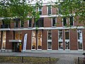
Nederlands: Afbeeldingen van de straat de Hooghout, Breda in Breda in de provincie Noord-Brabant in het zuiden van Nederland. De Bijster, Breda begint bij de straat de Beverweg, Breda, gaat vervolgens langs het Brabantpark (Park) en loopt door tot de rotonde nabij de Monseigneur de Vetstraat en de Heusdenhoutsestraat. Gelegen in de wijk Brabantpark, Breda.
Media in category "Hooghout, Breda"
The following 14 files are in this category, out of 14 total.
-
 Apotheek Brabantpark DSCF5323.jpg 2,048 × 1,536; 1.58 MB
-
 Brabantpark (Park) P1420094.jpg 4,000 × 2,672; 6.21 MB
-
 Hooghout, Breda DSCF5325.jpg 2,048 × 1,536; 1.6 MB
-
 Hooghout, Breda DSCF5328.jpg 2,048 × 1,536; 1.54 MB
-
 Hooghout, Breda DSCF5329.jpg 2,048 × 1,536; 1.59 MB
-
 Hooghout, Breda DSCF5330.jpg 2,048 × 1,536; 1.6 MB
-
 Hooghout, Breda DSCF5331.jpg 2,048 × 1,536; 1.62 MB
-
 Hooghout, Breda DSCF5335.jpg 2,048 × 1,536; 1.57 MB
-
 Hooghout, Breda P1420107.jpg 4,000 × 2,672; 5.85 MB
-
 Markuskerk DSCF5339.jpg 2,048 × 1,536; 1.55 MB
-
 P1030146Hooghout.JPG 3,264 × 2,448; 3.72 MB
-
 P1030147Bibliotheek Oost Breda.JPG 3,264 × 2,448; 3.82 MB
-
 P1030148Bibliotheek Oost Breda.JPG 2,448 × 3,264; 3.64 MB
-
 Terre de Hommes Breda DSCF5327.jpg 2,048 × 1,536; 1.52 MB

_P1420094.jpg)


