Category:Michaelkerk, Breda
Jump to navigation
Jump to search
| Camera location | | View all coordinates using: OpenStreetMap |
|---|
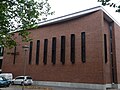
Nederlands: Afbeeldingen van de Michaelkerk, Hooghout 67, 4817 EA Breda. Gelegen in de wijk Brabantpark in het oosten van Breda in de provincie Noord-Brabant in het zuiden van Nederland (bron [1]; [2])
Subcategories
This category has the following 2 subcategories, out of 2 total.
I
V
- Voormalige Michaelkerk, Breda (10 F)
Media in category "Michaelkerk, Breda"
The following 5 files are in this category, out of 5 total.
-
 Brabantpark (Park) DSCF5342.jpg 2,048 × 1,536; 1.61 MB
-
 Hooghout, Breda DSCF5335.jpg 2,048 × 1,536; 1.57 MB
-
 P1030140copyToren Michaelkerk.JPG 2,448 × 3,264; 2.49 MB
-
 P1030145Michaelkerk.JPG 3,264 × 2,448; 3.67 MB
-
 Toren oude Michaelkerk DSCF5336.jpg 1,536 × 2,048; 1.57 MB
_DSCF5342.jpg)


