Category:Goxhill, East Riding of Yorkshire
Jump to navigation
Jump to search
English: Goxhill is a small hamlet in the East Riding of Yorkshire, England in an area known as Holderness. It is situated approximately 2 miles (3.2 km) south west of Hornsea town centre.
village in East Riding of Yorkshire, United Kingdom  | |||||
| Upload media | |||||
| Instance of | |||||
|---|---|---|---|---|---|
| Location | Hatfield, East Riding of Yorkshire, Yorkshire and the Humber, England | ||||
 | |||||
Subcategories
This category has the following 2 subcategories, out of 2 total.
Media in category "Goxhill, East Riding of Yorkshire"
The following 25 files are in this category, out of 25 total.
-
 Bridleway to Stud Farm - geograph.org.uk - 1463715.jpg 640 × 480; 94 KB
-
 Bridleway towards Weather Hill Farm - geograph.org.uk - 1463660.jpg 640 × 480; 85 KB
-
 Farmland near Goxhill - geograph.org.uk - 1463667.jpg 640 × 480; 103 KB
-
 Farmland near Sigglesthorne Grange - geograph.org.uk - 1463707.jpg 640 × 480; 76 KB
-
 Farmland West of Goxhill - geograph.org.uk - 1463680.jpg 640 × 480; 97 KB
-
 Fresh Rolls^ - geograph.org.uk - 30619.jpg 640 × 480; 88 KB
-
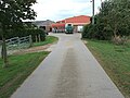
 Goxhill - geograph.org.uk - 516108.jpg 640 × 480; 121 KB
-
 Goxhill Byway looking NE.jpg 640 × 480; 154 KB
-
 Goxhill Byway looking SW.jpg 480 × 640; 134 KB
-
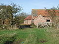 Manor Farm Goxhill.jpg 640 × 482; 117 KB
-
 Manor Farm, Goxhill - geograph.org.uk - 612231.jpg 640 × 478; 112 KB
-
 Minor Road Towards Goxhill - geograph.org.uk - 1463650.jpg 640 × 480; 86 KB
-
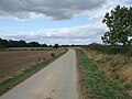 Minor Road Towards Sigglesthorne - geograph.org.uk - 1463673.jpg 640 × 480; 73 KB
-
 Minor Road Towards Sigglesthorne - geograph.org.uk - 1463698.jpg 640 × 480; 85 KB
-
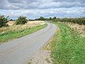 Minor Road Towards Sigglesthorne - geograph.org.uk - 1463721.jpg 640 × 480; 93 KB
-
 Oak Tree Farm Goxhill.jpg 640 × 452; 71 KB
-
 Stud Farm - geograph.org.uk - 1463691.jpg 640 × 480; 63 KB
-
 Stud Farm - geograph.org.uk - 30614.jpg 640 × 480; 92 KB
-
 Stud Farm, Goxhill - geograph.org.uk - 615619.jpg 468 × 640; 83 KB
-
 Track to Stud Farm - geograph.org.uk - 1463689.jpg 640 × 480; 83 KB
-
 Trans Pennine Trail - geograph.org.uk - 1463647.jpg 640 × 480; 116 KB
-
 Wassand Low Crossing.jpg 640 × 483; 92 KB
-
 Water Tower - geograph.org.uk - 30638.jpg 640 × 480; 91 KB
-
 West of Goxhill - geograph.org.uk - 615618.jpg 473 × 640; 92 KB
-
 Wheatfield at TA17104483 - geograph.org.uk - 30617.jpg 640 × 480; 105 KB


