Category:Govan (civil parish)
Jump to navigation
Jump to search
Scottish parish | |||||
| Upload media | |||||
| Instance of | |||||
|---|---|---|---|---|---|
| Part of |
| ||||
| Named after | |||||
| Location |
| ||||
| Capital | |||||
| Population |
| ||||
| Area |
| ||||
 | |||||
Subcategories
This category has the following 3 subcategories, out of 3 total.
H
- Hazelwood House, Glasgow (6 F)
- Hillhead Railway Tunnel (2 F)
K
Media in category "Govan (civil parish)"
The following 200 files are in this category, out of 1,570 total.
(previous page) (next page)-
 "The Model Boat" Mural, Purdon Street - geograph.org.uk - 5876180.jpg 1,075 × 1,600; 361 KB
-
 124 Bellahouston Drive - geograph.org.uk - 5466088.jpg 1,600 × 1,067; 355 KB
-
 23 Dowanside Lane - geograph.org.uk - 6317571.jpg 640 × 640; 329 KB
-
 375 Govan Road - geograph.org.uk - 5934433.jpg 1,024 × 477; 150 KB
-
 86-90 Hyndland Street - geograph.org.uk - 4898454.jpg 1,024 × 768; 172 KB
-
 A Clyde View - geograph.org.uk - 6282617.jpg 800 × 600; 486 KB
-
 A fishmonger's window - geograph.org.uk - 6198338.jpg 1,024 × 768; 273 KB
-
 A ginger cat - geograph.org.uk - 5928401.jpg 1,024 × 904; 454 KB
-

-

-
 A quiet scene at Braehead - geograph.org.uk - 2400109.jpg 640 × 385; 98 KB
-
 A red shed - geograph.org.uk - 3418485.jpg 640 × 480; 124 KB
-
 A summer evening in Glasgow Botanic Garden - geograph.org.uk - 6324919.jpg 1,024 × 768; 382 KB
-
 A view from the M8 - geograph.org.uk - 5149088.jpg 3,264 × 2,448; 3.75 MB
-
 A wavy bench - geograph.org.uk - 3418044.jpg 640 × 388; 139 KB
-
 A yellow machine at Shields Depot - geograph.org.uk - 3502158.jpg 640 × 445; 154 KB
-
 A739 crossing Shieldhall Road - geograph.org.uk - 3474144.jpg 640 × 380; 47 KB
-
 A739 crossing Shieldhall Road, Glasgow - geograph.org.uk - 5686857.jpg 1,024 × 761; 113 KB
-
 A739 from junction 25 of M8 - geograph.org.uk - 4445450.jpg 640 × 377; 40 KB
-
 A8 approaching the A877 - geograph.org.uk - 2958709.jpg 640 × 462; 56 KB
-
 Abhoring a vacuum - geograph.org.uk - 3434914.jpg 640 × 480; 277 KB
-
 ABS Scotland cash ^ carry - geograph.org.uk - 5060273.jpg 640 × 350; 81 KB
-
 Across the Clyde - geograph.org.uk - 6125291.jpg 1,024 × 683; 319 KB
-
 Aggregate Industries plant, Scotstoun - geograph.org.uk - 5765157.jpg 640 × 480; 115 KB
-
 Albion car park - geograph.org.uk - 5756264.jpg 640 × 480; 131 KB
-
 Albion car park - geograph.org.uk - 5756267.jpg 640 × 480; 164 KB
-
 Albion car park - geograph.org.uk - 5756268.jpg 640 × 322; 97 KB
-
 All wrapped up for demolition - geograph.org.uk - 6126788.jpg 1,600 × 1,562; 306 KB
-
 Alley off Holmfauldhead Drive - geograph.org.uk - 5974265.jpg 1,200 × 1,600; 372 KB
-
 Alleyway off Turnberry Road - geograph.org.uk - 4934985.jpg 1,024 × 768; 295 KB
-
 Allotment Gardens - geograph.org.uk - 3483232.jpg 640 × 480; 98 KB
-
 Along University Place - geograph.org.uk - 6125054.jpg 1,024 × 683; 393 KB
-
 Along Woodville Street - geograph.org.uk - 6125303.jpg 1,024 × 683; 425 KB
-
 Apartments on the Clyde in Glasgow - geograph.org.uk - 1945738.jpg 3,137 × 2,560; 2.92 MB
-
 Ashton Lane - geograph.org.uk - 2293740.jpg 590 × 640; 115 KB
-
 At Bells Bridge - geograph.org.uk - 4105490.jpg 4,893 × 3,379; 7.17 MB
-
 Autumn colours, Bingham's Pond - geograph.org.uk - 4504122.jpg 3,504 × 2,336; 4.74 MB
-
 Autumn colours, Dorchester Avenue - geograph.org.uk - 5947985.jpg 1,600 × 1,047; 731 KB
-
 Back Lane - geograph.org.uk - 1639504.jpg 640 × 480; 114 KB
-
 Back of flats on Highfield Drive - geograph.org.uk - 5948490.jpg 1,600 × 1,050; 302 KB
-
 Bar Gallus - geograph.org.uk - 5264288.jpg 640 × 358; 112 KB
-
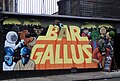 Bar Gallus mural - geograph.org.uk - 5264290.jpg 640 × 432; 131 KB
-

-
 Barclay Curle Titan Crane - geograph.org.uk - 6348975.jpg 1,600 × 1,200; 306 KB
-
 Barclay Curle Titan Crane - geograph.org.uk - 6348985.jpg 1,257 × 1,600; 363 KB
-
 Barclays Bank development at Tradeston - geograph.org.uk - 6319010.jpg 1,024 × 768; 303 KB
-
 Barclays Bank development at Tradeston - geograph.org.uk - 6319013.jpg 1,024 × 668; 211 KB
-
 Beauty, hair and flowers - geograph.org.uk - 6064787.jpg 1,600 × 1,055; 360 KB
-
 Beech leaves, Whittingehame Park - geograph.org.uk - 5174426.jpg 1,600 × 1,067; 534 KB
-
 Below the Great Western Road - geograph.org.uk - 6498636.jpg 1,600 × 778; 601 KB
-
 Bench beside the pond - geograph.org.uk - 6125145.jpg 1,024 × 683; 560 KB
-
 Bench for a Tree (2000) - geograph.org.uk - 2962520.jpg 640 × 480; 133 KB
-
 Benchmark, Lawrence Street, Glasgow - geograph.org.uk - 4383584.jpg 360 × 640; 75 KB
-
 Berryknowes Road, Cardonald - geograph.org.uk - 1364897.jpg 640 × 360; 91 KB
-
 Bike park, Hyndland Road - geograph.org.uk - 4968210.jpg 1,024 × 683; 338 KB
-
 Bingham's Pond - geograph.org.uk - 3607780.jpg 1,024 × 768; 116 KB
-
 Bingham's Pond - geograph.org.uk - 4504149.jpg 640 × 427; 83 KB
-
 Bingham's Pond - geograph.org.uk - 5946037.jpg 1,600 × 1,067; 388 KB
-
 Bingham's Pond - geograph.org.uk - 5946771.jpg 1,600 × 1,067; 508 KB
-
 Bingham's Pond - geograph.org.uk - 6126811.jpg 1,600 × 1,204; 511 KB
-
 Bingham's Pond, Glasgow - geograph.org.uk - 3450147.jpg 640 × 519; 85 KB
-
 Bins on Burgh lane - geograph.org.uk - 5194838.jpg 640 × 358; 116 KB
-
 BIP Building - geograph.org.uk - 2088306.jpg 640 × 480; 129 KB
-
 Black Oak in Glasgow Botanic Garden - geograph.org.uk - 6324932.jpg 768 × 1,024; 436 KB
-
 Block of flats - geograph.org.uk - 6348345.jpg 1,600 × 1,137; 317 KB
-
 Boarded up - geograph.org.uk - 6347073.jpg 1,600 × 1,131; 245 KB
-
 Boating pond at Victoria Park - geograph.org.uk - 6662317.jpg 1,024 × 576; 120 KB
-
 Bonanza Wholesale Fashions - geograph.org.uk - 5060274.jpg 640 × 294; 71 KB
-
 Botanic Gardens walkway, Glasgow - geograph.org.uk - 6619481.jpg 1,024 × 725; 1.26 MB
-
 Bothy at the Walled Garden - geograph.org.uk - 3456061.jpg 4,281 × 2,987; 5.61 MB
-
 Bothy window - geograph.org.uk - 3456083.jpg 4,586 × 3,426; 5.96 MB
-
 BP petrol station, Great Western Road - geograph.org.uk - 5945964.jpg 1,600 × 934; 302 KB
-
 Braehead - geograph.org.uk - 4391453.jpg 800 × 533; 178 KB
-
 Braehead Shopping Centre, Glasgow - geograph.org.uk - 3463493.jpg 640 × 480; 81 KB
-
 Braehead traffic - geograph.org.uk - 3048292.jpg 2,048 × 1,536; 1.54 MB
-
 Bridge abutment, Ford Road - geograph.org.uk - 4835625.jpg 1,024 × 768; 255 KB
-
 Bridge over the Forth and Clyde Canal - geograph.org.uk - 6574600.jpg 1,600 × 1,032; 389 KB
-
 Broomloan Place - geograph.org.uk - 5756463.jpg 640 × 480; 142 KB
-
 Brownfield site, Govanhill - geograph.org.uk - 2638084.jpg 640 × 480; 109 KB
-
 Buchanan Wharf development - geograph.org.uk - 6434316.jpg 1,024 × 599; 249 KB
-
 Buchanan Wharf development - geograph.org.uk - 6434319.jpg 1,024 × 544; 172 KB
-
 Buchanan Wharf development - geograph.org.uk - 6533526.jpg 1,024 × 768; 286 KB
-
 Buchanan Wharf development - geograph.org.uk - 6533531.jpg 1,024 × 768; 372 KB
-
 Buchanan Wharf development - geograph.org.uk - 6533537.jpg 1,024 × 768; 284 KB
-
 Buchanan Wharf development - geograph.org.uk - 6534617.jpg 1,024 × 629; 229 KB
-
 Buchanan Wharf development - geograph.org.uk - 6534630.jpg 1,024 × 516; 183 KB
-
 Buchanan Wharf development - geograph.org.uk - 6534858.jpg 768 × 1,024; 263 KB
-
 Buchanan Wharf development - geograph.org.uk - 6534859.jpg 1,024 × 748; 254 KB
-
 Buchanan Wharf development - geograph.org.uk - 6638697.jpg 1,024 × 836; 329 KB
-
 Buchanan Wharf development - geograph.org.uk - 6638701.jpg 1,024 × 655; 278 KB
-
 Buchanan Wharf development - geograph.org.uk - 6638704.jpg 1,024 × 640; 260 KB
-
 Building and car park - geograph.org.uk - 6348430.jpg 1,600 × 1,106; 293 KB
-
 Building base, Renfrew - geograph.org.uk - 4788999.jpg 640 × 480; 117 KB
-
 Building on Burgh Hall Street - geograph.org.uk - 3607339.jpg 640 × 480; 145 KB
-
 Building on Whitefield Road at Summertown Road - geograph.org.uk - 5934968.jpg 1,024 × 474; 144 KB
-
 Building site - geograph.org.uk - 1181808.jpg 640 × 480; 65 KB
-
 Building site beside South Street - geograph.org.uk - 3993332.jpg 1,024 × 792; 143 KB
-
 Building site hoarding - geograph.org.uk - 4252746.jpg 640 × 480; 165 KB
-
 Building site off Partickhill Road - geograph.org.uk - 5987074.jpg 1,024 × 768; 122 KB
-
 Building under construction - geograph.org.uk - 6219021.jpg 1,215 × 1,600; 420 KB
-
 Building work beside the River Kelvin - geograph.org.uk - 5435700.jpg 1,600 × 1,200; 350 KB
-
 Buildings on Fairley Street, Glasgow - geograph.org.uk - 3629150.jpg 1,024 × 768; 148 KB
-
 Buildings under construction - geograph.org.uk - 6219010.jpg 1,600 × 907; 280 KB
-
 Bumblebee on heather - geograph.org.uk - 3456203.jpg 1,669 × 1,222; 1.01 MB
-
 Bus lanes, Govan Road - geograph.org.uk - 6195812.jpg 1,024 × 683; 121 KB
-
 Bus stop on Cleveden Road, Kelvindale - geograph.org.uk - 6195496.jpg 1,024 × 683; 167 KB
-
 Bus Stop on Victoria Park Drive South - geograph.org.uk - 6369798.jpg 800 × 600; 373 KB
-
 Bute Hall door at Glasgow University - geograph.org.uk - 3849503.jpg 477 × 640; 148 KB
-
 Bute Hall staircase - geograph.org.uk - 3849497.jpg 480 × 640; 168 KB
-
 Café Adem - geograph.org.uk - 6348429.jpg 1,186 × 1,600; 411 KB
-
 Car dealerships at Renfrew - geograph.org.uk - 5149062.jpg 3,264 × 2,448; 2.4 MB
-
 Car park, Stanley Street Lane, Glasgow - geograph.org.uk - 4405624.jpg 1,600 × 1,200; 367 KB
-
 Car wash, Clyde Place - geograph.org.uk - 5485247.jpg 1,600 × 1,200; 874 KB
-
 Car wash, Govan Road - geograph.org.uk - 6196626.jpg 1,280 × 960; 306 KB
-
 Car Wash, Renfrew - geograph.org.uk - 2702222.jpg 640 × 480; 70 KB
-
 Carlton Place - geograph.org.uk - 6433619.jpg 1,024 × 526; 246 KB
-
 Carlton Place - geograph.org.uk - 6535968.jpg 1,024 × 444; 241 KB
-
 Carlton Place - geograph.org.uk - 6639645.jpg 1,024 × 769; 368 KB
-
 Carlton Place - geograph.org.uk - 6643243.jpg 1,024 × 666; 287 KB
-
 Cast iron lamp standard - geograph.org.uk - 5194830.jpg 480 × 640; 158 KB
-
 Cast iron lamp standard detail - geograph.org.uk - 5194834.jpg 640 × 480; 135 KB
-
 Cast iron lamp standards - geograph.org.uk - 5194828.jpg 480 × 640; 137 KB
-
 Cast iron railings, Belmont Crescent, Hillhead - geograph.org.uk - 6202678.jpg 1,280 × 960; 437 KB
-
 Cast iron railings, Belmont Street, Hillhead - geograph.org.uk - 6202677.jpg 960 × 1,280; 403 KB
-
 Cat on a car roof - geograph.org.uk - 4890946.jpg 640 × 461; 159 KB
-
 Catherines of Partick - geograph.org.uk - 6054047.jpg 1,600 × 1,259; 356 KB
-
 Catherines of Partick - geograph.org.uk - 6054050.jpg 1,600 × 1,457; 367 KB
-
 Cats Protection Supawstore - geograph.org.uk - 6162008.jpg 1,024 × 616; 254 KB
-
 CEMEX Clyde Tunnel concrete plant - geograph.org.uk - 6348797.jpg 1,600 × 1,097; 319 KB
-
 Cessnock Newsagent - geograph.org.uk - 5909753.jpg 1,024 × 768; 328 KB
-
 Chapel of Glasgow University - geograph.org.uk - 6324730.jpg 1,024 × 768; 203 KB
-

-

-
 Chimney, Gartnavel Hospitals - geograph.org.uk - 5945921.jpg 1,600 × 1,479; 436 KB
-
 Christ Apostolic Church - geograph.org.uk - 5909738.jpg 1,024 × 518; 205 KB
-
 Church Officer's House - geograph.org.uk - 5944869.jpg 1,600 × 1,059; 484 KB
-

-

-
 City Union Railway bridge, Glasgow - geograph.org.uk - 6618719.jpg 1,024 × 768; 1.49 MB
-
 Clarence Gardens - geograph.org.uk - 3419642.jpg 640 × 405; 132 KB
-
 Clearing the debris - geograph.org.uk - 3608108.jpg 1,024 × 768; 257 KB
-
 Clyde Bridge renovation works - geograph.org.uk - 6433603.jpg 1,024 × 768; 276 KB
-
 Clyde Bridge renovation works - geograph.org.uk - 6433626.jpg 1,024 × 768; 266 KB
-
 Clyde Bridge renovation works - geograph.org.uk - 6433628.jpg 1,024 × 768; 240 KB
-
 Clyde Bridge renovation works - geograph.org.uk - 6434323.jpg 1,024 × 507; 183 KB
-
 Clyde Bridge renovation works - geograph.org.uk - 6434325.jpg 1,024 × 474; 179 KB
-
 Clyde Bridge renovation works - geograph.org.uk - 6434326.jpg 1,024 × 729; 325 KB
-
 Clyde Bridge renovation works - geograph.org.uk - 6534569.jpg 1,024 × 768; 336 KB
-
 Clyde Bridge renovation works - geograph.org.uk - 6534866.jpg 1,024 × 768; 249 KB
-
 Clyde Bridge renovation works - geograph.org.uk - 6534867.jpg 1,024 × 768; 341 KB
-
 Clyde Bridge renovation works - geograph.org.uk - 6534868.jpg 899 × 1,024; 354 KB
-
 Clyde Bridge renovation works - geograph.org.uk - 6534870.jpg 1,024 × 768; 280 KB
-
 Clyde Bridge renovation works - geograph.org.uk - 6639637.jpg 1,024 × 769; 324 KB
-
 Clyde Bridge renovation works - geograph.org.uk - 6639648.jpg 1,024 × 714; 293 KB
-
 Clyde Bridge renovation works - geograph.org.uk - 6639654.jpg 1,024 × 768; 321 KB
-
 Clyde Bridge renovation works - geograph.org.uk - 6643242.jpg 1,024 × 768; 234 KB
-
 Clyde Tunnel Control sign - geograph.org.uk - 6348387.jpg 1,600 × 1,200; 794 KB
-
 CNT stone - geograph.org.uk - 957056.jpg 640 × 480; 70 KB
-
 Coloured apartments on Golspie Road - geograph.org.uk - 6444403.jpg 2,700 × 2,025; 308 KB
-
 Commerce Street - geograph.org.uk - 6533524.jpg 1,024 × 768; 329 KB
-
 Commerce Street - geograph.org.uk - 6533525.jpg 1,024 × 768; 282 KB
-
 Community Centre For Health - geograph.org.uk - 6078952.jpg 1,024 × 651; 110 KB
-
 Community Garden - geograph.org.uk - 965422.jpg 640 × 480; 114 KB
-
 Community Notice Board - geograph.org.uk - 4252750.jpg 640 × 427; 107 KB
-
 Construction continues - geograph.org.uk - 6312305.jpg 1,600 × 1,159; 303 KB
-
 Contrasting architecture on Cleveden Road - geograph.org.uk - 4877055.jpg 3,504 × 2,336; 4.05 MB
-
 Cooper ^ Co, 499 Great Western Road - geograph.org.uk - 6202689.jpg 1,280 × 955; 498 KB
-
 Covered material at King George V Dock - geograph.org.uk - 5765584.jpg 640 × 480; 148 KB
-

-
 Crathie Court - geograph.org.uk - 3418337.jpg 480 × 640; 135 KB
-
 Crathie Court - geograph.org.uk - 3418434.jpg 480 × 640; 108 KB
-
 Crathie Court - geograph.org.uk - 3418472.jpg 640 × 480; 160 KB
-
 Crathie Court - geograph.org.uk - 3418475.jpg 640 × 480; 153 KB
-
 Crathie Court - geograph.org.uk - 3418482.jpg 480 × 640; 172 KB
-
 Crathie Court - geograph.org.uk - 3418595.jpg 640 × 480; 120 KB
-
 Crathie Court - geograph.org.uk - 3418596.jpg 480 × 640; 135 KB
-
 Crathie Court - geograph.org.uk - 3418597.jpg 480 × 640; 132 KB
-
 Crathie Court - geograph.org.uk - 3418600.jpg 640 × 567; 165 KB
-
 Crathie Court - geograph.org.uk - 3418603.jpg 640 × 395; 110 KB
-
 Crathie Court - geograph.org.uk - 3418620.jpg 480 × 640; 115 KB
-
 Crocuses, Queen's Park - geograph.org.uk - 5304398.jpg 1,600 × 1,039; 573 KB
-
 Cross Park - geograph.org.uk - 3419585.jpg 640 × 480; 194 KB
-
 Cross Park - geograph.org.uk - 3419591.jpg 640 × 480; 168 KB
-
 Cross Park - geograph.org.uk - 3419593.jpg 640 × 480; 194 KB
-
 Cross-river view from Linthouse - geograph.org.uk - 6196620.jpg 1,280 × 960; 334 KB
-
 Crow Road railway station (site), Glasgow - geograph.org.uk - 6070524.jpg 1,600 × 1,200; 399 KB
-
 Crowne Plaza Hotel - geograph.org.uk - 6644274.jpg 533 × 800; 119 KB
-
 Cumbrae House - geograph.org.uk - 2911553.jpg 640 × 367; 107 KB
-
 Curlers Rest - geograph.org.uk - 6313368.jpg 1,600 × 1,090; 349 KB
-
 Cycle and pedestrian path - geograph.org.uk - 5576396.jpg 1,600 × 1,200; 422 KB
-
 Cycle path, Westland Drive - geograph.org.uk - 3819985.jpg 800 × 600; 510 KB
-
 Cycle route marker - geograph.org.uk - 2088449.jpg 480 × 640; 208 KB
-
 D R Adam Paisley brick - geograph.org.uk - 6053173.jpg 1,024 × 733; 534 KB
-
 Daffodils in Festival Park - geograph.org.uk - 6125147.jpg 1,024 × 683; 636 KB
-
 Date stone - geograph.org.uk - 957059.jpg 640 × 351; 27 KB
-
 Date stone at Orkney Place - geograph.org.uk - 5927422.jpg 606 × 1,024; 183 KB
-
 Daydream of a Nightmare - geograph.org.uk - 3454508.jpg 4,608 × 3,456; 6.78 MB
-
 Deanside Transit Branch - geograph.org.uk - 6563628.jpg 1,600 × 1,210; 481 KB
-
 Demolished factory - geograph.org.uk - 3708415.jpg 640 × 480; 297 KB
-
 Demolition and construction - geograph.org.uk - 6020446.jpg 1,600 × 1,060; 286 KB


_-_geograph.org.uk_-_2962520.jpg)


_instructions_-_geograph.org.uk_-_6643254.jpg)
_instructions_-_geograph.org.uk_-_6643255.jpg)


,_Glasgow_-_geograph.org.uk_-_6070524.jpg)


&filefrom=Deoch+an+Dorus%2C+Dumbarton+Road%2C+Partick+-+geograph.org.uk+-+6323112.jpg#mw-category-media)