Category:Geology of Montana
Jump to navigation
Jump to search
Wikimedia category | |||||
| Upload media | |||||
| Instance of | |||||
|---|---|---|---|---|---|
| Category combines topics | |||||
| Montana | |||||
state of the United States of America  someja satełitar in łujo     | |||||
| Pronunciation audio | |||||
| Instance of | |||||
| Part of | |||||
| Named after | |||||
| Location |
| ||||
| Located in or next to body of water | |||||
| Capital | |||||
| Legislative body | |||||
| Executive body | |||||
| Highest judicial authority | |||||
| Official language | |||||
| Anthem |
| ||||
| Head of government |
| ||||
| Inception |
| ||||
| Highest point | |||||
| Population |
| ||||
| Area |
| ||||
| Elevation above sea level |
| ||||
| Replaces | |||||
| Different from | |||||
| Maximum temperature record |
| ||||
| Minimum temperature record |
| ||||
| official website | |||||
 | |||||
States of the United States: Alabama · Alaska · Arizona · Arkansas · California · Colorado · Connecticut · Delaware · Florida · Georgia (U.S. state) · Hawaii · Idaho · Illinois · Indiana · Iowa · Kansas · Kentucky · Louisiana · Maine · Maryland · Massachusetts · Michigan · Minnesota · Mississippi (state) · Missouri · Montana · Nebraska · Nevada · New Hampshire · New Jersey · New Mexico · New York (state) · North Carolina · North Dakota · Ohio · Oklahoma · Oregon · Pennsylvania · Rhode Island · South Carolina · South Dakota · Tennessee · Texas · Utah · Vermont · Virginia · Washington (state) · West Virginia · Wisconsin · Wyoming – the District of Columbia: Washington, D.C.
the insular areas of the United States: American Samoa · Guam · the Northern Mariana Islands · Puerto Rico · the United States Virgin Islands – the United States Minor Outlying Islands: Bajo Nuevo Bank · Baker Island · Howland Island · Jarvis Island · Johnston Atoll · Kingman Reef · Midway Atoll · Navassa Island · Palmyra Atoll · Serranilla Bank · Wake Island
the insular areas of the United States: American Samoa · Guam · the Northern Mariana Islands · Puerto Rico · the United States Virgin Islands – the United States Minor Outlying Islands: Bajo Nuevo Bank · Baker Island · Howland Island · Jarvis Island · Johnston Atoll · Kingman Reef · Midway Atoll · Navassa Island · Palmyra Atoll · Serranilla Bank · Wake Island
Subcategories
This category has the following 19 subcategories, out of 19 total.
Media in category "Geology of Montana"
The following 31 files are in this category, out of 31 total.
-
 5356 1.md.gif 250 × 241; 29 KB
-
 Adel mountains montana hardybridge.jpg 1,000 × 684; 1.35 MB
-
 Aerial View Camas Prairie Ripples Montana.jpg 2,068 × 2,277; 1.18 MB
-
 Altyn and Appekunny Fm Slingshot Mtn.jpg 5,152 × 2,451; 7.45 MB
-
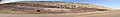
 Bearpaw Mtns.jpg 1,400 × 820; 610 KB
-
 Bearpaws.jp.jpg 360 × 158; 13 KB
-
 FEDLINK - United States Federal Collection (IA CAT10634531).pdf 1,200 × 1,600, 64 pages; 2.76 MB
-

-

-
 Double terminated quartz in rhyolite.jpg 4,032 × 3,024; 3.14 MB
-
 Eagle Butte, Bearpaw Mountains.jpg 1,400 × 844; 704 KB
-
 Eagle SS.jpg 4,032 × 1,570; 2.43 MB
-
 Giant ripple marks.jpg 450 × 324; 16 KB
-

-
 Hebgen Lake Landslide.jpg 980 × 667; 100 KB
-
 Hell Creek.jpg 720 × 466; 307 KB
-
 HPC-000950.jpg (66b39d7ed0454b3bb371e4e7058ecd8a).jpg 516 × 412; 28 KB
-
 Judith River Formation exposure-1.jpg 11,773 × 4,025; 40.19 MB
-
 Judith River Formation exposure-2.jpg 9,626 × 3,203; 28.88 MB
-
 Kootenai Formation.jpg 20,409 × 2,971; 48.15 MB
-
 Lewis overthrust fault nh10f.jpg 1,400 × 870; 71 KB
-
 Limestone Butte Montana Laccolith.jpg 1,500 × 1,000; 526 KB
-
 Lokiceratops (discovery, locality, and skeletal).jpg 1,606 × 2,155; 803 KB
-
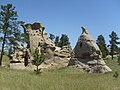 Medicine Rocks State Park.jpg 2,048 × 1,536; 852 KB
-
 Normal fault, MT.jpg 2,982 × 1,988; 5.01 MB
-

-
 Sevierorogeny.jpg 2,482 × 933; 131 KB
-
 Sleeping Giant 2010.jpg 1,910 × 1,193; 861 KB
-
 Square Butte, MT.jpg 836 × 522; 195 KB
-
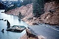 State Highway 287 slumped into Hebgen Lake.jpg 3,483 × 2,329; 7.69 MB
-
 TransZ.jpg 960 × 720; 23 KB


_2.jpg)
_2.jpg)


_(16601144800).jpg)


.jpg)


.jpg)


_(30588174684).jpg)


