Category:Geology of Louisiana
Appearance
Wikimedia category | |||||
| Upload media | |||||
| Instance of | |||||
|---|---|---|---|---|---|
| Category combines topics | |||||
| Louisiana | |||||
state of the United States of America | |||||
| Pronunciation audio | |||||
| Instance of | |||||
| Part of | |||||
| Named after | |||||
| Location |
| ||||
| Located in or next to body of water | |||||
| Capital | |||||
| Legislative body | |||||
| Executive body | |||||
| Highest judicial authority | |||||
| Anthem |
| ||||
| Head of government |
| ||||
| Inception |
| ||||
| Highest point | |||||
| Population |
| ||||
| Area |
| ||||
| Elevation above sea level |
| ||||
| Replaces | |||||
| Different from | |||||
| Maximum temperature record |
| ||||
| Minimum temperature record |
| ||||
| official website | |||||
 | |||||
Subcategories
This category has the following 24 subcategories, out of 24 total.
*
+
E
G
L
- Landslides in Louisiana (empty)
M
- Mining in Louisiana (2 F)
O
P
R
S
T
- Tectonic landforms in Louisiana (empty)
Media in category "Geology of Louisiana"
The following 19 files are in this category, out of 19 total.
-
Bulletin 429 Plate XIII A South bank Caddo Lake Wilcox beds.jpg 1,220 × 958; 180 KB
-
Bulletin 429 Plate XIII B Clay loam beds Mooringsport.jpg 1,215 × 1,088; 153 KB
-
Bulletin 429 Plate XIV A Concretions Wilcox.jpg 1,288 × 886; 135 KB
-
Bulletin 429 Plate XIV B Concretions Slaughterpen Bluff.jpg 1,287 × 1,029; 159 KB
-
Bulletin 429 Plate XXI A Well on Gilbert Tract.jpg 1,296 × 1,053; 161 KB
-
Bulletin 429 Plate XXI B Dawes Trustee Well No. 1.jpg 993 × 1,072; 57 KB
-
Bulletin 429 Plate XXII A Lirette gas well.jpg 882 × 1,216; 105 KB
-
Bulletin 429 Plate XXII B Gas escapement Lake Felicity.jpg 1,295 × 941; 93 KB
-
Geology and underground water resources of northern Louisiana (1906) (14763156165).jpg 2,224 × 1,496; 1.74 MB
-
Haynesville Shale Map.pdf 1,650 × 1,275; 362 KB
-
Haynesville Shale Map.png 1,650 × 1,275; 667 KB
-
Lower Mississippi River landloss over time.jpg 5,100 × 3,300; 398 KB
-
Map Caddo oil field(Louisiana).png 894 × 832; 244 KB
-
Mississippi Delta Lobes.jpg 800 × 484; 73 KB
-
Red River, Louisiana Cross Section1.jpg 5,487 × 6,734; 1.75 MB
-
USGS Landscape landloss WetlandLoss Red Louisiana.jpg 1,000 × 333; 160 KB
-
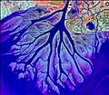
Wax Lake Delta.jpg 292 × 256; 84 KB


