Category:Geological maps of Canada
Jump to navigation
Jump to search
Countries of the Americas: Argentina · Belize · Bolivia · Brazil · Canada · Chile · Colombia · Costa Rica · Ecuador · El Salvador · Guatemala · Mexico · Nicaragua · Panama · Paraguay · Peru · United States of America · Uruguay · Venezuela
Other areas: French Guiana · Greenland · Guadeloupe · Martinique · Puerto Rico
Other areas: French Guiana · Greenland · Guadeloupe · Martinique · Puerto Rico
Subcategories
This category has the following 35 subcategories, out of 35 total.
*
- Old geological maps of Canada (13 F)
C
E
H
- Hydrological maps of Canada (1 F)
M
- Maps of the Canadian Shield (4 F)
V
Media in category "Geological maps of Canada"
The following 68 files are in this category, out of 68 total.
-

-
 1872 North Cascades Isoseismal Map.png 1,464 × 1,544; 508 KB
-

-
 Acasta Acasta.png 1,926 × 910; 1.68 MB
-
 Acasta.png 2,301 × 910; 1.72 MB
-
 Animikie Group and Marquette Range and Huronian supergroups.PNG 386 × 436; 59 KB
-
 Animikie Group, Marquette Range and Huronian supergroups2.PNG 692 × 776; 183 KB
-
 Annual report (1902) (14577381448).jpg 3,896 × 2,144; 1.27 MB
-
 Annual report (1913) (14801011613).jpg 2,528 × 2,834; 1.37 MB
-
 Annual report (1920) (14592483169).jpg 1,362 × 2,848; 583 KB
-
-
 Approximate area of the Niagara Escarpment 2.PNG 514 × 458; 30 KB
-
 Bedrock of Wernecke Mountains in the Yukon.png 595 × 767; 701 KB
-
 Burgess shale location.png 500 × 405; 87 KB
-
 Canada geol.jpg 2,000 × 1,414; 464 KB
-
 Canada geological map-WCSB.JPG 2,000 × 1,557; 2.07 MB
-
 Canada geological map.JPG 2,000 × 1,557; 2.25 MB
-
 Canada kimberlite locations.png 706 × 599; 133 KB
-
 Contributions to Canadian biology (1915) (14589422859).jpg 2,016 × 2,876; 740 KB
-

-
 Faille de Cadillac.png 963 × 464; 393 KB
-
 Geological Map of portions of Saskatchewan, Athabaska, and Keewatin Districts 1902.pdf 5,022 × 4,256; 4.58 MB
-
 Geology belts of western Canada.png 376 × 665; 40 KB
-
 Grand Manan Geology Map.jpg 2,550 × 3,300; 927 KB
-
 Great Lakes Tectonic Zone map.PNG 233 × 104; 6 KB
-
 Grenville extent.gif 1,110 × 890; 91 KB
-
 Grouse Creek block location1.jpg 1,131 × 1,206; 565 KB
-
 Gunnar Mine geologic map and cross section.png 365 × 573; 59 KB
-
 Itcha Range geology.png 571 × 370; 66 KB
-
 Jeanne dArc Basin.jpg 820 × 521; 58 KB
-
 Juan de fuca plate.png 536 × 652; 46 KB
-
 Main Endeavour hydrothermal map.png 250 × 226; 21 KB
-
 Map of the Circum-Superior Belt highlighting location of the Winnipegosis Komatiite Belt.png 5,640 × 3,583; 2.12 MB
-
 Map, Wopmay Orogen, Canada gov.pdf 6,506 × 5,770; 11.97 MB
-
 Marcellus Shale USGS.png 300 × 350; 78 KB
-
 Midcontinent Rift map.PNG 774 × 675; 55 KB
-
 Montney Formation.jpg 2,550 × 3,300; 1.19 MB
-
 Mount Cayley volcanic field.png 308 × 725; 181 KB
-
 Nazko volcanics.png 533 × 424; 148 KB
-
 NEPTUNE Canada overview map.jpg 544 × 445; 220 KB
-
 Niagara Escarpment map.png 931 × 535; 29 KB
-
 Non-Ferrous Metals - Eastern Canada map.pdf 3,975 × 2,975; 1.31 MB
-
 North america and scandinavia basement rocks.png 484 × 429; 15 KB
-
 North American provinces and orogens.PNG 497 × 583; 237 KB
-
 Northern Canada and Greenland Paleogene tectonics.jpg 448 × 1,613; 304 KB
-
 Northwestern Canadian Shield.jpg 799 × 617; 259 KB
-
 Oil shale in Canada.png 1,062 × 944; 145 KB
-
 Onondaga Formation.jpg 752 × 384; 60 KB
-
 Ottawabonnecheregrabenmap.png 600 × 525; 446 KB
-
 PrairiePotholeRegionMap.gif 295 × 302; 5 KB
-
 Report of the Canadian Arctic Expedition 1913-18 (1919) (20602297159).jpg 3,116 × 3,904; 590 KB
-
 South BC-NW USA-relief CaribooPlateau2.png 708 × 600; 963 KB
-
 Tectonic forces in Cascadia.png 800 × 425; 113 KB
-
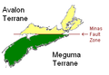 Terranes of Nova Scotia.PNG 281 × 194; 11 KB
-
 The Crystal Falls iron-bearing district of Michigan (1899) (20091627914).jpg 3,299 × 2,719; 810 KB
-
 The Michipicoten iron ranges (1902) (14579747000).jpg 3,328 × 4,176; 1.97 MB
-
 The Michipicoten iron ranges (1902) (14579985017).jpg 4,312 × 1,958; 1,002 KB
-
 The Michipicoten iron ranges (1902) (14764089544).jpg 2,176 × 4,116; 1,005 KB
-
 The Michipicoten iron ranges (1902) (14766124382).jpg 3,328 × 4,220; 2.28 MB
-
 The Michipicoten iron ranges (1902) (14766127952).jpg 3,182 × 4,310; 1.74 MB
-
 The Michipicoten iron ranges (1902) (14786315663).jpg 3,328 × 3,094; 1.45 MB
-
 The Onondaga Formation.png 3,162 × 2,405; 166 KB
-
 The Quarterly journal of the Geological Society of London (12684665984).jpg 1,480 × 1,021; 358 KB
-

-
 Ungava magmatic event He.jpg 346 × 547; 43 KB
-
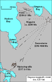 Ungava magmatic event.png 346 × 547; 22 KB
-
 Williston Basin tectonic map.jpg 635 × 748; 83 KB
-
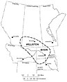 WillistonBasinLocation.jpg 650 × 800; 52 KB


_(14577381448).jpg)
_(14801011613).jpg)
_(14592483169).jpg)
_(14596748360).jpg)


_(14589422859).jpg)
_(20841301505).jpg)


_(20602297159).jpg)


_(20091627914).jpg)
_(14579747000).jpg)
_(14579985017).jpg)
_(14764089544).jpg)
_(14766124382).jpg)
_(14766127952).jpg)
_(14786315663).jpg)

.jpg)
_(14773680482).jpg)


.jpg)
%27_(11110409564).jpg)