
Category:Geological maps of Asia
Subcategories
This category has the following 11 subcategories, out of 11 total.
Media in category "Geological maps of Asia"
The following 141 files are in this category, out of 141 total.
-
 105 of 'Buried Cities and Bible Countries' (11212909116).jpg 1,325 × 1,780; 570 KB
-
 1926 map - Carte géologique du Liban par G. Zumoffen.jpg 9,160 × 11,632; 14.68 MB
-
 Anadolu plakası ve fay kuşakları.png 2,475 × 1,553; 1.93 MB
-
 Anatolian and Arabic Plate.jpg 1,900 × 982; 1.76 MB
-
 Anatolian Plate Vectoral ku.svg 2,477 × 1,554; 3.07 MB
-
 Anatolian Plate Vectoral.svg 2,477 × 1,554; 8.63 MB
-
 Andamanpook.jpg 415 × 571; 96 KB
-

-
 Arabian-Nubian Shield-fr.svg 1,181 × 1,494; 49 KB
-
 Arabian-Nubian Shield.svg 1,181 × 1,494; 49 KB
-
 Arafura-geomap.jpg 661 × 680; 142 KB
-
 Average elevation of Asian countries.jpg 1,414 × 1,525; 296 KB
-
 Beringia - late wisconsin glaciation.png 269 × 371; 24 KB
-
 Blocks of North China Craton.png 609 × 394; 33 KB
-
 Borneo Topography Kutai basin.png 1,725 × 1,824; 2.53 MB
-
 Cambodia geology2.jpg 3,508 × 2,218; 3.43 MB
-
 Carte Geologique Europe cropped Middle East.JPG 1,022 × 684; 130 KB
-
 Central Asia.tif 1,993 × 2,564; 19.51 MB
-
 China map with craton and tectonic elements .png 1,800 × 1,263; 205 KB
-
 North China Craton Map.png 1,800 × 1,263; 132 KB
-
 China, North Korea, and South Korea map with craton and tectonic elements final 3.png 1,373 × 1,146; 183 KB
-
 Chino-Korean craton location.jpg 512 × 532; 199 KB
-
-
 Continental rift model for the spreading of the South China Sea (cropped).jpeg 1,268 × 1,183; 56 KB
-
 Continental rift model for the spreading of the South China Sea.pdf 1,239 × 1,754; 43 KB
-
 Die Binnenbecken des Iranischen Hochlandes (1920) (14590887277).jpg 3,306 × 2,538; 1.43 MB
-
 Die Binnenbecken des Iranischen Hochlandes (1920) (14774236351).jpg 3,068 × 1,832; 864 KB
-
 Division of North China Craton.png 1,500 × 1,125; 326 KB
-
 Eastern Belt1.jpg 307 × 559; 777 KB
-
 ETH-BIB-Vorder-Asien, geotektonische Karte-Dia 247-12367.tif 3,623 × 2,482; 8.66 MB
-
 Eurasian & Anatolian Plate.jpg 837 × 344; 148 KB
-
 Exposure map of Archean basement rocks and Jiao-Liao-Ji Belt.png 561 × 514; 103 KB
-
 Extent of Siberian traps german.png 2,000 × 1,225; 3.28 MB
-
 Extent of Siberian traps he.png 2,000 × 1,225; 3.92 MB
-
 Extent of Siberian traps-it.svg 1,897 × 1,082; 3.75 MB
-
 Extent of Siberian traps-ru.svg 1,897 × 1,082; 3.75 MB
-
 Faults in qiantang basin.svg 1,730 × 1,295; 156 KB
-
 General map of central and southern Tibet.png 2,184 × 1,129; 137 KB
-
 Geognostische Karte des Libanon und Antilibanon in Sirien.jpg 7,990 × 6,801; 16.16 MB
-
 Geol Cyprus-fr.png 842 × 346; 130 KB
-
 Geological map of Kai Besar and Kai Kecil Islands.JPG 836 × 1,029; 177 KB
-
 Geological map of Kashmir Valley.jpg 5,160 × 4,740; 1.96 MB
-

-
 Geological map of portion of the Sultanate of Shehr & Makalla, South Arabia. LOC 2013594210-1.tif 7,216 × 5,545; 114.48 MB
-
 Geological map of Qinling.png 890 × 375; 56 KB
-
 Geological map of RSO.png 650 × 850; 40 KB
-
 Geological map of Seram Island.JPG 1,577 × 1,110; 320 KB
-
 Geological map of the CAOB.png 1,755 × 821; 2.3 MB
-
 Geological-summary-map-Barito Basin.jpg 529 × 750; 117 KB
-
 Geology of the Caucasus.jpg 590 × 450; 132 KB
-
 Gornoye Ozero geologic map.png 964 × 684; 139 KB
-
 GPS copy.gif 970 × 569; 97 KB
-
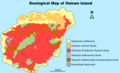 Geological map of Hainan Island.png 1,173 × 712; 209 KB
-
 Faults updated.png 1,316 × 1,125; 2.59 MB
-
 HimalayaCollisionMap.jpg 619 × 761; 203 KB
-
 Himalayan Litho-tectonic Zone.png 1,933 × 1,064; 375 KB
-
 Hypothesis 1 v2.png 456 × 945; 202 KB
-
 India-Asia collision with no deformation.jpg 800 × 600; 165 KB
-
 India-Eurasia Map featuring suture zones and key areas with ophiolitic suites.pdf 1,275 × 1,650; 1.01 MB
-
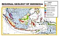 INDONESIA geology map.jpg 780 × 483; 103 KB
-
 Issyk Kul.png 1,348 × 745; 1.36 MB
-
 Junggar basin map(2).png 3,026 × 2,019; 97 KB
-
 Junggar basin map(3).png 3,026 × 2,021; 339 KB
-
 Junggar basin map.png 3,026 × 2,019; 95 KB
-
 Kalimantan-geomap.jpg 382 × 600; 64 KB
-
 Kalimantan-Tarakan-geomap.jpg 282 × 410; 43 KB
-
 Kara Sea structural map.png 821 × 752; 122 KB
-
 Karakorum fault superimposed on top of topographic map.pdf 1,275 × 1,650; 431 KB
-
 North China Craton diagram, Kusky's model.png 1,297 × 1,292; 322 KB
-
 Kusky evolutionary diagram, North China Craton.png 1,293 × 1,289; 323 KB
-
 Kusky map and cross- section diagram.png 996 × 752; 160 KB
-
 Kusky map evolutionary diagram combined 2.png 1,296 × 1,318; 340 KB
-
 Kusky map evolutionary diagram.png 996 × 752; 136 KB
-
 Kusky's subdivision of the Western Block of North China Craton.png 1,500 × 978; 363 KB
-
 Lebanon tectonics-ar.png 1,816 × 2,111; 1.05 MB
-
 Lebanon tectonics.png 1,816 × 2,111; 787 KB
-
 Lesser Sunda.png 398 × 332; 179 KB
-
 Libona Bukidnon geologic map.jpg 2,481 × 3,509; 1.18 MB
-
 Location map of the Nankai Trough.png 880 × 657; 359 KB
-
 Location of basin.png 655 × 410; 171 KB
-
 Location of junggar basin.svg 512 × 408; 2.34 MB
-
 Location of North China Craton.png 1,559 × 1,125; 593 KB
-
 Location of the Eastern Block of North China Craton.png 3,779 × 3,335; 922 KB
-
 Mahakam delta geologic map.jpg 1,048 × 1,280; 262 KB
-
 Makran subduction zone.png 615 × 340; 121 KB
-
 Map Geological Map of Asia 1928-1940 - Touring Club Italiano CART-TRC-25.jpg 6,103 × 6,825; 5.15 MB
-

-
 Map of exposed Archean basement rocks and Jiao-Liao-Ji Belt.jpg 552 × 517; 98 KB
-

-
 Map view evolution of the 1.85Ga Craton Amalgamation Model.png 430 × 476; 89 KB
-
 Mardin Anticline surface geologic map.jpg 1,210 × 645; 295 KB
-
 Mardin High.jpg 1,231 × 815; 312 KB
-
 Mardin Licenses near Syria and Iraq.jpg 1,570 × 1,003; 643 KB
-
 Mesozoic to Cenozoic of Junggar Basin(2).gif 1,100 × 775; 210 KB
-
 Mesozoic to Cenozoic of Junggar Basin.gif 1,100 × 767; 240 KB
-
 Mimodactylus map.png 1,888 × 1,519; 1.3 MB
-
 Nankai Trough location map.jpg 626 × 493; 43 KB
-
 Nias-geology-map.jpg 580 × 916; 122 KB
-
 Nineveh anticlinal structures.svg 709 × 555; 107 KB
-
 Western block eastern block image .png 609 × 394; 33 KB
-
 Zhai and Santosh model.png 454 × 309; 47 KB
-

-
 North China Craton phanerozoic folding model.png 640 × 676; 143 KB
-
 North China phanerozoic tectonic elements.png 586 × 420; 70 KB
-
 North China phanerozoic tectonic.png 590 × 448; 82 KB
-
 North China phanerozoic thickness contour.png 599 × 582; 46 KB
-
 North China phanerozoic thickness.png 543 × 368; 43 KB
-
 North-sumatra-basin-map.jpg 1,217 × 812; 203 KB
-
 Orta Araz təbii vilayətinin geoloji xəritəsi.2.jpg 2,039 × 2,893; 931 KB
-
 Palestine (1889 book) 29.jpg 1,662 × 2,863; 703 KB
-
 Petroleum Distribution in Junggar Basin.png 3,225 × 1,789; 99 KB
-
 Petroleum Distribution(2).png 3,225 × 1,852; 101 KB
-
 Plate setting Sunda megathrust.png 1,986 × 1,383; 439 KB
-
 Pleistocene Deposits of the Sind Valley Kashmir.jpg 6,564 × 2,880; 1.66 MB
-
 Reginal geology of Korean Peninsula.jpg 2,656 × 2,734; 1.35 MB
-
 Sejarah Geologi Bebatuan di Taman Bumi Mengkarang.jpg 2,647 × 3,743; 4.25 MB
-
 Sengor v2.1.png 2,152 × 972; 483 KB
-
 Sengor v2.png 2,152 × 972; 479 KB
-
 Siberiakratonet.jpg 374 × 284; 58 KB
-
 Siberian craton location.jpg 512 × 437; 139 KB
-
 Siberian oil fields.jpg 2,022 × 1,985; 324 KB
-
 Sibiria craton NO.jpg 377 × 272; 28 KB
-
 Simplified geological map of Himachal Pradesh.png 946 × 556; 145 KB
-
 Simplified geological map of Asia.svg 384 × 204; 144 KB
-
 SouthCaspian.jpg 595 × 562; 46 KB
-
 Southern Israel Geology.jpg 551 × 751; 81 KB
-
 Straigrta.png 1,920 × 1,080; 1,011 KB
-
 Taiwan Strait Sediment Distribution.png 1,304 × 1,508; 1.05 MB
-
 Taiwan-Shinji fold belt.jpg 1,432 × 1,616; 351 KB
-
 Tectonic setting map of Sumatra.jpg 1,269 × 1,522; 460 KB
-
 TianShan Tectonic Map.jpg 2,676 × 868; 185 KB
-
 Tibet-indonesia.png 1,000 × 578; 1.18 MB
-
 TibetanPlateauTectonics.png 3,422 × 2,055; 12.1 MB
-
 Topographic,tectonic and geological location map of Al Hajar Mountains.svg 539 × 686; 6.16 MB
-

-
 Boxed Woodlark Basin .png 691 × 483; 180 KB
-
 Yangtse craton location.jpg 512 × 532; 200 KB
-
 Yangtse Plate map-fr.png 566 × 404; 232 KB
-
 Yinggehai basin isopach.png 1,465 × 1,975; 403 KB
-

-
 Геологическая карта Казахстана и Средней Азии.png 653 × 600; 209 KB
.jpg)


.png)


_Pacific_Oceanographic_Laboratories_(1968)_(20044497123).jpg)
.jpeg)
_(14590887277).jpg)
_(14774236351).jpg)


.png)
.png)


.gif)


_29.jpg)

.png)


.png)


