Category:Foss Walk
Jump to navigation
Jump to search
English: The Foss Walk follows footpaths along or near the river Foss from its confluence with the Ouse in York to its source at Pond Head, four miles from Easingwold, passing through Strensall, Sheriff Hutton, Crayke and Oulston.
Media in category "Foss Walk"
The following 36 files are in this category, out of 36 total.
-
 Black Dike - geograph.org.uk - 426746.jpg 640 × 480; 143 KB
-
 Concrete road and footpath, Strensall - geograph.org.uk - 6777082.jpg 3,888 × 5,184; 5.69 MB
-
 Ebor ^ Centenary Ways and Foss Walk - geograph.org.uk - 5654774.jpg 1,600 × 1,064; 757 KB
-
 Ebor ^ Centenary Ways and Foss Walk - geograph.org.uk - 5658256.jpg 1,600 × 1,064; 1,014 KB
-
 Fingerpost on Towthorpe Road - geograph.org.uk - 5658267.jpg 1,600 × 1,064; 974 KB
-
 Footbridge beside the River Foss north of Strensall - geograph.org.uk - 5372675.jpg 1,600 × 1,200; 644 KB
-
 Footbridge on Ebor ^ Centenary Ways and Foss Walk - geograph.org.uk - 5658261.jpg 1,600 × 1,064; 1.15 MB
-
 Footpath To The Foss Walk - geograph.org.uk - 209615.jpg 640 × 480; 105 KB
-
 Foss Walk - geograph.org.uk - 3373797.jpg 1,024 × 768; 341 KB
-
 Foss Walk - geograph.org.uk - 3374936.jpg 1,024 × 768; 269 KB
-
 Foss Walk - geograph.org.uk - 533458.jpg 640 × 359; 70 KB
-
 Foss Walk approaching the sub station - geograph.org.uk - 3374922.jpg 1,024 × 768; 219 KB
-
 Foss Walk Country - geograph.org.uk - 263328.jpg 640 × 480; 101 KB
-
 Foss Walk near Mosswood House - geograph.org.uk - 5939180.jpg 1,600 × 1,200; 679 KB
-
 Foss Walk towards Crayke from Mosswood Lane - geograph.org.uk - 5939185.jpg 1,600 × 1,200; 539 KB
-
 Foss Walk view - geograph.org.uk - 4965992.jpg 2,592 × 1,936; 1.73 MB
-
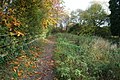
 Just A Hint Of Autumn - geograph.org.uk - 266651.jpg 640 × 480; 98 KB
-
 Pasture by the Foss Walk - geograph.org.uk - 3373803.jpg 1,024 × 768; 336 KB
-
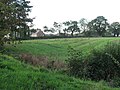 Peep O' Day Farm - geograph.org.uk - 266610.jpg 640 × 480; 99 KB
-
 Raisebeck - geograph.org.uk - 209738.jpg 640 × 480; 107 KB
-
 Riverside footpath, near New Earswick - geograph.org.uk - 5070372.jpg 640 × 480; 574 KB
-
 Stile to footpath to the Foss Walk - geograph.org.uk - 3374987.jpg 1,024 × 731; 267 KB
-
 The Centenary Way - geograph.org.uk - 211181.jpg 640 × 480; 108 KB
-
 The Drive To Mill Hill Farm - geograph.org.uk - 211948.jpg 640 × 478; 107 KB
-
 The Drive to Upper Towthorpe Farm - geograph.org.uk - 211964.jpg 640 × 480; 101 KB
-
 The Foss Walk - geograph.org.uk - 265966.jpg 640 × 480; 102 KB
-
 The Foss Walk - geograph.org.uk - 266608.jpg 640 × 480; 97 KB
-
 The Foss Walk at Marton Park - geograph.org.uk - 4038370.jpg 1,600 × 1,200; 1,001 KB
-
 The Foss Walk near Oulston - geograph.org.uk - 2819426.jpg 3,296 × 2,472; 1.03 MB
-
 The Foss Walk towards Oulston - geograph.org.uk - 4038045.jpg 1,600 × 1,050; 582 KB
-

-
 The riverside path near Earswick - geograph.org.uk - 3748477.jpg 1,024 × 681; 275 KB
-
 The riverside path towards Church Lane - geograph.org.uk - 3748176.jpg 1,024 × 681; 419 KB
-

-
 The Track To Peep O' Day Farm - geograph.org.uk - 264450.jpg 640 × 480; 104 KB
-
 The Village Green, Sheriff Hutton - geograph.org.uk - 210386.jpg 640 × 480; 102 KB


