Category:Crayke
Jump to navigation
Jump to search
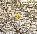
village and civil parish in North Yorkshire, United Kingdom  | |||||
| Upload media | |||||
| Instance of | |||||
|---|---|---|---|---|---|
| Location | Hambleton, North Yorkshire, Yorkshire and the Humber, England | ||||
| Population |
| ||||
| Area |
| ||||
| Said to be the same as | Crayke (Wikimedia duplicated page, civil parish) | ||||
 | |||||
English: Crayke is a village and civil parish in the Hambleton district of North Yorkshire, England, about two miles east of Easingwold.
Subcategories
This category has the following 4 subcategories, out of 4 total.
Media in category "Crayke"
The following 125 files are in this category, out of 125 total.
-
 A minor road near Providence Farm - geograph.org.uk - 2467158.jpg 800 × 600; 224 KB
-
 Access Track leading to Stocking Hall - geograph.org.uk - 6412351.jpg 5,184 × 3,456; 5.7 MB
-
 Approaching Crayke - geograph.org.uk - 6070959.jpg 1,024 × 768; 538 KB
-
 At the edge of the Howardian Hills - geograph.org.uk - 1868561.jpg 2,176 × 1,632; 758 KB
-
 Bettss-Crayke-map.png 690 × 635; 1.03 MB
-
 Binsley Lane - geograph.org.uk - 6412358.jpg 5,184 × 3,456; 5.74 MB
-
 Binsley Lane - geograph.org.uk - 6508964.jpg 1,024 × 768; 134 KB
-
 Binsley Lane at Crayke Lane - geograph.org.uk - 3534603.jpg 1,024 × 768; 262 KB
-
 Binsley Lane off Crayke Lane - geograph.org.uk - 3524634.jpg 1,024 × 768; 253 KB
-
 Binsley Lane towards Crayke Lane - geograph.org.uk - 3534598.jpg 1,024 × 768; 271 KB
-
 Brandsby Road near Crake - geograph.org.uk - 4038242.jpg 1,600 × 1,155; 1.03 MB
-
 Brandsby Street, Crayke - geograph.org.uk - 6414506.jpg 5,184 × 3,116; 7.11 MB
-
 Brandsby Street, Crayke - geograph.org.uk - 6508889.jpg 1,024 × 768; 137 KB
-
 Bridge over Ellers Beck, near Crayke - geograph.org.uk - 2299255.jpg 1,280 × 960; 711 KB
-
 Chelser Pit Lane - geograph.org.uk - 4966008.jpg 2,592 × 1,936; 1.62 MB
-
 Chesler-Pit Lane - geograph.org.uk - 2467149.jpg 800 × 600; 271 KB
-
 Church Hill, Crayke - geograph.org.uk - 2299287.jpg 1,280 × 960; 493 KB
-
 Church Hill, Crayke - geograph.org.uk - 3355164.jpg 1,024 × 768; 303 KB
-
 Church Hill, Crayke - geograph.org.uk - 3524642.jpg 1,024 × 768; 241 KB
-
 Cottage by the green in Crayke. - geograph.org.uk - 629028.jpg 640 × 480; 93 KB
-
 Cottages, Brandsby Road, Crayke - geograph.org.uk - 2299241.jpg 1,280 × 960; 492 KB
-
-
 Crayke - Church Hill and the church - geograph.org.uk - 1168566.jpg 640 × 480; 69 KB
-
 Crayke Castle - geograph.org.uk - 6508883.jpg 1,024 × 768; 215 KB
-
 Crayke Hall - geograph.org.uk - 2299227.jpg 1,280 × 960; 415 KB
-
 Crayke Hall, Church Hill - geograph.org.uk - 6414538.jpg 5,184 × 3,456; 6.2 MB
-
 Crayke Lane - geograph.org.uk - 1868543.jpg 2,448 × 3,264; 1.78 MB
-
 Crayke Lane - geograph.org.uk - 6412283.jpg 5,184 × 3,456; 6.61 MB
-
 Crayke Lane towards Crayke - geograph.org.uk - 2467086.jpg 800 × 600; 220 KB
-
 Crayke Manor - geograph.org.uk - 2299276.jpg 1,280 × 960; 805 KB
-
 Crayke, aerial 2018 - geograph.org.uk - 5767750.jpg 800 × 533; 105 KB
-
 Crayke, North Yorkshire ... The Old Post Office with YO61 277 (5047502061).jpg 3,072 × 2,304; 3.7 MB
-
 Daffy Lane - geograph.org.uk - 4966004.jpg 2,592 × 1,936; 1.57 MB
-
 Daffy Lane - geograph.org.uk - 6414865.jpg 5,184 × 3,456; 6.29 MB
-
 Daffy Lane at Mill Lane - geograph.org.uk - 2467111.jpg 800 × 600; 270 KB
-
 Daffy Lane at Park House - geograph.org.uk - 2467092.jpg 800 × 600; 251 KB
-
 Daffy Lane at Woodhouse Farm - geograph.org.uk - 2467095.jpg 800 × 600; 267 KB
-
 Daffy Lane looking East - geograph.org.uk - 6414548.jpg 5,184 × 3,456; 5.99 MB
-
 Daffy Lane looking West - geograph.org.uk - 6414862.jpg 5,184 × 3,456; 7.51 MB
-
 Daffy Lane towards Crayke Lodge - geograph.org.uk - 2467102.jpg 800 × 600; 243 KB
-
 Daffy Lane towards Park House - geograph.org.uk - 5939186.jpg 1,600 × 1,200; 542 KB
-
 Dutch House, near Crayke Manor - geograph.org.uk - 2299282.jpg 1,280 × 960; 497 KB
-
 Entering Crayke from the south - geograph.org.uk - 3355160.jpg 1,024 × 768; 265 KB
-
 Fields off Brandsby Road - geograph.org.uk - 6413787.jpg 5,184 × 3,456; 5.95 MB
-
 Footpath Climbing towards Holly Hill Rush - geograph.org.uk - 6413366.jpg 5,184 × 3,456; 7.29 MB
-
 Footpath heading North towards Crayke - geograph.org.uk - 6414872.jpg 5,184 × 3,456; 6.36 MB
-
 From Daffy Lane - geograph.org.uk - 4965998.jpg 2,592 × 1,936; 1.83 MB
-
 Green lane and permissive path - geograph.org.uk - 939096.jpg 640 × 480; 133 KB
-
 Hilltop seat - geograph.org.uk - 3355293.jpg 1,024 × 1,024; 581 KB
-
 Holly Wood - geograph.org.uk - 6508898.jpg 1,024 × 768; 114 KB
-
 Ivy Farmhouse, Crayke.jpg 1,024 × 683; 492 KB
-
 Joining Crayke Lane - geograph.org.uk - 2467164.jpg 800 × 600; 268 KB
-
 Key Lane, Crayke - geograph.org.uk - 6414516.jpg 5,184 × 3,456; 7.64 MB
-
 Myra Bank Farm - geograph.org.uk - 6412372.jpg 5,184 × 3,456; 6.18 MB
-
 Myra Bank Farm - geograph.org.uk - 6508958.jpg 1,024 × 768; 251 KB
-
 Myra Bank Lane - geograph.org.uk - 1868574.jpg 2,448 × 3,264; 1.92 MB
-
 Myra Bank Lane - geograph.org.uk - 3665252.jpg 1,600 × 1,200; 1 MB
-
 Myra Bank Lane, towards Myra Bank Farm - geograph.org.uk - 2467168.jpg 800 × 600; 255 KB
-
 Narrow Lane leading towards Stone Field House - geograph.org.uk - 6412346.jpg 5,184 × 3,456; 6.05 MB
-
 Near Launds Farm - geograph.org.uk - 4193196.jpg 1,600 × 1,200; 675 KB
-
 On the Foss Walk near Crayke Manor - geograph.org.uk - 6508892.jpg 1,024 × 768; 150 KB
-
 Ordnance Survey 1GL Bolt - geograph.org.uk - 5612336.jpg 640 × 485; 117 KB
-
 Outbuildings, Crayke Manor - geograph.org.uk - 2299271.jpg 1,280 × 960; 421 KB
-
 Overgrown Footbridge - geograph.org.uk - 4791793.jpg 1,200 × 1,600; 948 KB
-
 Pasture by Cook's Plantation - geograph.org.uk - 6413377.jpg 5,184 × 3,456; 6.46 MB
-
 Pig sheds at Woodfield Farm - geograph.org.uk - 6508895.jpg 1,024 × 768; 108 KB
-
 Poppies and Rape off Crayke Lane - geograph.org.uk - 3522684.jpg 1,024 × 768; 251 KB
-
 Poppies and Rape off Crayke Lane - geograph.org.uk - 3522689.jpg 1,024 × 768; 212 KB
-
 Public Footpath heading towards Leefe Plantation - geograph.org.uk - 6412381.jpg 5,184 × 3,456; 6.84 MB
-
 River Foss nr Crayke.jpg 640 × 359; 123 KB
-
 Road past Water Hall Farm - geograph.org.uk - 5918352.jpg 3,239 × 2,775; 1.92 MB
-
 Sheep - geograph.org.uk - 181331.jpg 640 × 480; 130 KB
-
 The Approaching Storm (13361837923).jpg 4,812 × 3,187; 5.83 MB
-
 The Dutch House - geograph.org.uk - 6413795.jpg 5,184 × 3,456; 6.99 MB
-
 The Dutch House gallery, cafe and gardens, near Crayke - geograph.org.uk - 5940442.jpg 1,600 × 1,200; 922 KB
-
 The infant River Foss, near Crayke Manor - geograph.org.uk - 2299263.jpg 1,280 × 960; 715 KB
-
 The northern end of Daffy Lane - geograph.org.uk - 4966006.jpg 2,592 × 1,936; 2.15 MB
-

-
 The village of Crayke - geograph.org.uk - 3355180.jpg 1,024 × 768; 353 KB
-
 The way to Easingwold - geograph.org.uk - 1868527.jpg 2,448 × 3,264; 1.48 MB
-

-
 Timber framed cottage at Crayke. - geograph.org.uk - 629536.jpg 640 × 480; 83 KB
-
 View from Binsley Lane - geograph.org.uk - 4966016.jpg 2,592 × 1,936; 1.52 MB
-
 View from Crayke Lane - geograph.org.uk - 4966013.jpg 2,592 × 1,936; 1.6 MB
-
 View from the hill at Crayke - geograph.org.uk - 1868513.jpg 3,264 × 2,448; 1.6 MB
-
 View from the hilltop, Crayke - geograph.org.uk - 3355301.jpg 1,024 × 768; 308 KB
-
 View North from the churchyard at Crayke - geograph.org.uk - 3355278.jpg 1,024 × 768; 277 KB
-
 View to Crayke - geograph.org.uk - 3355154.jpg 1,024 × 768; 249 KB
-
 Water Hall Farm, Crayke.jpg 1,024 × 596; 163 KB
-
 West Way, Crayke.jpg 1,024 × 683; 249 KB
-
 Woodfield Farm - geograph.org.uk - 5940451.jpg 1,600 × 1,200; 484 KB
-
 Yorkshire Gold (14149881842).jpg 6,000 × 4,000; 6.03 MB
-
 Yorkshire Sunset (14167689363).jpg 6,000 × 4,000; 7.04 MB
-
 Arable fields at Crayke - geograph.org.uk - 533454.jpg 640 × 359; 54 KB
-
 Church Hill, Crayke - geograph.org.uk - 629518.jpg 640 × 480; 86 KB
-
 Crayke - geograph.org.uk - 181317.jpg 640 × 480; 138 KB
-
 Crayke Lodge Plantation - geograph.org.uk - 348413.jpg 640 × 480; 58 KB
-
 Daffy Lane - geograph.org.uk - 348405.jpg 640 × 480; 63 KB
-
 Daffy Lane End - geograph.org.uk - 348434.jpg 640 × 480; 87 KB
-
 Downhill to Crayke Lodge - geograph.org.uk - 330804.jpg 640 × 480; 71 KB
-
 Entering Crayke from Easingwold - geograph.org.uk - 272046.jpg 640 × 480; 116 KB
-
 Farmhouse Preserves near Crayke - geograph.org.uk - 272054.jpg 640 × 480; 136 KB
-
 Farmland on the Foss Way - geograph.org.uk - 746363.jpg 640 × 427; 79 KB
-
 Farmland on the Foss Way - geograph.org.uk - 746366.jpg 640 × 427; 85 KB
-
 Field Track, Crayke Parish - geograph.org.uk - 533463.jpg 640 × 359; 56 KB
-
 Follow The Trees - geograph.org.uk - 266645.jpg 640 × 480; 101 KB
-
 Foss Way - geograph.org.uk - 745507.jpg 640 × 427; 90 KB
-
 Going Up To Easingwold - geograph.org.uk - 266663.jpg 640 × 480; 100 KB
-
 Hedgerow And Wood - geograph.org.uk - 266659.jpg 640 × 480; 89 KB
-
 High Springs Wood near Brandsby - geograph.org.uk - 272059.jpg 640 × 480; 142 KB
-
 Launds Farm - geograph.org.uk - 533452.jpg 640 × 359; 51 KB
-
 Leaning On A Gate - geograph.org.uk - 266638.jpg 640 × 480; 99 KB
-
 Mill Farm Crayke - geograph.org.uk - 533558.jpg 640 × 359; 86 KB
-
 Sign at the end of track to Stocking Hall - geograph.org.uk - 272051.jpg 640 × 480; 136 KB
-
 Sweep Right For Easingwold - geograph.org.uk - 264389.jpg 640 × 480; 98 KB
-
 The Green and Church Hill, Crayke - geograph.org.uk - 629511.jpg 640 × 480; 85 KB
-
 The Road From Easingwold - geograph.org.uk - 264451.jpg 640 × 480; 100 KB
-
 The Road From Oulston - geograph.org.uk - 266642.jpg 640 × 480; 101 KB
-
 The road to Brandsby from Crayke - geograph.org.uk - 272057.jpg 640 × 480; 145 KB
-
 Touching The Sky - geograph.org.uk - 266660.jpg 640 × 480; 101 KB
-
 Track to Haverwitz Farm near Easingwold - geograph.org.uk - 272043.jpg 640 × 480; 147 KB
-
 Track to Stocking Hall near Crayke - geograph.org.uk - 272049.jpg 640 × 480; 134 KB
-
 Trimmed Hedges And A Chalet - geograph.org.uk - 266634.jpg 640 × 480; 96 KB
-

-
 Woodhouse Farm near Crayke - geograph.org.uk - 330799.jpg 640 × 480; 119 KB


.jpg)


.jpg)


.jpg)
.jpg)


