Category:Forgandenny (civil parish)
Jump to navigation
Jump to search
Scottish parish in Perth and Kinross, Scotland, UK | |||||
| Upload media | |||||
| Instance of | |||||
|---|---|---|---|---|---|
| Part of |
| ||||
| Named after | |||||
| Location |
| ||||
| Population |
| ||||
| Area |
| ||||
 | |||||
Media in category "Forgandenny (civil parish)"
The following 176 files are in this category, out of 176 total.
-
 A former Place of Worship, Forgandenny - geograph.org.uk - 3510504.jpg 1,824 × 1,368; 557 KB
-
 Above the Water of May - geograph.org.uk - 2385916.jpg 4,288 × 2,290; 1.56 MB
-
 Animal feeders, Kirkton of Mailer, Perthshire - geograph.org.uk - 2672104.jpg 1,600 × 786; 355 KB
-
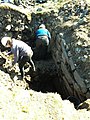 Archeologists at work - geograph.org.uk - 3938060.jpg 1,200 × 1,600; 619 KB
-
 Ardargie - geograph.org.uk - 3707354.jpg 640 × 480; 333 KB
-
 Ardargie gate lodge - geograph.org.uk - 6544949.jpg 1,600 × 974; 420 KB
-
 Ardargie pond - geograph.org.uk - 1241273.jpg 640 × 480; 97 KB
-
 Banks of the burn - geograph.org.uk - 1241622.jpg 640 × 480; 106 KB
-
 Barley, Horselea - geograph.org.uk - 3267277.jpg 640 × 360; 204 KB
-
 Blessed are the Merciful - geograph.org.uk - 2619928.jpg 480 × 640; 147 KB
-

-
 Broombarns Farm - geograph.org.uk - 6229759.jpg 1,024 × 720; 149 KB
-
 Broombarns Farm - geograph.org.uk - 6573349.jpg 3,357 × 2,518; 1.89 MB
-
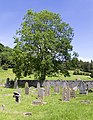 Burial ground, Kirkton of Mailer - geograph.org.uk - 4030386.jpg 498 × 640; 503 KB
-
 Castle Hill cairn - geograph.org.uk - 1241634.jpg 640 × 480; 70 KB
-
 Castle Law - geograph.org.uk - 6419257.jpg 1,024 × 683; 239 KB
-
 Castle Law Hill Fort - geograph.org.uk - 6281623.jpg 4,761 × 3,399; 3.42 MB
-
 Cattle, Glen Farg - geograph.org.uk - 5975898.jpg 1,024 × 683; 359 KB
-
 Cottage Post Office - geograph.org.uk - 1241626.jpg 640 × 480; 72 KB
-
 County Place - geograph.org.uk - 3940787.jpg 1,600 × 1,200; 566 KB
-
 Cragshonnochy Wood - geograph.org.uk - 6419132.jpg 1,024 × 683; 269 KB
-
 Craigend - geograph.org.uk - 3134439.jpg 640 × 360; 267 KB
-
 Craighall Farm access - geograph.org.uk - 5897720.jpg 1,600 × 1,067; 637 KB
-
 Craigowny Hill - geograph.org.uk - 6419117.jpg 1,024 × 683; 298 KB
-
 Culteuchar - geograph.org.uk - 3070922.jpg 640 × 360; 255 KB
-
 Culteuchar Farm - geograph.org.uk - 1241428.jpg 640 × 480; 56 KB
-
 Culteuchar Farm - geograph.org.uk - 2727047.jpg 640 × 476; 118 KB
-
 Culteuchar Hill - geograph.org.uk - 2727040.jpg 640 × 480; 65 KB
-
 Culteuchar Hill - geograph.org.uk - 4094464.jpg 2,560 × 1,920; 2.54 MB
-
 Culteuchar Hill - geograph.org.uk - 6419204.jpg 1,024 × 683; 252 KB
-

-
 Driveway to Newton of Condie - geograph.org.uk - 5897725.jpg 1,600 × 1,067; 572 KB
-
 Drumfinn Hill - geograph.org.uk - 2726315.jpg 640 × 477; 77 KB
-
 Earn Valley View - geograph.org.uk - 4430562.jpg 640 × 429; 91 KB
-
 Earthworks of the Castle Law fort - geograph.org.uk - 3231649.jpg 640 × 425; 131 KB
-
 Excavation in progress - geograph.org.uk - 3938076.jpg 1,200 × 1,600; 680 KB
-
 Farmland near Mailer - geograph.org.uk - 2223348.jpg 640 × 450; 84 KB
-
 Field boundary near Culteuchar Hill - geograph.org.uk - 2726286.jpg 640 × 465; 93 KB
-
 Field gate at Torhill - geograph.org.uk - 6544946.jpg 1,600 × 1,200; 554 KB
-
 Field, Ardargie - geograph.org.uk - 3707343.jpg 640 × 480; 257 KB
-
 Field, Torhill - geograph.org.uk - 3070917.jpg 640 × 360; 278 KB
-
 Fields at the head of Glenfarg Reservoir - geograph.org.uk - 5975895.jpg 1,024 × 683; 358 KB
-
 Fields, Hilton Farm - geograph.org.uk - 5319886.jpg 640 × 389; 53 KB
-

-
 Forgandenny Church - geograph.org.uk - 2619918.jpg 640 × 424; 112 KB
-
 Forgandenny Post Office - geograph.org.uk - 3070931.jpg 640 × 396; 251 KB
-
 Forgandenny Post Office - geograph.org.uk - 5897704.jpg 1,600 × 1,067; 475 KB
-
 Forgandenny to Ardargie Road - geograph.org.uk - 5975961.jpg 1,024 × 683; 572 KB
-
 Garblie Wood - geograph.org.uk - 3098419.jpg 2,592 × 1,944; 1.34 MB
-
 Garblie Wood - geograph.org.uk - 5975964.jpg 1,024 × 683; 543 KB
-
 Glenearn Park - geograph.org.uk - 3070935.jpg 640 × 480; 288 KB
-
 Glenfarg Reservoir - geograph.org.uk - 5975890.jpg 1,024 × 683; 352 KB
-
 Glenfarg to Forgandenny road - geograph.org.uk - 6420899.jpg 1,024 × 768; 308 KB
-
 Gorse on a hill - geograph.org.uk - 3938111.jpg 1,600 × 1,200; 909 KB
-
-

-

-
 Gravestone, Kirkton of Mailer churchyard - geograph.org.uk - 4030034.jpg 640 × 960; 1.11 MB
-
 Harvested field at Farmhall, near Forgandenny - geograph.org.uk - 5897710.jpg 1,600 × 1,067; 613 KB
-
 Heading Up The Track - geograph.org.uk - 4094483.jpg 2,560 × 1,920; 2.49 MB
-
 Heads or tails - geograph.org.uk - 1513122.jpg 640 × 480; 78 KB
-
 Hill Fort at Castle Law - geograph.org.uk - 1854058.jpg 640 × 480; 70 KB
-

-
 Hill sheep - geograph.org.uk - 1241638.jpg 640 × 480; 57 KB
-
 Hilton Junction - geograph.org.uk - 6453594.jpg 800 × 533; 741 KB
-
 Horselea Farm - geograph.org.uk - 1241674.jpg 640 × 480; 58 KB
-
 Horses at Kinnaird - geograph.org.uk - 3940772.jpg 1,600 × 1,200; 545 KB
-
 Improved access route to Horselea - geograph.org.uk - 5897694.jpg 1,600 × 1,067; 355 KB
-
 Junction near the sawmill - geograph.org.uk - 1241421.jpg 640 × 480; 76 KB
-
 Kirkton Hill from Strathearn - geograph.org.uk - 2345056.jpg 4,196 × 2,752; 2.2 MB
-
 Kirkton Hill, south of Perth - geograph.org.uk - 2672110.jpg 1,600 × 1,200; 324 KB
-
 Kirkton of Mailer and Strathearn from Kirkton Hill - geograph.org.uk - 2345098.jpg 3,900 × 2,535; 1.72 MB
-
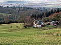
 Kirkton of Mailer Farm - geograph.org.uk - 2345026.jpg 3,704 × 2,116; 1.09 MB
-
 Landscape east of Rossie Ochill - geograph.org.uk - 4412060.jpg 5,184 × 3,456; 5.82 MB
-
 Larch strip, Culteuchar Hill - geograph.org.uk - 6419253.jpg 1,024 × 683; 270 KB
-
 Larch wood, Ochil Hills - geograph.org.uk - 5975881.jpg 640 × 427; 123 KB
-
 Law of Dumbuils - geograph.org.uk - 6420334.jpg 1,024 × 683; 265 KB
-
 Lochan near Berry Hill - geograph.org.uk - 6420904.jpg 1,024 × 683; 261 KB
-
 Lochan near Castle Law - geograph.org.uk - 3938094.jpg 1,600 × 1,200; 994 KB
-
 Lochan on Culteuchar Hill - geograph.org.uk - 6419202.jpg 1,024 × 683; 246 KB
-
 Lochelbank Wind Farm - geograph.org.uk - 6281602.jpg 4,887 × 3,664; 4.28 MB
-
 Lochelbank Wind Farm - geograph.org.uk - 6420887.jpg 1,024 × 683; 251 KB
-
 Lochelbank Wind Farm - geograph.org.uk - 6420982.jpg 1,024 × 683; 216 KB
-
 M90 near Craigend - geograph.org.uk - 6134183.jpg 800 × 533; 644 KB
-
 Mailer Hill - geograph.org.uk - 1938034.jpg 640 × 480; 98 KB
-
 Marsh, Glenfarg Head - geograph.org.uk - 5975917.jpg 1,024 × 683; 422 KB
-
 Marsh, Glenfarg Head - geograph.org.uk - 5975918.jpg 1,024 × 683; 356 KB
-
 Minor road descending towards Rossie Ochill - geograph.org.uk - 4412071.jpg 5,184 × 3,456; 7.2 MB
-
 Near Heatheryleys - geograph.org.uk - 6420980.jpg 1,024 × 683; 317 KB
-
 Newly planted woodland, Glenearnhill - geograph.org.uk - 6419247.jpg 1,024 × 683; 247 KB
-
 Newly planted woodland, Glenearnhill - geograph.org.uk - 6419250.jpg 1,024 × 683; 281 KB
-
 North Lodge - geograph.org.uk - 1241264.jpg 640 × 480; 60 KB
-
 Oaks, Forgandenny - geograph.org.uk - 3070928.jpg 640 × 360; 265 KB
-
 Ochil Hills near Auchengownie - geograph.org.uk - 6420999.jpg 1,024 × 683; 271 KB
-
 Old Cottage at Farmhall entrance - geograph.org.uk - 5897706.jpg 1,600 × 1,067; 374 KB
-
 Old Milestone by the B935, Forgandenny - geograph.org.uk - 6047832.jpg 640 × 551; 476 KB
-
 Open gate on Culteuchar Hill - geograph.org.uk - 6281583.jpg 5,152 × 3,864; 7.04 MB
-
 Ornamental wall at Strathallan Estate - geograph.org.uk - 5897680.jpg 1,600 × 1,067; 387 KB
-
 Oxbow lake at Kirkton of Mailer - geograph.org.uk - 2344999.jpg 4,288 × 2,848; 3.11 MB
-
 Oxbow lake in Strathearn - geograph.org.uk - 2345071.jpg 4,288 × 2,848; 1.63 MB
-
 Pasture at Baxterknowe - geograph.org.uk - 5897678.jpg 1,600 × 895; 338 KB
-
 Pasture in Strathallan Estate - geograph.org.uk - 5897683.jpg 1,600 × 1,067; 489 KB
-
 Path sign by Kinnaird Cottage - geograph.org.uk - 5976000.jpg 1,024 × 683; 473 KB
-
 Path sign near Glen Farg reservoir - geograph.org.uk - 5975885.jpg 683 × 1,024; 335 KB
-
 Path sign near Heatheryleys - geograph.org.uk - 6420986.jpg 1,024 × 683; 346 KB
-
 Pines and Castle Law - geograph.org.uk - 6419449.jpg 1,024 × 683; 255 KB
-
 Plunging into the forest - geograph.org.uk - 1241280.jpg 640 × 480; 107 KB
-
 Powerful lattice - geograph.org.uk - 3938022.jpg 1,200 × 1,600; 413 KB
-
 Private level crossing (2) - geograph.org.uk - 2619948.jpg 640 × 500; 90 KB
-
 Private level crossing - geograph.org.uk - 2619938.jpg 640 × 447; 101 KB
-
 Pylon near Westhall - geograph.org.uk - 2722826.jpg 640 × 480; 109 KB
-
 Quarry near Glenfarg Reservoir - geograph.org.uk - 5975903.jpg 1,024 × 683; 474 KB
-

-
 Remembrance display, Forgandenny - geograph.org.uk - 5975933.jpg 683 × 1,024; 370 KB
-
 Renovation in progress - geograph.org.uk - 3940765.jpg 1,531 × 1,123; 285 KB
-
 Reservoir near Eastfield - geograph.org.uk - 3347493.jpg 640 × 473; 277 KB
-
 Ripening barley - geograph.org.uk - 3070939.jpg 640 × 480; 281 KB
-
 River Earn at Boat of Forgan - geograph.org.uk - 2345987.jpg 1,024 × 713; 139 KB
-
 River Earn in flood - geograph.org.uk - 4761211.jpg 1,500 × 1,000; 2 MB
-
 River Earn near Aberdalgie - geograph.org.uk - 2230773.jpg 640 × 483; 89 KB
-
 Road to Boathill - geograph.org.uk - 5897713.jpg 1,600 × 1,067; 526 KB
-
 Road to Glenfarg - geograph.org.uk - 3707346.jpg 640 × 480; 341 KB
-
 Roadside Daffodils - geograph.org.uk - 1241246.jpg 640 × 480; 83 KB
-
 Rolling Ochil Hills - geograph.org.uk - 6541812.jpg 1,600 × 1,179; 502 KB
-
 Rossie cottage - geograph.org.uk - 1241450.jpg 640 × 480; 72 KB
-
 Rossie Ochil - geograph.org.uk - 6419135.jpg 1,024 × 683; 200 KB
-
 Rossie Ochill from the south - geograph.org.uk - 6544936.jpg 1,600 × 1,111; 368 KB
-
 Rossie Ochill Home Farm access road - geograph.org.uk - 6544941.jpg 1,600 × 1,200; 386 KB
-
 Scrubby high ground in the eastern Ochil Hills - geograph.org.uk - 6541809.jpg 1,600 × 1,082; 423 KB
-
 Sharp bend, Rossie Chill - geograph.org.uk - 6420895.jpg 1,024 × 768; 378 KB
-
 Sheep Grazing on Glenearn Hill - geograph.org.uk - 789469.jpg 640 × 425; 222 KB
-
 Sheep, Craighall - geograph.org.uk - 5975956.jpg 1,024 × 683; 184 KB
-

-
 Slopes northwest of Ardargie Hill - geograph.org.uk - 6544945.jpg 1,600 × 1,117; 377 KB
-
 Small housing estate at Forgandenny - geograph.org.uk - 5897700.jpg 1,600 × 1,067; 393 KB
-
 Snowdrops, Craigend - geograph.org.uk - 2811349.jpg 640 × 379; 276 KB
-
 South Dumbuils farm - geograph.org.uk - 1241651.jpg 640 × 468; 50 KB
-
 South Dumbuils Farm - geograph.org.uk - 2722835.jpg 640 × 423; 59 KB
-
 South portal of Perth rail tunnel. - geograph.org.uk - 5280386.jpg 3,872 × 2,592; 6.28 MB
-
 South side of Culteuchar Hill - geograph.org.uk - 6419198.jpg 1,024 × 683; 248 KB
-
-
 Strathallan School - geograph.org.uk - 1395430.jpg 640 × 427; 49 KB
-
 The B9112 heading south east - geograph.org.uk - 3573220.jpg 640 × 434; 59 KB
-
 The B935 heading for Bridge of Earn - geograph.org.uk - 6215076.jpg 2,592 × 1,944; 1.15 MB
-
 The River Earn - geograph.org.uk - 796160.jpg 640 × 426; 64 KB
-
 The River Earn at Dupplin - geograph.org.uk - 2391850.jpg 4,288 × 2,848; 5.21 MB
-
 The road to Earlston - geograph.org.uk - 1241444.jpg 640 × 480; 81 KB
-

-
 The Water of May - geograph.org.uk - 2406120.jpg 640 × 488; 181 KB
-
 Towards Kirkton Hill - geograph.org.uk - 4430555.jpg 640 × 400; 109 KB
-
 Track in Garblie Wood - geograph.org.uk - 5975997.jpg 1,024 × 683; 498 KB
-
 Track near Eastfield - geograph.org.uk - 3347443.jpg 640 × 452; 297 KB
-
 Track near Westhall - geograph.org.uk - 2722817.jpg 480 × 640; 74 KB
-
 Track through the Forest - geograph.org.uk - 816504.jpg 640 × 399; 199 KB
-
 Tree lined road at Ardargie - geograph.org.uk - 6544943.jpg 1,600 × 1,173; 676 KB
-
 Tree-covered slopes - geograph.org.uk - 1241440.jpg 640 × 480; 44 KB
-
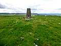
 Trig point and masts on Mailer Hill - geograph.org.uk - 3199471.jpg 1,024 × 692; 130 KB
-
 Trig point on Culteuchar Hill - geograph.org.uk - 6281590.jpg 5,152 × 3,864; 7.28 MB
-
 Unnamed burn - geograph.org.uk - 1241667.jpg 640 × 480; 100 KB
-
 Unnamed Burn in the Forest - geograph.org.uk - 816518.jpg 425 × 640; 296 KB
-
 Unnamed Lochan in Wood - geograph.org.uk - 816479.jpg 640 × 407; 271 KB
-

-
 View from Culteuchar Hill - geograph.org.uk - 6419244.jpg 1,024 × 683; 222 KB
-
 Wallace Road - geograph.org.uk - 5975882.jpg 1,024 × 683; 355 KB
-
 War Memorial, Forgandenny - geograph.org.uk - 5975942.jpg 683 × 1,024; 477 KB
-
 Way in to Rossie House - geograph.org.uk - 1241456.jpg 640 × 480; 75 KB
-
 West of Lochelbank Hill - geograph.org.uk - 3347475.jpg 640 × 443; 260 KB
-
 Westhall Farm - geograph.org.uk - 1241671.jpg 640 × 480; 51 KB
-
 Wetland, Mount Stewart - geograph.org.uk - 3267380.jpg 640 × 360; 206 KB
-
 Wheat, Gallowmuir - geograph.org.uk - 3267373.jpg 640 × 360; 221 KB
-
 Woodland above Eastfield - geograph.org.uk - 6420894.jpg 1,024 × 768; 385 KB
-
 Woodland above the Water of May - geograph.org.uk - 3693554.jpg 640 × 480; 300 KB
-
 Woodland by Craigowny Hill - geograph.org.uk - 6419138.jpg 1,024 × 683; 387 KB
-
 Woodland by Craigowny Hill - geograph.org.uk - 6419139.jpg 1,024 × 683; 348 KB
-
 Woodland edge - geograph.org.uk - 6419197.jpg 1,024 × 683; 307 KB
-
 Woodland south of Culteuchar Hill - geograph.org.uk - 6419194.jpg 1,024 × 683; 374 KB


_-_geograph.org.uk_-_2619948.jpg)


