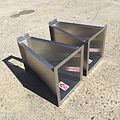
Category:Flow measurement flumes
Jump to navigation
Jump to search
Subcategories
This category has the following 4 subcategories, out of 4 total.
F
P
- Parshall flumes (3 F)
Media in category "Flow measurement flumes"
The following 27 files are in this category, out of 27 total.
-
3-inch-montana-flume-stainless-steel.jpg 2,448 × 2,448; 2.41 MB
-
8-inch-palmer-bowlus-flume.jpg 2,448 × 3,264; 3.44 MB
-
Cast-in-place concrete trapezoidal measuring flumes (IA castinplaceconcr15bond).pdf 1,112 × 1,458, 20 pages; 1.13 MB
-
A prefabricated flume for gaging ephemeral streams (IA CAT10225089).pdf 1,391 × 1,854, 8 pages; 810 KB
-
FLUME - a computer model for estimating flow through long-throated measuring flumes (IA CAT87882401).pdf 877 × 1,114, 78 pages; 3 MB
-
Constructing simple measuring flumes for irrigation canals (IA CAT88909026).pdf 1,268 × 1,633, 17 pages; 5.4 MB
-
Chelmer Weir - geograph.org.uk - 564587.jpg 640 × 426; 146 KB
-
Field performance of large critical-depth flumes for measuring runoff from semiarid rangelands (IA fieldperformance69osbo).pdf 1,116 × 1,493, 22 pages; 948 KB
-
Flow Measuring Flumes.JPG 2,304 × 1,728; 1.48 MB
-
Flow meter for measuring ground water seepage from road cuts (IA flowmeterformeas11burr).pdf 997 × 1,437, 6 pages; 266 KB
-
Flume and water collector on Maesnant - geograph.org.uk - 4803240.jpg 640 × 480; 188 KB
-
Flume in ditch on east side of A419 - geograph.org.uk - 4621075.jpg 1,024 × 683; 309 KB
-
Flume on Nant Tanllwyth - geograph.org.uk - 2982692.jpg 3,872 × 2,592; 7.01 MB
-
Flume, Hafren Forest - geograph.org.uk - 228904.jpg 640 × 480; 176 KB
-
Gauging weir on River Chelmer - geograph.org.uk - 4309371.jpg 640 × 480; 141 KB
-
H-Flumes For Measurement of Flows of Water Containing High Concentrations of Suspended Sediment (IA hflumesformeasur16unit).pdf 1,110 × 1,475, 18 pages; 778 KB
-
Measuring flume on the River Marden - geograph.org.uk - 1545465.jpg 640 × 480; 101 KB
-
Measuring water in irrigation channels with Parshall flumes and small weirs (IA measuringwaterin843pars).pdf 781 × 1,277, 68 pages; 7.35 MB
-
Nant Tanllwyth flume - geograph.org.uk - 1122567.jpg 640 × 480; 264 KB
-
Palmer-bowlus-flume-irrigation.jpg 360 × 480; 105 KB
-
Rain Gauge - geograph.org.uk - 470915.jpg 640 × 480; 280 KB
-
Severn Flume - geograph.org.uk - 1125971.jpg 640 × 480; 269 KB
-
St Austell River - geograph.org.uk - 1215268.jpg 640 × 426; 88 KB
-
The Severn and flume - geograph.org.uk - 1125952.jpg 640 × 480; 293 KB
-
Trapezoidal flumes for measuring flow in irrigation channels (IA trapezoidalflume14robi).pdf 1,033 × 1,472, 18 pages; 971 KB
-
Weir - geograph.org.uk - 804050.jpg 640 × 480; 78 KB


