Category:Footholme Flume Gauging Station
Jump to navigation
Jump to search
English: River Dunsop at Footholme Flume.
Media in category "Footholme Flume Gauging Station"
The following 12 files are in this category, out of 12 total.
-
 Bowland Forest High BB7, UK - panoramio (1).jpg 988 × 741; 301 KB
-
 Depth gauge, River Dunsop - geograph.org.uk - 4905852.jpg 1,024 × 768; 285 KB
-
 Dunsop Valley 13.jpg 3,072 × 2,304; 3.57 MB
-
 Dunsop Valley 14.jpg 3,072 × 2,304; 3.54 MB
-
 Dunsop Valley 16.jpg 3,072 × 2,304; 3.31 MB
-
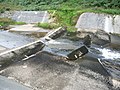
 Footholme measuring flume, River Dunsop - geograph.org.uk - 4905846.jpg 1,024 × 768; 284 KB
-
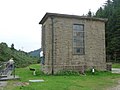
 Meter House - geograph.org.uk - 686718.jpg 480 × 640; 169 KB
-
 River Dunsop - geograph.org.uk - 885902.jpg 640 × 480; 123 KB
-
 River Dunsop and Meter House - geograph.org.uk - 739904.jpg 640 × 427; 72 KB
-
 Waterworks Building - geograph.org.uk - 1822345.jpg 450 × 600; 51 KB
-
 Waterworks building, Dunsop Valley - geograph.org.uk - 3630275.jpg 640 × 480; 111 KB
-
 Weirs on the River Dunsop - geograph.org.uk - 688610.jpg 640 × 480; 200 KB
.jpg)


