Category:Floods in the United Kingdom
Jump to navigation
Jump to search
Countries of Europe: Albania · Austria · Azerbaijan‡ · Belarus · Belgium · Bosnia and Herzegovina · Bulgaria · Croatia · Czech Republic · Denmark · Estonia · Finland · France‡ · Georgia‡ · Germany · Greece · Hungary · Iceland · Republic of Ireland · Italy · Kazakhstan‡ · Latvia · Lithuania · Luxembourg · Montenegro · Netherlands‡ · North Macedonia · Norway · Poland · Portugal‡ · Romania · Russia‡ · Serbia · Slovakia · Slovenia · Spain‡ · Sweden · Switzerland · Turkey‡ · Ukraine · United Kingdom
Limited recognition: Kosovo
‡: partly located in Europe
Limited recognition: Kosovo
‡: partly located in Europe
Wikimedia category | |||||
| Upload media | |||||
| Instance of | |||||
|---|---|---|---|---|---|
| Category combines topics | |||||
 | |||||
Subcategories
This category has the following 15 subcategories, out of 15 total.
'
*
+
2
D
F
S
Media in category "Floods in the United Kingdom"
The following 34 files are in this category, out of 34 total.
-
 After the Downpour - geograph.org.uk - 1568586.jpg 640 × 427; 230 KB
-
 Allan Park Road flood (May 2011) - 1.jpg 1,600 × 1,200; 205 KB
-
 Allan Park Road flood (May 2011) - 2.jpg 1,600 × 1,200; 237 KB
-
 Allan Park Road flood (May 2011) - 3.jpg 1,200 × 1,600; 336 KB
-
 Allan Park Road flood (May 2011) - 4.jpg 1,600 × 1,200; 396 KB
-
 Au Morandarte Flickr DSC04881 (14660653351).jpg 3,264 × 2,448; 2.6 MB
-
 Beneath the earth (3698247389).jpg 853 × 1,280; 158 KB
-
 Bronagh flooding.jpg 2,048 × 1,365; 231 KB
-
 Cycle path crossing flooded field - geograph.org.uk - 1727570.jpg 640 × 376; 53 KB
-
 Devonport Leat after heavy rain - geograph.org.uk - 1588957.jpg 640 × 427; 96 KB
-
 East Dart river after heavy rain (39008929621).jpg 5,938 × 3,551; 4.44 MB
-
 ECDM 20221122 FL UK.pdf 2,479 × 1,754; 1.3 MB
-

-
 Flickr seattlecamera 280 (9985008514).jpg 4,000 × 3,000; 2.92 MB
-
 Flickr seattlecamera 281 (9984984365).jpg 4,000 × 3,000; 2.93 MB
-
 Flood marks at the base - geograph.org.uk - 1571073.jpg 640 × 427; 111 KB
-
 Flooded Corner near Easter Dalziel - geograph.org.uk - 288916.jpg 640 × 480; 197 KB
-
 Flooding, Sheep and Hightown Hill - geograph.org.uk - 289477.jpg 640 × 480; 162 KB
-
 Flooding.png 336 × 450; 98 KB
-
 Gate into a mash pasture - geograph.org.uk - 625003.jpg 640 × 480; 88 KB
-
 Generic UK flood image.jpg 159 × 160; 12 KB
-
 Ludflood1920footprint.png 730 × 394; 269 KB
-
 Midland Red West bus 435 (GOL 435N), February 1990.jpg 1,712 × 1,152; 556 KB
-
 River Trent during heavy rain - geograph.org.uk - 479066.jpg 640 × 427; 41 KB
-
 Small flood - geograph.org.uk - 288445.jpg 640 × 480; 93 KB
-

-
 Stormhank653 oli 20240103.jpg 720 × 700; 512 KB
-
 Telford Bridge 6 September 2008.jpg 453 × 604; 36 KB
-
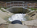 The new flood tunnel seems to be working (6973651014).jpg 4,000 × 3,000; 3.15 MB
-
 The Swale after heavy rain - geograph.org.uk - 1600872.jpg 640 × 480; 63 KB
-
 Uriah 25 June 2007.jpg 8,385 × 6,321; 7.04 MB
-
 Flooding at Kilbally - geograph.org.uk - 290670.jpg 640 × 479; 50 KB
-
 Flooding in Langstrothdale - geograph.org.uk - 289765.jpg 640 × 480; 79 KB
-
 Kildrummy Mills - geograph.org.uk - 625742.jpg 640 × 440; 64 KB

_-_1.jpg)
_-_2.jpg)
_-_3.jpg)
_-_4.jpg)
.jpg)
.jpg)


.jpg)

.jpg)
.jpg)


,_February_1990.jpg)


,_RP-F-2001-7-545-37.jpg)


.jpg)


