Category:Flooded roads in the United Kingdom
Jump to navigation
Jump to search
Media in category "Flooded roads in the United Kingdom"
The following 24 files are in this category, out of 24 total.
-
 Good Easter, Essex, England - ford over River Can east of Good Easter village 01.JPG 5,472 × 3,648; 17.17 MB
-
 Good Easter, Essex, England - ford over River Can east of Good Easter village 02.JPG 5,472 × 3,648; 17.45 MB
-
 Pincey Brook bridge on Greenhill, Hatfield Broad Oak, Essex 03.jpg 6,240 × 4,160; 25.61 MB
-
 Aldham Bridge, Wombwell on Monday 25th June 2007.JPG 3,488 × 2,616; 2.21 MB
-
 Anon - Travellers on a flooded lane - 6706.jpg 2,048 × 1,560; 515 KB
-
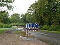
 Binsey Lane, 2007 floods - geograph.org.uk - 5856609.jpg 1,840 × 1,232; 991 KB
-

-
 First Essex bus 65683 (YR52 VEU), Colchester, 30 May 2012 (1).jpg 4,592 × 3,056; 2.06 MB
-
 Flash flood in Kegworth.png 1,280 × 720; 1.42 MB
-
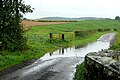 Flooded lane near Powburn - geograph.org.uk - 1507894.jpg 640 × 426; 203 KB
-
 Floods at Buttington, Montgomeryshire (15091237088).jpg 405 × 622; 57 KB
-
 Floods in Oswestry and Welshpool (20349659999).jpg 628 × 406; 73 KB
-
 Floodspickering.jpg 1,710 × 1,110; 2.62 MB
-
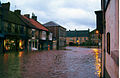
 Low Street flooded - geograph.org.uk - 44064.jpg 640 × 480; 103 KB
-
 Lower Wortley Ring Road - geograph.org.uk - 697349.jpg 640 × 480; 75 KB
-
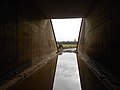 M20 underpass, Addington.jpg 5,152 × 3,864; 4.35 MB
-
 Midland Red West bus 435 (GOL 435N), February 1990.jpg 1,712 × 1,152; 556 KB
-
 Midland Red West coach 733 (WOC 733T), February 1990.jpg 1,552 × 1,160; 422 KB
-
 Network Colchester bus 515 (HX51 LRO) 30 May 2012.jpg 4,592 × 3,056; 2.02 MB
-
 Oxford Road Flood (9805527403).jpg 1,762 × 1,175; 1.98 MB
-
 Receding Flood - geograph.org.uk - 1071718.jpg 640 × 470; 72 KB
-
 Sandford Lane, Hurst - geograph.org.uk - 504191.jpg 640 × 480; 175 KB
-
 Westbury flooding under avoiding line bridge.jpg 1,024 × 768; 214 KB
-


.jpg)
,_Colchester,_30_May_2012_(1).jpg)


.jpg)
.jpg)


,_February_1990.jpg)
,_February_1990.jpg)
_30_May_2012.jpg)
.jpg)


