Category:Fieldway, Wavertree
Jump to navigation
Jump to search
| Object location | | View all coordinates using: OpenStreetMap |
|---|
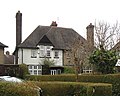
A residential street in Wavertree Garden Suburb, Liverpool, featuring a circular field at its centre and some Grade II listed houses.
Media in category "Fieldway, Wavertree"
The following 3 files are in this category, out of 3 total.
-
 45 & 47 Fieldway.jpg 3,976 × 3,560; 6.01 MB
-
 46 & 48 Fieldway.jpg 4,243 × 3,400; 6.65 MB
-
 Conservation area sign, Fieldway.jpg 3,338 × 3,678; 6.67 MB


