Category:Farnell (civil parish)
Jump to navigation
Jump to search

Scottish parish in Angus, Scotland, UK | |||||
| Upload media | |||||
| Instance of | |||||
|---|---|---|---|---|---|
| Named after | |||||
| Location |
| ||||
| Population |
| ||||
| Area |
| ||||
 | |||||
Media in category "Farnell (civil parish)"
The following 83 files are in this category, out of 83 total.
-
 A934 heading to Friockheim - geograph.org.uk - 1967970.jpg 640 × 480; 80 KB
-
 A934 heading to Friockheim - geograph.org.uk - 1967979.jpg 640 × 480; 62 KB
-
 Angus arable - geograph.org.uk - 6024271.jpg 1,024 × 683; 329 KB
-
 Arable land, Kinnaird - geograph.org.uk - 6023596.jpg 1,024 × 683; 365 KB
-
 Arable land, Kinnaird - geograph.org.uk - 6023601.jpg 1,024 × 683; 381 KB
-
 Arable land, Woodend - geograph.org.uk - 4739276.jpg 1,024 × 768; 307 KB
-
 Barley, Carcary - geograph.org.uk - 4540799.jpg 800 × 450; 390 KB
-
 Barley, Carcary - geograph.org.uk - 4540801.jpg 800 × 450; 307 KB
-
 Beech wood and mound, Greenlaw - geograph.org.uk - 4739246.jpg 1,024 × 768; 321 KB
-

-
 Burghill - Brechin - Arbroath junction - geograph.org.uk - 1065509.jpg 640 × 426; 106 KB
-
 Butterbur (Petasites hybridus) - geograph.org.uk - 2692362.jpg 479 × 640; 97 KB
-
 Butterbur beside the Pantaskel Burn - geograph.org.uk - 2692363.jpg 640 × 480; 92 KB
-
 Cattle, Carcary - geograph.org.uk - 4540803.jpg 800 × 450; 343 KB
-
 Corner of Smithy House - geograph.org.uk - 6749461.jpg 2,448 × 3,264; 4.37 MB
-
 Ditch, Carcary - geograph.org.uk - 4540798.jpg 800 × 450; 354 KB
-
 Ditch, Greenlaw - geograph.org.uk - 4739241.jpg 1,024 × 768; 336 KB
-
 Dyke corner by Bockler Den Burn near Montrose - geograph.org.uk - 5883969.jpg 3,128 × 2,346; 2.49 MB
-
 Easterly view of Rossie Moor - geograph.org.uk - 6059891.jpg 3,264 × 2,448; 2.56 MB
-
 Edge of Montreathmont Forest - geograph.org.uk - 4739237.jpg 1,024 × 768; 363 KB
-

-
 Farnell - geograph.org.uk - 6024267.jpg 1,024 × 683; 446 KB
-
 Farnell Parish Church - geograph.org.uk - 6816994.jpg 1,024 × 683; 183 KB
-
 Farnell Village - Bridge of Dun Junction - geograph.org.uk - 1001826.jpg 640 × 427; 126 KB
-
 Farnell War Memorial - geograph.org.uk - 6023605.jpg 1,024 × 683; 560 KB
-
 Fields by New Forebank - geograph.org.uk - 2447005.jpg 3,456 × 2,304; 1.26 MB
-
 Fields Near Little Carcary - geograph.org.uk - 5987821.jpg 640 × 372; 85 KB
-
 Fithie Farm - geograph.org.uk - 1151112.jpg 640 × 427; 75 KB
-
 Fithie Wood near Montrose - geograph.org.uk - 5882710.jpg 5,184 × 3,888; 5.49 MB
-
 Greenlaw - geograph.org.uk - 4739238.jpg 1,024 × 768; 383 KB
-
 Haughs of Kinnaird, field edge - geograph.org.uk - 6023593.jpg 1,024 × 683; 441 KB
-
 Little Fithie - geograph.org.uk - 5987814.jpg 640 × 396; 99 KB
-
 Maules Wood - geograph.org.uk - 4739324.jpg 1,024 × 768; 364 KB
-
 Minor road on edge of Maules Wood - geograph.org.uk - 5165580.jpg 640 × 480; 124 KB
-
 Montreathmont Forest - geograph.org.uk - 3813058.jpg 640 × 426; 306 KB
-
 Montreathmont Forest - geograph.org.uk - 4739230.jpg 1,024 × 768; 497 KB
-
 Oilseed rape stubble, Haughs of Kinnaird - geograph.org.uk - 6023590.jpg 1,024 × 683; 406 KB
-

-

-
-

-
 OS Cut Mark, Smithy House - geograph.org.uk - 6749455.jpg 2,448 × 3,264; 4.28 MB
-
 Path, Montreathmont Forest - geograph.org.uk - 3815653.jpg 640 × 426; 301 KB
-
 Power line, Montreathmont Forest - geograph.org.uk - 3813020.jpg 640 × 426; 242 KB
-
 Power line, Montreathmont Forest - geograph.org.uk - 3813048.jpg 640 × 426; 333 KB
-
 Rainbow at Little Carcary - geograph.org.uk - 1245188 (cropped).jpg 584 × 390; 43 KB
-
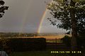 Rainbow at Little Carcary - geograph.org.uk - 1245188.jpg 640 × 427; 54 KB
-

-
 Ride, Marquis Hill - geograph.org.uk - 6023598.jpg 1,024 × 683; 475 KB
-
 Road at Bockler Den Burn near Montrose - geograph.org.uk - 5882708.jpg 5,184 × 3,888; 6.21 MB
-
 Road by Woodend - geograph.org.uk - 4739281.jpg 1,024 × 768; 352 KB
-
 Road heading to Carcary Lodge - geograph.org.uk - 1968026.jpg 640 × 480; 99 KB
-
 Road heading to Haughs of Kinnaird - geograph.org.uk - 1968066.jpg 640 × 480; 110 KB
-
 Road to Carcary Lodge - geograph.org.uk - 1968059.jpg 640 × 480; 80 KB
-
 Road to Haughs of Kinnaird - geograph.org.uk - 1968015.jpg 640 × 480; 64 KB
-
 Road, Fithie - geograph.org.uk - 6024274.jpg 1,024 × 683; 386 KB
-
 Rossie Moor as viewed from the roadside by Fithie Wood - geograph.org.uk - 6059868.jpg 3,264 × 2,448; 2.78 MB
-
 Scots Pine Trees near Fithie - geograph.org.uk - 1151119.jpg 640 × 427; 85 KB
-
 Scots pines, Montreathmont Forest - geograph.org.uk - 3813008.jpg 640 × 480; 344 KB
-
 Singletrack, Montreathmont - geograph.org.uk - 3813001.jpg 640 × 480; 319 KB
-
 Strathella - geograph.org.uk - 6024280.jpg 1,024 × 683; 340 KB
-
 Strathella Cottage - geograph.org.uk - 1151115.jpg 640 × 427; 76 KB
-
 Strathella Cottage - geograph.org.uk - 6024286.jpg 1,024 × 683; 422 KB
-
 Strathella Cottage Ruin - geograph.org.uk - 1178840.jpg 640 × 426; 106 KB
-
 Strathella Wood, near Fithie - geograph.org.uk - 1151129.jpg 640 × 427; 43 KB
-
 Stubble and Maules Wood - geograph.org.uk - 4739298.jpg 1,024 × 768; 255 KB
-
 Stubble south of Brechin - geograph.org.uk - 4739321.jpg 1,024 × 768; 227 KB
-
 Stubble, Strathella - geograph.org.uk - 6024279.jpg 1,024 × 683; 406 KB
-
 Sunlit Trees near Brechin - geograph.org.uk - 1063478.jpg 640 × 426; 116 KB
-
 The A933 at Montreathmont - geograph.org.uk - 5167680.jpg 640 × 480; 100 KB
-
 The big ride, Montreathmont Forest - geograph.org.uk - 3813015.jpg 640 × 426; 300 KB
-
 The Pantaskel Burn - geograph.org.uk - 2692364.jpg 640 × 480; 84 KB
-
 Through Trees to Scotlogs - geograph.org.uk - 2446988.jpg 3,456 × 2,304; 2.15 MB
-
 Track into Fithie Wood - geograph.org.uk - 6058915.jpg 3,264 × 2,448; 3.06 MB
-
 Tramlines - geograph.org.uk - 4540795.jpg 800 × 450; 284 KB
-
 View east from Bockler Den Burn near Montrose - geograph.org.uk - 5885283.jpg 5,184 × 3,888; 5.62 MB
-
 View north from roadside near Bockler Den Burn, Montrose - geograph.org.uk - 5885281.jpg 5,184 × 3,888; 5.2 MB
-

-
 View of Lilylorn Burn looking upstream - geograph.org.uk - 1159540.jpg 640 × 428; 123 KB
-
 Wheat, Carcary - geograph.org.uk - 4540805.jpg 800 × 450; 356 KB
-
 Wheat, Fithie - geograph.org.uk - 6024270.jpg 640 × 427; 77 KB
-
 Winter cereal, Kinnaird Park - geograph.org.uk - 4739325.jpg 1,024 × 768; 276 KB
-
 Wood by Bockler Den Burn near Montrose - geograph.org.uk - 5885278.jpg 5,184 × 3,888; 6.4 MB


_-_geograph.org.uk_-_2692362.jpg)


.jpg)


