Category:Farm tracks in South Yorkshire
Jump to navigation
Jump to search
Ceremonial counties of England: Bedfordshire · Cambridgeshire · Derbyshire · East Riding of Yorkshire · Essex · Hampshire · Hertfordshire · Lancashire · Lincolnshire · Norfolk · North Yorkshire · Northamptonshire · Northumberland · Nottinghamshire · Oxfordshire · South Yorkshire · West Sussex · West Yorkshire · Worcestershire
City-counties:
Former historic counties:
Other former counties:
City-counties:
Former historic counties:
Other former counties:
Media in category "Farm tracks in South Yorkshire"
The following 12 files are in this category, out of 12 total.
-
 Chapel Farm - geograph.org.uk - 161440.jpg 640 × 480; 170 KB
-
 Farm Track - geograph.org.uk - 128719.jpg 640 × 480; 84 KB
-
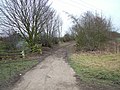
 Farm Track - geograph.org.uk - 183940.jpg 640 × 480; 110 KB
-
 Farm Track and Fields - geograph.org.uk - 134067.jpg 640 × 480; 57 KB
-
 Farm Track in Sandhill - geograph.org.uk - 117761.jpg 640 × 480; 108 KB
-
 Farm track into grassland - geograph.org.uk - 900098.jpg 640 × 480; 72 KB
-
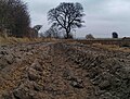
 Farm track near Dadsley Well Bridge - geograph.org.uk - 170866.jpg 640 × 427; 96 KB
-

-
 Track alongside field - geograph.org.uk - 1100535.jpg 640 × 483; 86 KB
-
 Track and gate to moorland - geograph.org.uk - 836284.jpg 640 × 480; 76 KB
-
 Track in Bance Edge Plantation, Dunford - geograph.org.uk - 1273252.jpg 640 × 480; 137 KB
-
 Track off Woodhouse Green Road - geograph.org.uk - 1235754.jpg 640 × 480; 88 KB


