Category:Farm tracks in England
Jump to navigation
Jump to search

Subcategories
This category has the following 18 subcategories, out of 18 total.
B
- Farm tracks in Bedfordshire (23 F)
C
D
- Farm tracks in Derbyshire (84 F)
E
- Farm tracks in Essex (5 F)
H
- Farm tracks in Hampshire (6 F)
- Farm tracks in Hertfordshire (1 F)
L
- Farm tracks in Lancashire (3 F)
N
O
- Farm tracks in Oxfordshire (35 F)
W
- Farm tracks in West Sussex (7 F)
Y
- Farm tracks in South Yorkshire (12 F)
Media in category "Farm tracks in England"
The following 27 files are in this category, out of 27 total.
-
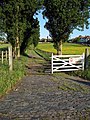
 Access to Park Farm - geograph.org.uk - 837487.jpg 480 × 640; 71 KB
-
 Ash parish in Kent England - Cooper Street Drove.jpg 3,000 × 2,000; 6.33 MB
-
 College Farm - geograph.org.uk - 444598.jpg 480 × 640; 191 KB
-
 Concrete track north of East Fields Farm - geograph.org.uk - 1535841.jpg 640 × 426; 161 KB
-
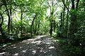
 Copse - geograph.org.uk - 235894.jpg 640 × 480; 106 KB
-
 Entrance to the Turvey Farms - geograph.org.uk - 276588.jpg 640 × 480; 90 KB
-
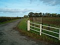
 Entrance to Warr's Farm - geograph.org.uk - 1386088.jpg 640 × 480; 53 KB
-
 Farm road at Monkton Kent England.jpg 3,000 × 2,000; 6.93 MB
-
 Farm Track - geograph.org.uk - 334494.jpg 640 × 442; 99 KB
-
 Farm track off Gaddesby Lane - geograph.org.uk - 144469.jpg 600 × 450; 62 KB
-
 Farm track off Reynolds Lane - geograph.org.uk - 2750665.jpg 640 × 430; 133 KB
-
 Farm track off Waterworks Lane - geograph.org.uk - 6349048.jpg 800 × 600; 131 KB
-
 Farm track southeast of Ripley, Surrey.jpg 4,128 × 3,096; 6.81 MB
-
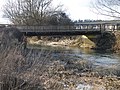 Field access bridge - geograph.org.uk - 1741326.jpg 3,648 × 2,736; 2.16 MB
-
 Escape across the A14 - geograph.org.uk - 539243.jpg 640 × 480; 67 KB
-

-
 New Track near Frank's Farm - geograph.org.uk - 1577573.jpg 640 × 480; 109 KB
-
 Private road to Mouseden Farm - geograph.org.uk - 4770875.jpg 640 × 428; 129 KB
-
 Ridgeway Lane, Lytes Cary.jpg 5,152 × 3,864; 4.51 MB
-
 Stafford Common - geograph.org.uk - 967610.jpg 640 × 457; 121 KB
-
 The track across Feldon Burn - geograph.org.uk - 525837.jpg 640 × 480; 96 KB
-
-
 To Reynolds Lane - geograph.org.uk - 5108799.jpg 640 × 426; 124 KB
-
 Track to Caen Farm - geograph.org.uk - 3352019.jpg 640 × 426; 123 KB
-
 Track to Little Mount Farm - geograph.org.uk - 6550691.jpg 1,024 × 684; 300 KB
-
 Turtle bridge - geograph.org.uk - 1741207.jpg 3,648 × 2,736; 2.21 MB
-
 Unmetalled track on the top of Bow Bridge, Iwood.jpg 2,900 × 4,032; 7.95 MB


