
Category:FFH-Gebiet Allgäuer Hochalpen
| Diese Kategorie repräsentiert ein Schutzgebiet nach Naturschutzrecht in Deutschland. |
|---|
| This category was created according to a clear scheme; it should not be moved, deleted or recategorized. It is stored in this upload map, among other places. Description and background on the Wiki project page |
| Upload photo to Wiki Loves Earth! - Wiki Loves Earth Germany page |
protected area in the European Union defined by the habitats directive in Bayern, Germany  | |||||
| Upload media | |||||
| Instance of | |||||
|---|---|---|---|---|---|
| Location | Oberallgäu, Swabia, Bavaria, Germany | ||||
| Applies to jurisdiction | |||||
| Inception |
| ||||
| Area |
| ||||
 | |||||
Deutsch: Tiere, Pflanzen und deren Lebensraum im Bereich des Naturschutzgebietes Allgäuer Hochalpen im Landkreis Oberallgäu.
Subcategories
This category has the following 9 subcategories, out of 9 total.
A
E
- Engeratsgundsee (5 F)
K
- Kematsriedmoos (47 F)
L
- Laufbichelsee (3 F)
O
- Oberer Gaisalpsee (7 F)
S
- Schrecksee (14 F)
- Seealpsee (Allgäu) (30 F)
- Stuibenfall (Oytal) (11 F)
U
- Unterer Gaisalpsee (20 F)
Media in category "FFH-Gebiet Allgäuer Hochalpen"
The following 53 files are in this category, out of 53 total.
-
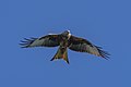 A majestic milan bird in front of blue sky.jpg 3,220 × 2,147; 2.76 MB
-
 Allgäuer Hochalpen - Koblat.jpg 5,312 × 2,988; 5.46 MB
-
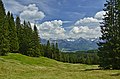
 Allgäuer Wiesen.jpg 4,000 × 3,000; 4.64 MB
-
 Alpen-Kratzdistel (Cirsium spinosissimum), Standort Nebelhorngipfel, 2224m IMG 7072.JPG 3,888 × 2,592; 3.68 MB
-
 Bad Oberdorf, Hintersteiner Tal.jpg 4,000 × 3,000; 4.41 MB
-
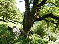
 Baum-Pilze.jpg 4,000 × 3,000; 4.35 MB
-
 Berg-Flockenblume, Iseler.jpg 3,669 × 2,886; 1.95 MB
-
 Berghang, Retterschwanger Tal.jpg 4,000 × 3,000; 4.96 MB
-
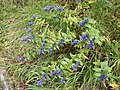
 Blauer Eisenhut - Aufstieg Warth zur Rappenseehütte - 2. Tag (9800489654).jpg 3,968 × 2,976; 1.42 MB
-
 Blick ins Ostrachtal.jpg 3,927 × 2,828; 2.12 MB
-
 Blick vom Iseler.jpg 4,000 × 3,000; 4.71 MB
-
 Blick vom Königsweg in der Nagelfluhkette über Oberstdorf auf Allgäuer Hochalpen.jpg 5,972 × 3,929; 11.56 MB
-
 Breitachklamm SW von Oberstdorf.jpg 3,945 × 2,630; 8.2 MB
-
 Burgschrofen.jpg 4,000 × 3,000; 4.67 MB
-
 Deutscher Enzian.jpg 3,000 × 4,000; 4.53 MB
-
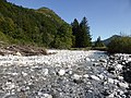 Fluss Bsonderach.jpg 4,000 × 3,000; 4.7 MB
-
 Flussbett Bsonderach.jpg 4,000 × 3,000; 4.78 MB
-
 Gentiana asclepiadea, Hintersteiner Tal.jpg 4,000 × 3,000; 4.26 MB
-
 Gentianella germanica, Deutscher Enzian.jpg 4,000 × 3,000; 4.7 MB
-
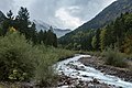
 Gundbach bei Oberjoch.jpg 4,000 × 3,000; 4.53 MB
-
 Hochmoor Strausberg Moos.jpg 4,000 × 3,000; 4.61 MB
-
 Imberger Horn; Gipfelfelsen.jpg 4,000 × 3,000; 4.69 MB
-
 Iseler Gipfel.jpg 4,000 × 3,000; 4.47 MB
-
 Kühgundkopf, 1.907 m.jpg 4,000 × 3,000; 4.69 MB
-
 Lichterspiel mit Gipfel.jpg 3,888 × 2,592; 6.42 MB
-
 MK57960 Stillach.jpg 2,738 × 1,825; 4.27 MB
-
 Moorauge, Kematsried Moos.jpg 4,000 × 3,000; 4.65 MB
-
 Murmeltier - Aufstieg zur Rappenseehütte - 2. Tag (9800543336).jpg 3,968 × 2,976; 1.89 MB
-
 Pilze am Totholz, Gundalpe.jpg 2,560 × 1,920; 3 MB
-
 Pilze im Kematsried Moos.jpg 4,000 × 3,000; 4.66 MB
-
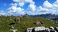
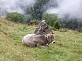 Rind an der Unteren Ochsenalpe.jpg 4,000 × 3,000; 4.38 MB
-
 Schattenberg05.jpg 2,304 × 1,728; 2.98 MB
-
 Schwalbenwurz-Enzian, Strausberg.jpg 4,000 × 3,000; 4.72 MB
-
 Seewände und Seebach im Oytal.jpg 5,184 × 3,888; 6.27 MB
-
 Silberdistel, Stengellose Eberwurz.jpg 4,000 × 3,000; 4.43 MB
-
 Sonnenuntergang im Paradies.jpg 3,888 × 2,592; 6.78 MB
-
 Steinbock am Übergang zum Biberkopf - 3. Tag (9800507685).jpg 1,920 × 1,440; 1.41 MB
-
 Steinböcke am Heilbronner Weg.jpg 5,472 × 3,080; 6.28 MB
-
 Strausberg Moor.jpg 4,000 × 3,000; 4.54 MB
-
 Strausberg Moos.jpg 4,000 × 3,000; 4.72 MB
-
 Strausberg, Strausbergalpe.jpg 4,000 × 3,000; 4.49 MB
-
 Strausbergalpe; Strausberg Moos.jpg 4,000 × 3,000; 4.43 MB
-
 Trollblume - Trollius europaeus auf einer Bergwiese.jpg 2,448 × 3,264; 1.07 MB
-
 Unbekannte Raupe, Strausberg.jpg 4,000 × 3,000; 4.66 MB
-
 Vielfältige Allgäuer Hochalpen (02).JPG 4,320 × 2,432; 3.7 MB
-
 Vielfältige Allgäuer Hochalpen (03).JPG 4,320 × 2,432; 4.48 MB
-
 Vielfältige Allgäuer Hochalpen (04).JPG 3,368 × 2,254; 3.16 MB
-
 Vielfältige Allgäuer Hochalpen (05).JPG 4,320 × 2,432; 4.05 MB
-
 Vielfältige Allgäuer Hochalpen (06).JPG 4,320 × 2,432; 3.66 MB
-
 Vielfältige Allgäuer Hochalpen (08).JPG 4,320 × 2,432; 4.25 MB
-
 Vielfältige Allgäuer Hochalpen (10).JPG 4,320 × 2,432; 4.58 MB
-
 Willersalpe - LSG-00248.01 - Hintersteinertal - Allgäuer Hochalpen - DSC03884.jpg 6,000 × 4,000; 21.5 MB
-
 WLE Nebelhorn Höfartsweg 2.jpg 4,000 × 3,000; 14.77 MB


,_Standort_Nebelhorngipfel,_2224m_IMG_7072.JPG)


.jpg)


.jpg)


.jpg)


.JPG)
.JPG)
.JPG)
.JPG)
.JPG)
.JPG)
.JPG)

