Category:English-language maps of Texas
Jump to navigation
Jump to search
States of the United States: Alabama · Alaska · Arkansas · California · Florida · Louisiana · Maryland · Massachusetts · New Jersey · New Mexico · New York · North Carolina · Ohio · Oklahoma · Pennsylvania · Texas · Utah – Washington, D.C.
Media in category "English-language maps of Texas"
The following 67 files are in this category, out of 67 total.
-
Majority minority counties in Texas based on 2020 Census data.png 2,737 × 2,190; 1.08 MB
-
'Texas New Yorker' Travelers' Railroad Map of the State of Texas 1872 UTA.jpg 6,778 × 9,481; 18.42 MB
-
(Texas County Map with Route of the G.H.& S.A. Railway) 1876 UTA.jpg 2,931 × 1,599; 1.51 MB
-
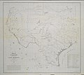
Austin & Tanner Map of Texas with Parts of the Adjoining States 1836 UTA.jpg 7,003 × 8,786; 13.33 MB
-
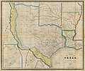
Burr The State of Texas, 1835-1845 1846 UTA.jpg 3,218 × 2,688; 1.54 MB
-
Colton Texas 1854 (1855) UTA.jpg 4,026 × 3,379; 14.47 MB
-
Colton Texas 1855 (1856) UTA.jpg 4,709 × 3,853; 3.34 MB
-
Colton's Texas 1861 UTA.jpg 3,713 × 3,225; 2.33 MB
-
Colton-Southwestern Immigration Co. New Map of Texas 1881 UTA.jpg 8,232 × 5,956; 18.4 MB
-
Correct Map of Texas...G.H.& S.A. Railway 1876 UTA.jpg 5,819 × 4,493; 4.94 MB
-
Cram Dallas, Texas 1890 UTA.jpg 3,201 × 4,176; 4.85 MB
-
Creuzbaur J. De Cordova's Map of Texas 1849 UTA.jpg 8,834 × 9,597; 19.36 MB
-
Gamble-Mitchell County Map of Texas 1882 UTA.jpg 5,748 × 3,910; 6.08 MB
-
Gamble-Mitchell County Map of the State of Texas 1881 UTA.jpg 4,095 × 2,688; 2.44 MB
-
Gray's New Map of Brenham, Washington Co., Texas ca. 1885.jpg 1,364 × 2,135; 1.15 MB
-
Gray's New Map of Cisco, Eastland Co., Texas 1885 UTA.jpg 4,205 × 5,869; 8.97 MB
-
Gray's New Map of Fort Worth, Texas 1885 UTA.jpg 1,800 × 1,149; 1.7 MB
-
Gray's New Map of Texas and Indian Territory 1876 UTA.jpg 4,188 × 2,608; 1.72 MB
-
Gray's New Map of Weatherford, Parker Co., Texas 1885 UTA.jpg 5,478 × 5,869; 10.68 MB
-
Hunt & Randel Map of Texas 1839 UTA.jpg 7,718 × 9,957; 15.5 MB
-
Ikin Map of Texas 1841 UTA.jpg 2,046 × 1,767; 2.14 MB
-
International & Great Northern Railroad Correct Map of Texas 1878 UTA.jpg 2,688 × 4,063; 2.53 MB
-
Konen Colorado & Red River Land Co. c. 1835 UTA (map).jpg 3,407 × 2,688; 1.3 MB
-
Lee Map of Texas 1836 UTA.jpg 5,280 × 7,906; 19.27 MB
-
Livermore Military Map of the Rio Grande Frontier 1883 (1926) UTA.jpg 9,477 × 5,448; 13 MB
-
Map of Texas and Part of New Mexico 1857 (1887) UTA.jpg 4,188 × 2,630; 1.54 MB
-
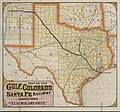
Map of the Gulf, Colorado and Santa Fe 'Texas Midland Route' 1880 UTA.jpg 9,230 × 8,592; 13.64 MB
-
Morse & Breese Texas 1844 UTA.jpg 1,386 × 1,693; 1.67 MB
-
Myers, Noyes, & Forrest Official Map Arlington, Texas 1926 UTA.jpg 10,674 × 7,159; 19.7 MB
-
O. M. Roberts Texas Map No. 1 1881 UTA.jpg 3,277 × 2,824; 3.68 MB
-
O. M. Roberts Texas Map No. 2 1881 UTA.jpg 3,149 × 2,697; 2.39 MB
-
O. M. Roberts Texas Map No. 3 1881 UTA.jpg 3,160 × 2,742; 2.59 MB
-
O. M. Roberts Texas Map No. 4 1881 UTA.jpg 3,092 × 2,762; 2.55 MB
-
O. W. Gray & Son City of Galveston ca. 1884 UTA.jpg 4,991 × 8,018; 9.91 MB
-
O. W. Gray & Son City of Houston 1884 UTA.jpg 7,809 × 5,272; 17.09 MB
-
O. W. Gray & Son Palestine, Texas ca. 1885 UTA.jpg 7,370 × 5,728; 12.2 MB
-
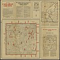
Oil Map of Callahan County 1919 UTA.jpg 1,800 × 1,796; 2.98 MB
-
Philip & Son Mexico & Texas 1853 UTA.jpg 3,319 × 2,688; 1.78 MB
-
Pressler Traveller's Map of the State of Texas 1867 UTA.jpg 3,500 × 3,641; 3.74 MB
-
Rand McNally Standard Map of Texas 1921 UTA.jpg 2,688 × 3,681; 1.69 MB
-
Rand, McNally & Co. Map of Texas 1889 UTA.jpg 3,004 × 2,688; 1.6 MB
-
Richardson's New Map of Texas including Part of Mexico 1861 UTA.jpg 1,800 × 1,357; 2.67 MB
-
Richardson's New Map of the State of Texas Including Part of Mexico 1859 UTA.jpg 3,473 × 2,688; 1.93 MB
-
Rogers Road Map of Tarrant County 1920 UTA.jpg 2,742 × 3,108; 6.69 MB
-
San Antonio Light Bird's Eye View Map of San Antonio, Texas December 1891 UTA.jpg 3,150 × 2,136; 3.32 MB
-
Sectional Map of Texas Traversed by the Missouri, Kansas & Texas Railway 1904 UTA.jpg 2,688 × 2,577; 1.46 MB
-
Sectional Map State of Texas Dallas and Tarrant Counties 1915 UTA.jpg 12,192 × 8,522; 18.49 MB
-
Shuler Geological Map of Dallas County 1918 UTA.jpg 2,898 × 3,020; 3.96 MB
-
Texas & Pacific Railway Plot of the Town of Arlington, Texas 1878 (1913) UTA.jpg 9,392 × 7,157; 12.9 MB
-
Texas in Doubleday, Page & Co's Geographical Manual and New Atlas 1918 UTA.jpg 3,286 × 2,688; 2.19 MB
-
U.S. Coast Survey Preliminary Chart of Galveston Bay, Texas 1855 (1856) UTA.jpg 2,316 × 2,735; 7.05 MB
-
U.S. Government Map of the Lower Rio Grande 1876 UTA.jpg 9,796 × 6,606; 16.73 MB
-
USGS Reconnaissance Map of Dallas County, Texas 1893 (1909) UTA.jpg 6,846 × 8,300; 16.44 MB
-
USGS Reconnaissance Map of Tarrant County, Texas 1918 (1894 edition) UTA.jpg 4,004 × 5,040; 7.72 MB
-
Warner & Beers County Map of Texas and Indian Territory 1875 UTA.jpg 4,661 × 5,368; 11.21 MB
-
Weichsel & Co 1919 Map and Guide of Dallas & Suburbs UTA.jpg 6,513 × 8,753; 18.45 MB
-
Wellge Perspective Map of Fort Worth, Tex. 1891 UTA.jpg 9,000 × 5,326; 15.61 MB
-
Williams, Tanner, & Mitchell Map of Texas from the most recent authorities 1845 (1846) UTA.jpg 3,349 × 2,750; 10.19 MB
-
Young & Mitchell A New Map of Texas 1836 UTA.jpg 4,000 × 2,769; 19.51 MB
-
Young-Cowperthwait Map of the State of Texas from the Latest Authorities 1854 (1855) UTA.jpg 4,310 × 3,518; 16.78 MB
-
Young-DeSilver Map of Texas from the Latest Authorities 1855 (1856) UTA.jpg 4,856 × 4,007; 7.91 MB
-
Young-DeSilver Map of the State of Texas from the Latest Authorities 1856 (1859) UTA.jpg 9,666 × 7,979; 19.43 MB


