Category:English-language maps of North Carolina
Jump to navigation
Jump to search
States of the United States: Alabama · Alaska · Arkansas · California · Florida · Louisiana · Maryland · Massachusetts · New Jersey · New Mexico · New York · North Carolina · Ohio · Oklahoma · Pennsylvania · Texas · Utah – Washington, D.C.
Media in category "English-language maps of North Carolina"
The following 10 files are in this category, out of 10 total.
-
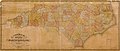 1833 Map of North Carolina.jpg 6,437 × 2,722; 3.05 MB
-
 1855 Colton Map of North Carolina - Geographicus - NorthCarolina-colton-1855.jpg 4,000 × 3,214; 4.05 MB
-
 Administrative map, state of North Carolina LOC 98683668.jpg 4,503 × 3,360; 1.53 MB
-
 General soil map of North Carolina LOC 2007629229.jpg 10,344 × 10,444; 11.16 MB
-

-
 North Carolina map of Köppen climate classification.svg 1,900 × 1,085; 49 KB
-
 North Carolina regions map.svg 744 × 1,052; 1.72 MB
-
 North Carolina; county subdivisions, townships and places. 1970. LOC gm72003065.jpg 13,851 × 7,905; 9.8 MB
-
 State of North Carolina; base map. LOC 76691498.jpg 10,285 × 4,322; 6.11 MB
-
 The Federal Aid Highway System, Progress map. North Carolina - btv1b531954479.jpg 17,271 × 9,742; 18.12 MB


.jpg)


