Category:End of Georgia (U.S. state) State Route signs
Jump to navigation
Jump to search
States of the United States: Alabama · California · Colorado · Delaware · Florida · Georgia · Illinois · Indiana · Iowa · Massachusetts · Minnesota · Mississippi · Missouri · Nevada · New Jersey · New York · North Carolina · Ohio · Oklahoma · Pennsylvania · Rhode Island · South Carolina · Utah · Vermont · Wisconsin
Media in category "End of Georgia (U.S. state) State Route signs"
The following 87 files are in this category, out of 87 total.
-
 Albany U.S. 82 Business EB End.jpg 5,184 × 3,456; 7.77 MB
-
 Albany U.S. 82 Business NB End.jpg 5,184 × 3,456; 4.62 MB
-
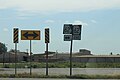
 Bus 1, Bus 4, Bus 23 End, Ware County.jpg 5,184 × 3,456; 6.5 MB
-
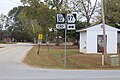
 End US 84 GA 38 Sign in Midway GA.JPG 2,592 × 1,944; 1.08 MB
-
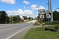
 Fla-Ga state line US 19 south01.jpg 3,264 × 2,098; 2.12 MB
-
 GA 215 end, Vienna.jpg 5,184 × 3,456; 9.99 MB
-
 GA 362 End, Spalding County.JPG 5,184 × 3,456; 5.96 MB
-
 GA 376 End Clyattville.JPG 3,072 × 2,304; 3.12 MB
-
 GA 376 end in Echols County.JPG 3,072 × 2,304; 3.01 MB
-
 GA 38 US 84 EB end, Midway.jpg 5,184 × 3,456; 5.19 MB
-
 GA 400 northern terminus sign, April 2017.jpg 1,348 × 1,731; 811 KB
-
 GA SR 45 SB end, Iron City.jpg 5,184 × 3,456; 9.17 MB
-
 GA11 bypass eastern terminus, Lakeland.jpg 5,184 × 3,456; 6 MB
-
 GA111EB terminus at GA33, Moultrie.jpg 5,184 × 3,456; 8.11 MB
-
 GA112 end Grady County.jpg 5,184 × 3,456; 7.92 MB
-
 GA122 end Ware County.jpg 5,184 × 3,456; 8.98 MB
-
 GA122 end, Thomasville.jpg 5,184 × 3,456; 7.87 MB
-
 GA128 NB end Roberta.jpg 5,184 × 3,456; 7.46 MB
-
 GA133sRoadSign-EndGA234 (31008552985).jpg 2,400 × 1,600; 1.62 MB
-
 GA135 bypass terminus, Lanier County.jpg 5,184 × 3,456; 6.36 MB
-
 GA147 End, Reidsville.jpg 5,184 × 3,456; 6.32 MB
-
 GA155 SB end Spalding County.jpg 5,184 × 3,456; 5.44 MB
-
 GA158 end, Irwin County.jpg 5,184 × 3,456; 7.99 MB
-
 GA17AltEnd-GA17sSignRoad (31180184062).jpg 2,400 × 1,600; 1.98 MB
-
 GA188 end Grady County.jpg 5,184 × 3,456; 7.23 MB
-
 GA188 end Thomas County.jpg 5,184 × 3,456; 7.73 MB
-
 GA200EB End, Newton.jpg 5,184 × 3,456; 8.73 MB
-
 GA200WB end, Blakely.jpg 5,184 × 3,456; 8.33 MB
-
 GA202 end, Thomas County.jpg 5,184 × 3,456; 6.78 MB
-
 GA202NB terminus at GA111, Colquitt County.jpg 5,184 × 3,456; 8.4 MB
-
 GA206 Conn EB end.jpg 5,184 × 3,456; 7.71 MB
-
 GA206 Conn WB end.jpg 5,184 × 3,456; 10.01 MB
-
 GA206 Connector EB End.jpg 5,184 × 3,456; 7.71 MB
-
 GA206 end, Douglas.jpg 5,184 × 3,456; 7.73 MB
-
 GA215 end, Ben Hill County.jpg 5,184 × 3,456; 7.99 MB
-
 GA216EB end.jpg 5,184 × 3,456; 8.97 MB
-
 GA233EndSign-GA90ew (30707030500).jpg 2,400 × 1,600; 2.3 MB
-
 GA234wRoad-GA45nsSigns (32785404151).jpg 2,400 × 1,600; 2.46 MB
-
 GA251 SB end at US17 GA25 in Darien.jpg 5,184 × 3,456; 7.51 MB
-
 GA253SpurNB end.jpg 5,184 × 3,456; 7.16 MB
-
 GA256 end at GA33, Sylvester.jpg 5,184 × 3,456; 9.13 MB
-
 GA285 EB end, Decatur County.jpg 5,184 × 3,456; 8.22 MB
-
 GA3 GA300 end, Jefferson county line, Florida state line.jpg 5,184 × 3,456; 8.19 MB
-
 GA300EndSignRoad-InvertedNumeralThree (25372766979).jpg 2,400 × 1,600; 1.63 MB
-
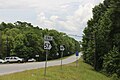
 GA313SB End, Sylvester.jpg 5,184 × 3,456; 8.12 MB
-
 GA33 Conn WB end, Crisp County.jpg 5,184 × 3,456; 8.55 MB
-
 GA33 end Thomas County.jpg 5,184 × 3,456; 7.59 MB
-
 GA33 NB end, Crisp County.jpg 5,184 × 3,456; 9.81 MB
-
 GA333NB end, Brooks County.jpg 5,184 × 3,456; 9.39 MB
-
 GA35 end Grady County.jpg 5,184 × 3,456; 11.13 MB
-
 GA35Conn NB end, Thomas County.jpg 5,184 × 3,456; 8.01 MB
-
 GA35Conn SB end, Thomas County.jpg 5,184 × 3,456; 7.85 MB
-
 GA388EndGrovetown.JPG 3,008 × 1,587; 1.95 MB
-
 GA400 Toll - End Sign (28491163352).jpg 1,200 × 800; 547 KB
-
 GA56EB end, Reidsville.jpg 5,184 × 3,456; 7.5 MB
-
 GA57 SE end, McIntosh County.jpg 5,184 × 3,456; 6.31 MB
-
 GA62 Bypass EB end, Blakely.jpg 5,184 × 3,456; 4.25 MB
-
 GA7 Connector EB end, Fort Valley.jpg 5,184 × 3,456; 8.73 MB
-
 GA90 SB end, Willacoochee.jpg 5,184 × 3,456; 6.64 MB
-
 GA90 terminus at US82, Willacoochee.JPG 4,320 × 3,240; 4.47 MB
-
 GA92 end, Griffin.jpg 5,184 × 3,456; 8.01 MB
-
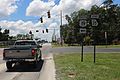
 GA94 end at Inner Perimeter Rd.JPG 5,152 × 3,864; 8 MB
-
 GA99 NB end, McIntosh County.jpg 5,184 × 3,456; 5.95 MB
-
 Georgia GA384 SB end.jpg 5,184 × 3,456; 4.23 MB
-
 Georgia State Route 1 Connector end, Lumpkin.jpg 5,184 × 3,456; 7.87 MB
-
 Georgia State Route 149 Connector, NW terminus.JPG 4,608 × 3,456; 5.67 MB
-
 Georgia State Route 159SB end, Ashburn.JPG 4,320 × 3,240; 4.54 MB
-
 Georgia State Route 188 eastern end.jpg 1,536 × 2,048; 882 KB
-
 Georgia State Route 268 end at GA32.jpg 5,184 × 3,456; 8.51 MB
-
 Georgia State Route 285 eastern terminus.jpg 5,184 × 3,456; 9.52 MB
-
 Georgia State Route 3 Bypass SB end.jpg 5,184 × 3,456; 6.05 MB
-
 Georgia State Route 302 Northern terminus.jpg 5,184 × 3,456; 7.65 MB
-
 Georgia State Route 302 Spur end at GA97.jpg 5,184 × 3,456; 7.1 MB
-
 Georgia State Route 31 Connector, eastern terminus.JPG 5,152 × 3,864; 7.87 MB
-
 Georgia State Route 377 NB end, Americus.jpg 5,184 × 3,456; 6.25 MB
-
 Georgia State Route 38 Conn East End, Cairo.jpg 4,320 × 3,240; 4.51 MB
-
 Georgia State Route 39 Connector EB end, Lumpkin.jpg 5,184 × 3,456; 10.4 MB
-
 Georgia State Route 45 Alternate Northern End, Arlington.jpg 5,184 × 3,456; 10.23 MB
-
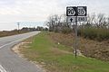
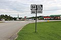
 Georgia State Route 64, eastern terminus.JPG 5,152 × 3,864; 7.85 MB
-
 Georgia State Route 7 Alternate end, Valdosta.JPG 4,608 × 3,456; 4.78 MB
-
 Georgia State Route 7 Alternate end.JPG 4,320 × 3,240; 4.53 MB
-
 Georgia State Route 7 Connector Western terminus.JPG 4,320 × 3,240; 4.42 MB
-
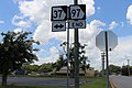 Georgia State Route 97 NE end, Camilla.jpg 5,184 × 3,456; 5.38 MB
-
 Georgia State Route 97 Spur end at GA97.jpg 5,184 × 3,456; 5.38 MB
-
 Georiga State Route 233 southern terminus.JPG 4,608 × 3,456; 5.14 MB
-
 Spur 7 End south, Perry.jpg 5,184 × 3,456; 6.36 MB
-
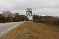
 W End of GA 40; Folkston.jpg 3,648 × 2,736; 1.98 MB


.jpg)


.jpg)


.jpg)
.jpg)


.jpg)


.jpg)


