Category:End of Utah State Route signs
Jump to navigation
Jump to search
States of the United States: Alabama · California · Colorado · Delaware · Florida · Georgia · Illinois · Indiana · Iowa · Massachusetts · Minnesota · Mississippi · Missouri · Nevada · New Jersey · New York · North Carolina · Ohio · Oklahoma · Pennsylvania · Rhode Island · South Carolina · Utah · Vermont · Wisconsin
Media in category "End of Utah State Route signs"
The following 47 files are in this category, out of 47 total.
-
 "Ends" US-89 Sign at UT-85 near I-15 in Lehi - panoramio.jpg 1,600 × 1,200; 351 KB
-
 (Current) East End of UT-7 AKA the Southern Parkway - panoramio.jpg 1,600 × 1,200; 345 KB
-
 East at north end of SR-144 in American Fork Canyon, Nov 16.jpg 2,592 × 1,944; 2.36 MB
-
 East at SR-113 & US-40 US-189 junction in Heber City, Utah, Apr 16.jpg 2,592 × 1,944; 2.39 MB
-
 East at US-89 & SR-129, Pleasant Grove-Lindon border, Utah, Jun 16.jpg 2,592 × 1,944; 2.44 MB
-
 East at US-89 & SR-145 junction, American Fork, Utah, Aug 16.jpg 2,592 × 1,944; 2.39 MB
-
 East on SR-319 at Jordanelle State Park-Hailstone sign, Apr 16.jpg 2,592 × 1,944; 2.32 MB
-
 East toward junction of SR-178 & SR-198, Feb 16.jpg 2,816 × 2,112; 2.45 MB
-
 End 85 (30275850957).jpg 4,032 × 3,024; 1.78 MB
-
 End 85 (44303582905).jpg 4,032 × 3,024; 2.04 MB
-
 END UT-34 at UT-18, TO I-15 - panoramio.jpg 1,600 × 1,200; 666 KB
-
 END UT-34 Shield - panoramio.jpg 1,600 × 1,200; 455 KB
-
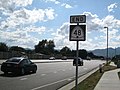 END UT-48 Shield - panoramio.jpg 1,600 × 1,200; 530 KB
-
 End UT-54 - panoramio.jpg 1,600 × 1,200; 484 KB
-
 END UT-9, JCT I-15, 1-2 Mile - panoramio.jpg 1,600 × 1,200; 386 KB
-
 Garrisonlandscape.JPG 3,648 × 2,432; 3.38 MB
-
 Last UT-48 Shield West of Bangerter Hwy (UT-154) - panoramio.jpg 1,600 × 1,200; 563 KB
-
 North at north end SR-99, Fillmore, Utah, Oct 16.jpg 2,592 × 1,944; 2.31 MB
-
 North at SR-92 & SR-129 in Highland, Utah, Jun 16.jpg 2,592 × 1,944; 2.4 MB
-
 Northeast at SR-135 & SR-129 junction, Pleasant Grove, Utah, Jan 17.jpg 2,592 × 1,944; 2.36 MB
-
 Northeast at US-6 & SR-198 junction in Spanish Fork, Utah, May 16.jpg 2,592 × 1,944; 2.34 MB
-
 Northwest at SR-73 & SR-145 junction, Saratoga Springs, Utah, Oct 16.jpg 2,592 × 1,944; 2.35 MB
-
 SLC Construction - panoramio.jpg 3,000 × 4,000; 2.63 MB
-
 South at SR-83 & SR-102 junction, Box Elder County, Utah, Feb 17.jpg 2,592 × 1,944; 2.36 MB
-
 South at US-6 & SR-141 junction, Genola, Utah, May 16.jpg 2,592 × 1,944; 2.42 MB
-
 South at US-6 & SR-68 junction, Elberta, Utah, May 16.jpg 2,592 × 1,944; 2.4 MB
-
 Southeast at SR-73 & SR-145 junction, Saratoga Springs, Utah, Oct 16.jpg 2,592 × 1,944; 2.34 MB
-
 Southwest at SR-319 western terminus, Apr 16.jpg 2,592 × 1,944; 2.29 MB
-
 Sr100 eend 99 i1499.jpg 4,032 × 3,024; 4.84 MB
-
 Sr100 wend i1535.jpg 4,032 × 3,024; 5.76 MB
-
 Sr28 78 jct i1462.jpg 4,032 × 3,024; 3.62 MB
-
 Sr78 wend i1472.jpg 4,032 × 3,024; 5.74 MB
-
 Sr99 nend i1494.jpg 4,032 × 3,024; 4.3 MB
-
 State Street and Main Street, Hurricane, Utah.jpg 922 × 659; 480 KB
-
 US 191 & Utah Route 211 Markers.jpg 2,448 × 3,264; 3.67 MB
-
 US 6, SR 198 (30275854127).jpg 4,032 × 3,024; 1.38 MB
-
 US-89 & SR-151 signs, Apr 16.jpg 2,592 × 1,944; 2.41 MB
-
 UT-209-210 Junction - panoramio.jpg 1,600 × 1,200; 504 KB
-
 UT-68 Junction, UT-140 End - panoramio.jpg 1,600 × 1,200; 612 KB
-
 UT261 southern terminus.jpg 2,912 × 4,368; 3.82 MB
-
 Utah State Highway 9 - 9078824667.jpg 2,304 × 3,072; 679 KB
-
 Utah State Highway 9 - 9081181170.jpg 3,072 × 2,304; 460 KB
-
 Wayne county4 ut sr72.jpg 1,536 × 1,024; 522 KB
-
 West at former SR-68 & SR-140 junction, Bluffdale, Utah, Sep 16.jpg 2,592 × 1,944; 2.25 MB
-
 West at junction of I-15, US-6, & SR-198, Santaquin, Utah, May 16.jpg 2,592 × 1,944; 2.35 MB
-
 West at the SR-32 & SR-35 junction in Francis, Utah, Apr 16.jpg 2,592 × 1,944; 2.41 MB
-
 West at western terminus SR-135, Lindon, Utah.jpg 2,592 × 1,944; 2.31 MB

_East_End_of_UT-7_AKA_the_Southern_Parkway_-_panoramio.jpg)


.jpg)
.jpg)


_-_panoramio.jpg)


.jpg)


