Category:Election maps of Saxony
Jump to navigation
Jump to search
Federal states of Germany:
Deutsch: Diese Kategorie enthält Karten zu Wahlen im Bundesland Sachsen.
English: This category contains maps of elections in the federal state of Saxony.
Subcategories
This category has the following 4 subcategories, out of 4 total.
C
- Election maps of Chemnitz (5 F)
D
- Election maps of Dresden (8 F)
E
L
- Election maps of Leipzig (8 F)
Media in category "Election maps of Saxony"
The following 200 files are in this category, out of 235 total.
(previous page) (next page)-
 1990 Saxony state election.svg 4,962 × 3,780; 3.53 MB
-
 1994 Saxony state election.svg 4,962 × 3,780; 3.46 MB
-
 1999 Saxony state election.svg 4,962 × 3,780; 3.14 MB
-
 2004 Saxony state election.svg 4,962 × 3,780; 3.19 MB
-
 2009 Saxony state election.svg 4,962 × 3,780; 3.19 MB
-
 2014 Saxony state election.svg 4,962 × 3,780; 3.26 MB
-
 2019 Saxony state election.svg 4,962 × 3,780; 3.26 MB
-
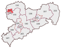
 BWahlkreis 152.svg 480 × 375; 38 KB
-
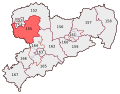
 BWahlkreis 153.svg 480 × 375; 38 KB
-
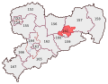
 BWahlkreis 154.svg 480 × 375; 38 KB
-
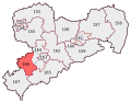
 BWahlkreis 155.svg 480 × 375; 38 KB
-
 BWahlkreis 156.svg 480 × 375; 38 KB
-
 BWahlkreis 157.svg 480 × 375; 38 KB
-
 BWahlkreis 158.svg 480 × 375; 38 KB
-
 BWahlkreis 159.svg 480 × 375; 38 KB
-
 BWahlkreis 160.svg 480 × 375; 38 KB
-
 BWahlkreis 161.svg 480 × 375; 38 KB
-
 BWahlkreis 162.svg 480 × 375; 38 KB
-
 BWahlkreis 163.svg 480 × 375; 38 KB
-
 BWahlkreis 164.svg 480 × 375; 38 KB
-
 BWahlkreis 165.svg 480 × 375; 38 KB
-
 BWahlkreis 166.svg 480 × 375; 38 KB
-
 BWahlkreis 167.svg 480 × 375; 38 KB
-
 Kreistagswahl Sachsen 2024.svg 2,068 × 1,508; 246 KB
-
 Landratswahl Annaberg 2001 2. Wahlgang.svg 850 × 850; 28 KB
-
 Landratswahl Aue-Schwarzenberg 2001.svg 780 × 780; 34 KB
-
 Landratswahl Bautzen 1. Wahlgang 2022.svg 1,482 × 1,306; 709 KB
-
 Landratswahl Bautzen 2. Wahlgang 2022.svg 1,482 × 1,306; 709 KB
-
 Landratswahl Bautzen 2001.svg 1,116 × 1,116; 58 KB
-
 Landratswahl Bautzen 2008.svg 1,488 × 1,488; 121 KB
-
 Landratswahl Bautzen 2015.svg 800 × 800; 1.42 MB
-
 Landratswahl Chemnitzer Land 2001.svg 691 × 691; 25 KB
-
 Landratswahl Delitzsch 2001.svg 1,010 × 1,010; 41 KB
-
 Landratswahl Döbeln 2001.svg 709 × 709; 27 KB
-
 Landratswahl Erzgebirgskreis 2008 2. Wahlgang.svg 1,630 × 1,630; 124 KB
-
 Landratswahl Erzgebirgskreis 2015.svg 820 × 820; 1.42 MB
-
 Landratswahl Freiberg 2001 2. Wahlgang.svg 1,098 × 1,098; 47 KB
-
 Landratswahl Görlitz 2008 1. Wahlgang.svg 1,878 × 1,878; 92 KB
-
 Landratswahl Görlitz 2008 2. Wahlgang.svg 1,878 × 1,878; 92 KB
-
 Landratswahl Görlitz 2015.svg 720 × 720; 1.4 MB
-
 Landratswahl Görlitz 2022 1. Wahlgang.svg 1,908 × 1,938; 642 KB
-
 Landratswahl Görlitz 2022 2. Wahlgang.svg 1,908 × 1,938; 644 KB
-
 Landratswahl Kamenz 2002.svg 1,240 × 1,240; 63 KB
-
 Landratswahl Leipzig 2008 1. Wahlgang.svg 1,240 × 1,240; 87 KB
-
 Landratswahl Leipzig 2008 2. Wahlgang.svg 1,240 × 1,240; 87 KB
-
 Landratswahl Leipzig 2015.svg 720 × 720; 1.39 MB
-
 Landratswahl Leipziger Land 2001 1. Wahlgang.svg 992 × 992; 43 KB
-
 Landratswahl Leipziger Land 2001 2. Wahlgang.svg 992 × 992; 43 KB
-
 Landratswahl Löbau-Zittau 2001.svg 939 × 939; 44 KB
-
 Landratswahl Meißen 2002.svg 957 × 957; 37 KB
-
 Landratswahl Meißen 2008.svg 1,134 × 1,134; 70 KB
-
 Landratswahl Meißen 2015.svg 720 × 720; 1.37 MB
-
 Landratswahl Meißen 2020.svg 1,137 × 1,137; 557 KB
-
 Landratswahl Mittelsachsen 2008.svg 1,630 × 1,630; 113 KB
-
 Landratswahl Mittelsachsen 2015.svg 780 × 780; 1.41 MB
-
 Landratswahl Mittelsachsen 2022 1. Wahlgang.svg 780 × 780; 1.41 MB
-
 Landratswahl Mittelsachsen 2022 2. Wahlgang.svg 780 × 780; 1.41 MB
-
 Landratswahl Mittlerer Erzgebirgskreis 2001.svg 974 × 974; 50 KB
-
 Landratswahl Mittweida 2001.svg 1,045 × 1,045; 46 KB
-
 Landratswahl Muldentalkreis 2001.svg 974 × 974; 50 KB
-
 Landratswahl Niederschlesischer Oberlausitzkreis 2001.svg 1,293 × 1,293; 51 KB
-
 Landratswahl Nordsachsen 2008 1. Wahlgang.svg 1,665 × 1,665; 84 KB
-
 Landratswahl Nordsachsen 2008 2. Wahlgang.svg 1,665 × 1,665; 84 KB
-
 Landratswahl Nordsachsen 2015.svg 820 × 820; 1.39 MB
-
 Landratswahl Nordsachsen 2022.svg 1,330 × 1,330; 1.4 MB
-
 Landratswahl Riesa-Großenhain 2001.svg 1,081 × 1,081; 38 KB
-
 Landratswahl Sonneberg 2023 1. Wahlgang.svg 1,063 × 1,063; 351 KB
-
 Landratswahl Sonneberg 2023 2. Wahlgang.svg 1,063 × 1,063; 351 KB
-
 Landratswahl Stollberg 2001.svg 602 × 602; 21 KB
-
 Landratswahl Sächsische Schweiz 2001.svg 1,028 × 1,028; 57 KB
-
 Landratswahl Sächsische Schweiz 2022.svg 1,593 × 978; 572 KB
-
 Landratswahl Sächsische Schweiz-Osterzgebirge 2008.svg 1,559 × 1,559; 90 KB
-
 Landratswahl Sächsische Schweiz-Osterzgebirge 2015.svg 820 × 820; 1.39 MB
-
 Landratswahl Vogtland 1. Wahlgang 2022.svg 1,178 × 1,254; 545 KB
-
 Landratswahl Vogtland 2. Wahlgang 2022.svg 1,178 × 1,254; 545 KB
-
 Landratswahl Vogtland 2002.svg 1,258 × 1,258; 99 KB
-
 Landratswahl Vogtland 2008.svg 1,276 × 1,276; 104 KB
-
 Landratswahl Vogtland 2015.svg 710 × 710; 1.38 MB
-
 Landratswahl Weißeritzkreis 2001.svg 904 × 904; 41 KB
-
 Landratswahl Zwickau 1. Wahlgang 2022.svg 984 × 984; 518 KB
-
 Landratswahl Zwickau 2. Wahlgang 2022.svg 984 × 984; 518 KB
-
 Landratswahl Zwickau 2008.svg 957 × 957; 59 KB
-
 Landratswahl Zwickau 2015.svg 710 × 710; 1.38 MB
-
 Landratswahl Zwickauer Land 2001.svg 833 × 833; 32 KB
-
 Landtagswahl Sachsen 2019, 1. und 2.Stimmenmehrheiten.svg 2,076 × 600; 897 KB
-
 Landtagswahlkreis 01 Sachsen 2024.svg 1,368 × 1,055; 628 KB
-
 Landtagswahlkreis 02 Sachsen 2024.svg 1,368 × 1,055; 628 KB
-
 Landtagswahlkreis 03 Sachsen 2024.svg 1,368 × 1,055; 628 KB
-
 Landtagswahlkreis 04 Sachsen 2024.svg 1,368 × 1,055; 628 KB
-
 Landtagswahlkreis 05 Sachsen 2024.svg 1,368 × 1,055; 628 KB
-
 Landtagswahlkreis 06 Sachsen 2024.svg 1,368 × 1,055; 628 KB
-
 Landtagswahlkreis 07 Sachsen 2024.svg 1,368 × 1,055; 628 KB
-
 Landtagswahlkreis 08 Sachsen 2024.svg 1,368 × 1,055; 628 KB
-
 Landtagswahlkreis 09 Sachsen 2024.svg 1,368 × 1,055; 628 KB
-
 Landtagswahlkreis 10 Sachsen 2024.svg 1,368 × 1,055; 628 KB
-
 Landtagswahlkreis 11 Sachsen 2024.svg 1,368 × 1,055; 628 KB
-
 Landtagswahlkreis 12 Sachsen 2024.svg 1,368 × 1,055; 628 KB
-
 Landtagswahlkreis 13 Sachsen 2024.svg 1,368 × 1,055; 628 KB
-
 Landtagswahlkreis 14 Sachsen 2024.svg 1,368 × 1,055; 628 KB
-
 Landtagswahlkreis 15 Sachsen 2024.svg 1,368 × 1,055; 628 KB
-
 Landtagswahlkreis 16 Sachsen 2024.svg 1,368 × 1,055; 628 KB
-
 Landtagswahlkreis 17 Sachsen 2024.svg 1,368 × 1,055; 628 KB
-
 Landtagswahlkreis 18 Sachsen 2024.svg 1,368 × 1,055; 628 KB
-
 Landtagswahlkreis 19 Sachsen 2024.svg 1,368 × 1,055; 628 KB
-
 Landtagswahlkreis 20 Sachsen 2024.svg 1,368 × 1,055; 628 KB
-
 Landtagswahlkreis 21 Sachsen 2024.svg 1,368 × 1,055; 628 KB
-
 Landtagswahlkreis 22 Sachsen 2024.svg 1,368 × 1,055; 628 KB
-
 Landtagswahlkreis 23 Sachsen 2024.svg 1,368 × 1,055; 628 KB
-
 Landtagswahlkreis 24 Sachsen 2024.svg 1,368 × 1,055; 628 KB
-
 Landtagswahlkreis 25 Sachsen 2024.svg 1,368 × 1,055; 628 KB
-
 Landtagswahlkreis 26 Sachsen 2024.svg 1,368 × 1,055; 628 KB
-
 Landtagswahlkreis 27 Sachsen 2024.svg 1,368 × 1,055; 628 KB
-
 Landtagswahlkreis 28 Sachsen 2024.svg 1,368 × 1,055; 628 KB
-
 Landtagswahlkreis 29 Sachsen 2024.svg 1,368 × 1,055; 628 KB
-
 Landtagswahlkreis 30 Sachsen 2024.svg 1,368 × 1,055; 628 KB
-
 Landtagswahlkreis 31 Sachsen 2024.svg 1,368 × 1,055; 628 KB
-
 Landtagswahlkreis 32 Sachsen 2024.svg 1,368 × 1,055; 628 KB
-
 Landtagswahlkreis 33 Sachsen 2024.svg 1,368 × 1,055; 628 KB
-
 Landtagswahlkreis 34 Sachsen 2024.svg 1,368 × 1,055; 628 KB
-
 Landtagswahlkreis 35 Sachsen 2024.svg 1,368 × 1,055; 628 KB
-
 Landtagswahlkreis 36 Sachsen 2024.svg 1,368 × 1,055; 628 KB
-
 Landtagswahlkreis 37 Sachsen 2024.svg 1,368 × 1,055; 628 KB
-
 Landtagswahlkreis 38 Sachsen 2024.svg 1,368 × 1,055; 628 KB
-
 Landtagswahlkreis 39 Sachsen 2024.svg 1,368 × 1,055; 628 KB
-
 Landtagswahlkreis 40 Sachsen 2024.svg 1,368 × 1,055; 628 KB
-
 Landtagswahlkreis 41 Sachsen 2024.svg 1,368 × 1,055; 628 KB
-
 Landtagswahlkreis 42 Sachsen 2024.svg 1,368 × 1,055; 628 KB
-
 Landtagswahlkreis 43 Sachsen 2024.svg 1,368 × 1,055; 628 KB
-
 Landtagswahlkreis 44 Sachsen 2024.svg 1,368 × 1,055; 628 KB
-
 Landtagswahlkreis 45 Sachsen 2024.svg 1,368 × 1,055; 628 KB
-
 Landtagswahlkreis 46 Sachsen 2024.svg 1,368 × 1,055; 628 KB
-
 Landtagswahlkreis 47 Sachsen 2024.svg 1,368 × 1,055; 628 KB
-
 Landtagswahlkreis 48 Sachsen 2024.svg 1,368 × 1,055; 628 KB
-
 Landtagswahlkreis 49 Sachsen 2024.svg 1,368 × 1,055; 628 KB
-
 Landtagswahlkreis 50 Sachsen 2024.svg 1,368 × 1,055; 628 KB
-
 Landtagswahlkreis 51 Sachsen 2024.svg 1,368 × 1,055; 628 KB
-
 Landtagswahlkreis 52 Sachsen 2024.svg 1,368 × 1,055; 628 KB
-
 Landtagswahlkreis 53 Sachsen 2024.svg 1,368 × 1,055; 628 KB
-
 Landtagswahlkreis 54 Sachsen 2024.svg 1,368 × 1,055; 628 KB
-
 Landtagswahlkreis 55 Sachsen 2024.svg 1,368 × 1,055; 628 KB
-
 Landtagswahlkreis 56 Sachsen 2024.svg 1,368 × 1,055; 628 KB
-
 Landtagswahlkreis 57 Sachsen 2024.svg 1,368 × 1,055; 628 KB
-
 Landtagswahlkreis 58 Sachsen 2024.svg 1,368 × 1,055; 628 KB
-
 Landtagswahlkreis 59 Sachsen 2024.svg 1,368 × 1,055; 628 KB
-
 Landtagswahlkreis 60 Sachsen 2024.svg 1,368 × 1,055; 628 KB
-
 Landtagswahlkreis Sachsen 01 2014.svg 776 × 593; 481 KB
-
 Landtagswahlkreis Sachsen 02 2014.svg 776 × 593; 487 KB
-
 Landtagswahlkreis Sachsen 03 2014.svg 776 × 593; 487 KB
-
 Landtagswahlkreis Sachsen 04 2014.svg 776 × 593; 487 KB
-
 Landtagswahlkreis Sachsen 05 2014.svg 776 × 593; 487 KB
-
 Landtagswahlkreis Sachsen 06 2014.svg 776 × 593; 487 KB
-
 Landtagswahlkreis Sachsen 07 2014.svg 776 × 593; 487 KB
-
 Landtagswahlkreis Sachsen 08 2014.svg 776 × 593; 487 KB
-
 Landtagswahlkreis Sachsen 09 2014.svg 776 × 593; 487 KB
-
 Landtagswahlkreis Sachsen 10 2014.svg 776 × 593; 487 KB
-
 Landtagswahlkreis Sachsen 11 2014.svg 776 × 593; 487 KB
-
 Landtagswahlkreis Sachsen 12 2014.svg 776 × 593; 487 KB
-
 Landtagswahlkreis Sachsen 13 2014.svg 776 × 593; 487 KB
-
 Landtagswahlkreis Sachsen 14 2014.svg 776 × 593; 487 KB
-
 Landtagswahlkreis Sachsen 15 2014.svg 776 × 593; 487 KB
-
 Landtagswahlkreis Sachsen 16 2014.svg 776 × 593; 487 KB
-
 Landtagswahlkreis Sachsen 17 2014.svg 776 × 593; 487 KB
-
 Landtagswahlkreis Sachsen 18 2014.svg 776 × 593; 487 KB
-
 Landtagswahlkreis Sachsen 19 2014.svg 776 × 593; 487 KB
-
 Landtagswahlkreis Sachsen 20 2014.svg 776 × 593; 487 KB
-
 Landtagswahlkreis Sachsen 21 2014.svg 776 × 593; 487 KB
-
 Landtagswahlkreis Sachsen 22 2014.svg 776 × 593; 487 KB
-
 Landtagswahlkreis Sachsen 23 2014.svg 776 × 593; 487 KB
-
 Landtagswahlkreis Sachsen 24 2014.svg 776 × 593; 487 KB
-
 Landtagswahlkreis Sachsen 25 2014.svg 776 × 593; 487 KB
-
 Landtagswahlkreis Sachsen 26 2014.svg 776 × 593; 487 KB
-
 Landtagswahlkreis Sachsen 27 2014.svg 776 × 593; 487 KB
-
 Landtagswahlkreis Sachsen 28 2014.svg 776 × 593; 487 KB
-
 Landtagswahlkreis Sachsen 29 2014.svg 776 × 593; 487 KB
-
 Landtagswahlkreis Sachsen 30 2014.svg 776 × 593; 487 KB
-
 Landtagswahlkreis Sachsen 31 2014.svg 776 × 593; 487 KB
-
 Landtagswahlkreis Sachsen 32 2014.svg 776 × 593; 487 KB
-
 Landtagswahlkreis Sachsen 33 2014.svg 776 × 593; 487 KB
-
 Landtagswahlkreis Sachsen 34 2014.svg 776 × 593; 487 KB
-
 Landtagswahlkreis Sachsen 35 2014.svg 776 × 593; 487 KB
-
 Landtagswahlkreis Sachsen 36 2014.svg 776 × 593; 487 KB
-
 Landtagswahlkreis Sachsen 37 2014.svg 776 × 593; 487 KB
-
 Landtagswahlkreis Sachsen 38 2014.svg 776 × 593; 487 KB
-
 Landtagswahlkreis Sachsen 39 2014.svg 776 × 593; 487 KB
-
 Landtagswahlkreis Sachsen 40 2014.svg 776 × 593; 487 KB
-
 Landtagswahlkreis Sachsen 41 2014.svg 776 × 593; 487 KB
-
 Landtagswahlkreis Sachsen 42 2014.svg 776 × 593; 487 KB
-
 Landtagswahlkreis Sachsen 43 2014.svg 776 × 593; 487 KB
-
 Landtagswahlkreis Sachsen 44 2014.svg 776 × 593; 487 KB
-
 Landtagswahlkreis Sachsen 45 2014.svg 776 × 593; 487 KB
-
 Landtagswahlkreis Sachsen 46 2014.svg 776 × 593; 487 KB
-
 Landtagswahlkreis Sachsen 47 2014.svg 776 × 593; 487 KB
-
 Landtagswahlkreis Sachsen 48 2014.svg 776 × 593; 487 KB
-
 Landtagswahlkreis Sachsen 49 2014.svg 776 × 593; 487 KB
-
 Landtagswahlkreis Sachsen 50 2014.svg 776 × 593; 487 KB
-
 Landtagswahlkreis Sachsen 51 2014.svg 776 × 593; 487 KB
-
 Landtagswahlkreis Sachsen 52 2014.svg 776 × 593; 487 KB
-
 Landtagswahlkreis Sachsen 53 2014.svg 776 × 593; 487 KB
-
 Landtagswahlkreis Sachsen 54 2014.svg 776 × 593; 487 KB
-
 Landtagswahlkreis Sachsen 55 2014.svg 776 × 593; 487 KB


