Category:Election maps of Mecklenburg-Vorpommern
Jump to navigation
Jump to search
Federal states of Germany:
Deutsch: Diese Kategorie enthält Karten zu Wahlen im Bundesland Mecklenburg-Vorpommern.
English: This category contains maps of elections in the federal state of Mecklenburg-Western Pommerania.
Subcategories
This category has the following 2 subcategories, out of 2 total.
Media in category "Election maps of Mecklenburg-Vorpommern"
The following 22 files are in this category, out of 22 total.
-
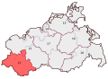
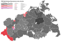
 BWahlkreis 12.svg 550 × 400; 42 KB
-
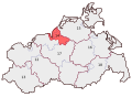
 BWahlkreis 13.svg 550 × 400; 42 KB
-
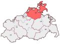
 BWahlkreis 14.svg 550 × 400; 42 KB
-
 BWahlkreis 15.svg 550 × 400; 42 KB
-
 BWahlkreis 16.svg 550 × 400; 42 KB
-
 BWahlkreis 17.svg 550 × 400; 42 KB
-
 BWahlkreis 18.svg 550 × 400; 42 KB
-
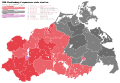
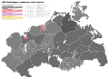 1990 Mecklenburg-Vorpommern state election.svg 2,157 × 1,553; 441 KB
-
 1994 Mecklenburg-Vorpommern state election.svg 2,157 × 1,495; 501 KB
-
 1998 Mecklenburg-Vorpommern state election.svg 2,157 × 1,495; 423 KB
-
 2002 Mecklenburg-Vorpommern state election.svg 2,157 × 1,495; 423 KB
-
 2006 Mecklenburg-Vorpommern state election.svg 2,157 × 1,495; 454 KB
-
 2011 Mecklenburg-Vorpommern state election.svg 2,157 × 1,495; 460 KB
-
 2016 Mecklenburg-Vorpommern state election.svg 2,157 × 1,495; 524 KB
-
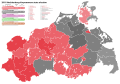
 Mecklenburg-Vorpommern Landtagswahlkarte 1994.svg 1,200 × 1,017; 279 KB
-
 Mecklenburg-Vorpommern Landtagswahlkarte 1998.svg 1,200 × 1,017; 279 KB
-
 Mecklenburg-Vorpommern Landtagswahlkarte 2002.svg 708 × 697; 296 KB
-
 Mecklenburg-Vorpommern Landtagswahlkarte 2006.svg 708 × 697; 296 KB
-
 Mecklenburg-Vorpommern Landtagswahlkarte 2011.svg 698 × 684; 143 KB
-
 Mecklenburg-Vorpommern Landtagswahlkarte 2016.svg 512 × 507; 151 KB
-
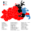
 Mecklenburg-Vorpommern Landtagswahlkreise 2011.svg 698 × 684; 142 KB
-
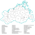
 Mecklenburg-Vorpommern Landtagswahlkreise 2016.svg 698 × 684; 149 KB


