Category:Edinburgh Trams maps (proposed lines)
Jump to navigation
Jump to search
Maps relating to the various proposed routes of the Edinburgh Trams system. For maps of the line as built, see Category:Edinburgh Trams maps (as built).
Media in category "Edinburgh Trams maps (proposed lines)"
The following 10 files are in this category, out of 10 total.
-
 Edinburgh Gateway tram connections.jpg 1,531 × 655; 568 KB
-
 Edinburgh trams and suburban railway 2023.svg 838 × 449; 117 KB
-
 Edinburgh trams and suburban railway.svg 838 × 449; 110 KB
-
 Edinburgh trams initial service.png 1,800 × 700; 143 KB
-
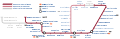
 Edinburgh Trams line 1.png 1,800 × 584; 137 KB
-
 Edinburgh Trams line 2.png 1,800 × 584; 134 KB
-
 Edinburgh Trams line 3.png 1,800 × 1,269; 185 KB
-
 Edinburgh tramway map.svg 850 × 275; 202 KB
-
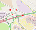 Map of proposed Edinburgh Gateway station (annotated).jpg 1,050 × 866; 371 KB
-
 Map of proposed Edinburgh Gateway station.jpg 1,050 × 866; 114 KB


.jpg)
