Category:Duwamish River
Jump to navigation
Jump to search
tributary to Elliot Bay in King County, Washington state, United States of America | |||||
| Upload media | |||||
| Instance of | |||||
|---|---|---|---|---|---|
| Location |
| ||||
| Has part(s) |
| ||||
| Length |
| ||||
| Mouth of the watercourse | |||||
| Tributary | |||||
| Different from | |||||
 | |||||
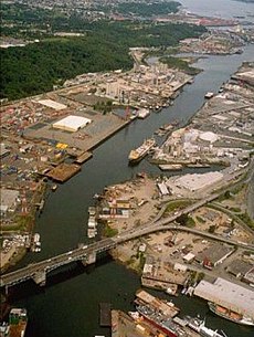
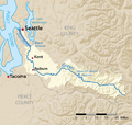
The Duwamish River and Duwamish Waterway in Washington State; its upper portion is the Green River.
Subcategories
This category has the following 29 subcategories, out of 29 total.
7
- 7th Avenue South Street End (13 F)
B
D
- Duwamish River Trail (5 F)
- Duwamish River Turning Basin (10 F)
- Duwamish Waterway Park (6 F)
E
F
G
H
- Harbor Island Marina (12 F)
J
- Jim Clark Marina (5 F)
K
- Kellogg Island (6 F)
N
P
S
- Seattle Terminal 5 (33 F)
- South Park Marina (10 F)
Media in category "Duwamish River"
The following 176 files are in this category, out of 176 total.
-
1985 time capsule at Foster, Tukwila, Washington.jpg 3,264 × 2,448; 2.42 MB
-
Aerial of Hanford Street Dock and Spokane Street Dock Seattle, 1960.jpg 1,413 × 672; 446 KB
-
Aerial view looking west - West Seattle Bridge and Spokane St Br.jpg 800 × 531; 210 KB
-
Aerial view of barges and warehouses on Duwamish Waterway.jpg 3,264 × 2,448; 3.93 MB
-
Aerial view of Highway 99 crossing Duwamish Waterway in Seattle.jpg 3,264 × 2,448; 5.46 MB
-
Aerial view of Seattle Freeway and Highway 99 cloverleaf in Seattle.jpg 3,264 × 2,448; 6.38 MB
-
Aerial view of Seattle Freeway crossing Harbor Island.jpg 3,264 × 2,448; 6.06 MB
-
Aerial view of Seattle, Washington, with a focus on the Duwamish Waterway.png 8,688 × 5,792; 236.28 MB
-
Asahel Curtis panorama of harbor and shipyards, Seattle (1919).jpg 3,544 × 999; 395 KB
-
Barge on the Duwamish 01.jpg 3,264 × 2,448; 1.99 MB
-
Barnacle-covered Radiator (3853583056).jpg 4,212 × 2,768; 2.66 MB
-
Barton & Company from the water, circa 1917.jpg 3,039 × 1,019; 530 KB
-
BECU Tukwila from Green River Trail 02.jpg 6,000 × 4,000; 13.26 MB
-
BEER CAN FLOATING ON DUWAMISH RIVER - NARA - 552126.jpg 2,019 × 3,000; 481 KB
-
Black River Junction plaque at Fort Dent.jpg 3,264 × 2,448; 2.53 MB
-
Boeing Plant 2 during demolition 01.jpg 4,288 × 2,848; 5.4 MB
-
Boeing Plant 2 during demolition 02.jpg 4,288 × 2,848; 4.82 MB
-
Boeing Plant 2 during demolition 03.jpg 4,288 × 2,848; 5.12 MB
-
Boeing Plant 2 during demolition 04.jpg 4,288 × 2,848; 5.08 MB
-
Bulk carrier 'Ken Hou' in Seattle.jpg 501 × 521; 243 KB
-
Cassells Point, Duwamish River, Washington, ca 1891 (LAROCHE 29).jpeg 853 × 500; 106 KB
-
Cecil Moses Memorial Park - shore.jpg 3,264 × 2,448; 2.29 MB
-
Cecil Moses Memorial Park - shoreDetail.jpg 1,733 × 929; 520 KB
-
City of Tukwila Community Center 02.jpg 3,264 × 2,448; 1.99 MB
-
CM Juarez off the Duwamish (24822198494).jpg 4,798 × 3,199; 844 KB
-
Construction Seattle (port town drive) - panoramio.jpg 2,272 × 1,461; 1.42 MB
-
DISCARDED TIRE FRAMES REEDS IN A BACKWATER OF THE DUWAMISH RIVER - NARA - 552255.jpg 3,000 × 2,036; 736 KB
-
Dredge Duwamish, September 6, 1913 - DPLA - 2a78418d723189ae4791249f1874b041.jpg 7,821 × 6,448; 3.06 MB
-
Duwamish - Codiga Farms 01.jpg 3,264 × 2,448; 1.77 MB
-
Duwamish and Rainer 3.JPG 2,304 × 1,728; 960 KB
-
Duwamish from West Seattle Bridge 01.jpg 2,592 × 1,944; 725 KB
-
Duwamish from West Seattle Bridge 02.jpg 3,264 × 2,448; 2.17 MB
-
Duwamish near Codiga Farms 01.jpg 3,264 × 2,448; 1.89 MB
-
Duwamish near Codiga Farms 02.jpg 3,264 × 2,448; 1.84 MB
-
Duwamish pano 01.jpg 7,123 × 2,722; 8.45 MB
-
Duwamish River around S 116th Street 01.jpg 3,264 × 2,448; 2.04 MB
-
Duwamish River at South Park.jpg 2,401 × 1,771; 1.66 MB
-
Duwamish River downstream from former Foster Station.jpg 3,264 × 2,448; 2.29 MB
-
Duwamish River downstream from Tukwila International Boulevard.jpg 3,264 × 2,448; 1.92 MB
-
Duwamish River highlighted.jpg 981 × 945; 246 KB
-
Duwamish River near 1st Ave S & E Marginal Way aerial 01.jpg 4,288 × 2,848; 4.39 MB
-
Duwamish River near 1st Ave S & E Marginal Way aerial 01A.jpg 4,288 × 2,848; 8.28 MB
-
Duwamish River pano looking southwest from 8th Ave street end.jpg 14,444 × 2,165; 19.74 MB
-
Duwamish River-13.jpg 900 × 675; 280 KB
-
Duwamish Waterway at South Park.jpg 4,288 × 2,848; 5.97 MB
-
Duwamish Waterway oxbow remnant.jpg 3,264 × 2,448; 2.17 MB
-
Duwamish Waterway pano 01.jpg 6,332 × 1,468; 1.23 MB
-
Duwamish Waterway pano 02.jpg 9,666 × 2,288; 3.17 MB
-
Duwamish Waterway pano 03.jpg 8,525 × 2,266; 2.39 MB
-
Duwamishmap.png 1,979 × 1,875; 1.34 MB
-
Duwamishvalley1899-1959.png 1,369 × 2,149; 74 KB
-
East Waterway of the Duwamish 01.jpg 6,000 × 4,000; 10.68 MB
-
Ferries, summer 2012.jpg 960 × 720; 70 KB
-
Fishing on the Duwamish 2021-09-06 - 01.jpg 6,000 × 4,000; 9.71 MB
-
Fishing on the Duwamish 2021-09-06 - 01A.jpg 5,935 × 3,861; 14.73 MB
-
Floating home near First Avenue South Bridge, Seattle, 1954.jpg 3,982 × 3,164; 1.37 MB
-
Floating homes near 1st Avenue South Bridge, Seattle, 1954.jpg 3,794 × 2,968; 1.43 MB
-
FMIB 44974 San Juan Fishing & Packing Co, Seattle, U S A.jpeg 1,280 × 560; 270 KB
-
FMIB 45073 Plant of J F Duthie & Co, Seattle - cleaned.jpeg 1,253 × 237; 92 KB
-
FMIB 45073 Plant of J F Duthie & Co, Seattle.jpeg 1,253 × 237; 147 KB
-
FMIB 45217 San Juan Fishing and Packing Co, Seattle USA.jpeg 1,243 × 565; 190 KB
-
Industrial South Seattle - Flickr - brewbooks (2).jpg 3,264 × 2,448; 3.67 MB
-
Industrial Uses (3853623272).jpg 4,088 × 2,640; 1.8 MB
-
J. F. Duthie & Company, Harbor Island, Seattle, 1919.jpg 1,014 × 319; 67 KB
-
Kayak Tour (3853623234).jpg 3,728 × 2,756; 1.61 MB
-
Looking north on the Duwamish River from immediately west of the Allentown Bridge.jpg 6,000 × 4,000; 13.14 MB
-
Looking south on the Duwamish from Harbor Island 01.jpg 6,000 × 4,000; 11.31 MB
-
Mighty Mussels Measure Pollution (6756928907).jpg 1,024 × 666; 321 KB
-
Natural Yard Care (3853623152).jpg 4,071 × 2,706; 2.56 MB
-
Over the Duwamish - Flickr - brewbooks (1).jpg 3,264 × 2,448; 3.43 MB
-
Over the Duwamish - Flickr - brewbooks (2).jpg 3,264 × 2,448; 3.21 MB
-
Over the Duwamish - Flickr - brewbooks.jpg 3,264 × 2,448; 3.86 MB
-
Over the Duwamish River - Flickr - brewbooks (1).jpg 1,920 × 1,080; 1.33 MB
-
Over the Duwamish River - Flickr - brewbooks.jpg 1,920 × 1,080; 1.3 MB
-
Panorama of harbor and shipyards, Seattle (CURTIS 475).jpeg 768 × 602; 58 KB
-
Panorama of harbor and shipyards, Seattle (CURTIS 476).jpeg 768 × 614; 44 KB
-
Panorama of harbor and shipyards, Seattle (CURTIS 477).jpeg 768 × 609; 39 KB
-
Panorama of harbor and shipyards, Seattle (CURTIS 478).jpeg 768 × 622; 32 KB
-
Panoramic view from Seattle's Harbor Island Fishing Bridge 01.jpg 5,954 × 2,383; 3.63 MB
-
Port of Seattle - panoramio.jpg 1,080 × 720; 173 KB
-
Port of Seattle, 1990 (32615793528).jpg 794 × 1,200; 709 KB
-
River otters duwamish river.jpg 4,000 × 3,000; 6.13 MB
-
River scene near Georgetown, Washington, ca 1914 (MOHAI 6559).jpg 700 × 541; 59 KB
-
Riverside Casino, Tukwila Washington.jpg 3,264 × 2,448; 2.2 MB
-
San Juan Fishing and Packing Co, Seattle (CURTIS 42).jpeg 768 × 597; 55 KB
-
Seaplane at Standard Oil Co, Seattle, ca 1925 (MOHAI 2391).jpg 640 × 451; 57 KB
-
Seattle - 7th Avenue South Street End - abandoned pier 01.jpg 6,000 × 4,000; 13.38 MB
-
Seattle - 7th Avenue South Street End - men tying up a barge.jpg 6,000 × 4,000; 12.06 MB
-
Seattle - 7th Avenue South Street End - nearby industry 01.jpg 4,000 × 6,000; 13.63 MB
-
Seattle - 7th Avenue South Street End - tug 'Jennifer H'.jpg 6,000 × 4,000; 11.48 MB
-
Seattle - Duwamish pano from 8th & Portland.jpg 6,624 × 1,376; 1.5 MB
-
Seattle - Duwamish shoreline north of South Park Bridge.jpg 3,264 × 2,448; 2.39 MB
-
Seattle - East Waterway Terminal, 1915 (22761986476).jpg 3,357 × 2,499; 1.74 MB
-
Seattle - Harbor Island and East Duwamish Waterway, circa 1980 (24751255614).jpg 1,200 × 794; 238 KB
-
Seattle - Island Tug and Barge 01.jpg 4,288 × 2,848; 4.84 MB
-
Seattle - Island Tug and Barge 02.jpg 4,288 × 2,848; 4.35 MB
-
Seattle - Jack Block pano.jpg 11,371 × 1,691; 2.26 MB
-
Seattle - Kellogg Island aerial 01.jpg 4,288 × 2,848; 4.03 MB
-
Seattle - Kellogg Island aerial 01A.jpg 4,288 × 2,848; 7.65 MB
-
Seattle - Kellogg Island aerial 02.jpg 4,288 × 2,848; 3.93 MB
-
Seattle - Kellogg Island aerial 02A.jpg 4,288 × 2,848; 7.91 MB
-
Seattle - looking north across the Duwamish River at 8th Avenue.jpg 918 × 443; 91 KB
-
Seattle - looking south on the Duwamish at Eighth Avenue 01.jpg 6,000 × 4,000; 10.81 MB
-
Seattle - paddleboarders & kayaker on the Duwamish 01.jpg 6,000 × 4,000; 12.45 MB
-
Seattle - panoramic view of the Duwamish from 7th Ave S in South Park.jpg 9,741 × 2,413; 12.68 MB
-
Seattle - Sanborn 1904 - Georgetown & South Park map - 1904 - raw.jpg 1,944 × 2,592; 646 KB
-
Seattle - Sanborn 1904 - Georgetown & South Park map - 1904.jpg 1,892 × 2,445; 656 KB
-
Seattle - SeaTac Marine - Fox Avenue Terminal.jpg 6,000 × 4,000; 10.82 MB
-
Seattle - sign for Tribal Elder Bernice White Place.jpg 6,000 × 4,000; 9.69 MB
-
Seattle - South Park Marina 01.jpg 3,264 × 2,448; 2.14 MB
-
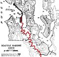
Seattle 1909 harbor improvements proposal on topo.jpg 984 × 1,548; 344 KB
-
Seattle container port.jpg 3,072 × 1,728; 1.16 MB
-
Seattle megaprojects volume moved.png 2,963 × 1,831; 304 KB
-
Seattle pano from Jack Block Park -June 2010.jpg 9,753 × 3,003; 2.57 MB
-
Seattle Public Utilities Pump Station 23 - 01.jpg 6,000 × 4,000; 11.86 MB
-
Seattle Public Utilities Pump Station 23 - 02.jpg 6,000 × 4,000; 9.77 MB
-
Seattle topo map showing old route of Duwamish River.jpg 984 × 1,531; 308 KB
-
Snopac Innovator 01.jpg 4,288 × 2,848; 4.53 MB
-
Snopac Innovator 02.jpg 4,288 × 2,848; 4.84 MB
-
South Park Home (3853623172).jpg 3,792 × 2,672; 2.53 MB
-
Terminal 18 Park - 02.jpg 6,000 × 4,000; 13.65 MB
-
Toward the sound - 98108 - from the park - panoramio.jpg 1,152 × 864; 240 KB
-
Township No 24 North Range No 4 East, 1864 (MOHAI 14539).jpg 846 × 1,000; 101 KB
-
Trestles over the tidal flats, ca 1903 (MOHAI 6104).jpg 700 × 548; 34 KB
-
TUGBOAT HAULS BARGE DOWN INDUSTRIAL WATERWAY OF THE DUWAMISH RIVER - NARA - 552129.jpg 3,000 × 2,029; 621 KB
-
Tukwila - Duwamish River - 01.jpg 2,592 × 1,944; 724 KB
-
Tukwila - Duwamish River - 02.jpg 2,592 × 1,944; 733 KB
-
Tukwila - Foster Landing historical marker & river.jpg 3,264 × 2,448; 2.38 MB
-
Tukwila - Foster Landing historical marker.jpg 2,448 × 3,264; 2.39 MB
-
Tukwila - looking under Interstate 5 from Green River Trail.jpg 3,264 × 2,448; 1.79 MB
-
Tukwila - S 129th Street bridge over Interstate 5 - 01.jpg 6,000 × 4,000; 13.67 MB
-
Tukwila - S 129th Street bridge over Interstate 5 - 02.jpg 6,000 × 4,000; 12.49 MB
-
Tukwila - S 159 St crosses Interstate 5.jpg 3,264 × 2,448; 1.9 MB
-
Tukwila, WA - wetland research barge moored on the Duwamish 01.jpg 6,000 × 4,000; 13.86 MB
-
Tukwila, Washington - Foster Golf Links 01.jpg 3,264 × 2,448; 2.53 MB
-
USS West Bridge (ID-2888).jpg 740 × 580; 138 KB
-
View across the Duwamish to the Georgetown Steam Plant Pump Station 01.jpg 6,000 × 4,000; 11.4 MB
-
View across the Duwamish to the Georgetown Steam Plant Pump Station 02.jpg 6,000 × 4,000; 10.81 MB
-
View across the Duwamish to the Georgetown Steam Plant Pump Station 03.jpg 6,000 × 4,000; 9.36 MB
-
View from Terminal 18 Park - 01.jpg 6,000 × 4,000; 13.23 MB
-
View from Terminal 18 Park - 02.jpg 6,000 × 4,000; 10.11 MB
-
View from Terminal 18 Park - 03.jpg 6,000 × 4,000; 12.22 MB
-
View from Terminal 18 Park - 04.jpg 6,000 × 4,000; 13.16 MB
-
West Seattle - Flickr - brewbooks (1).jpg 3,264 × 2,448; 3.8 MB
-
West Seattle.jpg 3,132 × 2,448; 3.16 MB
-
West Waterway of the Duwamish 01.jpg 5,847 × 3,767; 10 MB
-
Western Washington at a glance - panoramio.jpg 3,264 × 2,448; 1.87 MB


