Category:Dry stone walls in Oxfordshire
Jump to navigation
Jump to search
Ceremonial counties of England: Cambridgeshire · Cheshire · Cornwall · Cumbria · Derbyshire · Devon · Dorset · Durham · Gloucestershire · Greater Manchester · Herefordshire · Lancashire · Leicestershire · Lincolnshire · North Yorkshire · Northamptonshire · Northumberland · Oxfordshire · Rutland · Somerset · South Yorkshire · Staffordshire · West Sussex · West Yorkshire · Wiltshire · Worcestershire
City-counties:
Former historic counties:
Other former counties:
City-counties:
Former historic counties:
Other former counties:
Media in category "Dry stone walls in Oxfordshire"
The following 44 files are in this category, out of 44 total.
-
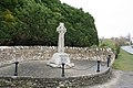 Black Bourton war memorial - geograph.org.uk - 1116076.jpg 640 × 427; 91 KB
-
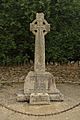 BlackBourton WarMemorial.jpg 853 × 1,280; 778 KB
-
-
 Broadwell's Golden Jubilee bench - geograph.org.uk - 1479380.jpg 640 × 480; 106 KB
-
 Broughton Poggs Mill - geograph.org.uk - 304622.jpg 640 × 480; 103 KB
-
 The Trigger Pond pub, Bucknell - geograph.org.uk - 64196.jpg 640 × 480; 111 KB
-
 Carterton, Rock Farm Cottages - geograph.org.uk - 361104.jpg 640 × 471; 143 KB
-
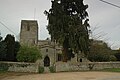
 Chastleton Church.JPG 1,280 × 960; 462 KB
-
 Chesterton StMary south.JPG 3,000 × 1,988; 2.26 MB
-
 Stonework in the hedge - geograph.org.uk - 1638083.jpg 640 × 480; 136 KB
-
 Chilson notice board - geograph.org.uk - 1096564.jpg 640 × 427; 86 KB
-
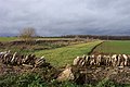 Cotswold walls - geograph.org.uk - 294766.jpg 640 × 427; 82 KB
-
 Crossroads south of Holwell - geograph.org.uk - 1747696.jpg 640 × 480; 89 KB
-
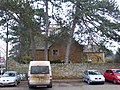 Castle House (geograph 5272559).jpg 4,896 × 3,672; 7.15 MB
-
 Dry stone walling construction - geograph.org.uk - 236428.jpg 640 × 480; 111 KB
-
 Across the road - geograph.org.uk - 1801771.jpg 4,000 × 3,000; 3.33 MB
-
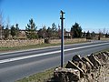
 Old Milestone by the B4030, Bicester Road, Enstone (geograph 6076627).jpg 1,506 × 1,184; 400 KB
-
 Wisteria covered house, Church Enstone - geograph.org.uk - 1323946.jpg 640 × 480; 121 KB
-

-
 Footpath on the edge of Langford - geograph.org.uk - 1520040.jpg 640 × 480; 110 KB
-
 Freeland Wesleyan Chapel west.jpg 1,239 × 1,280; 637 KB
-
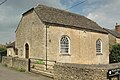 Freeland WesleyanChapel.JPG 2,910 × 1,940; 833 KB
-
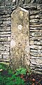
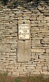 Fulbrook milestone.jpg 1,500 × 2,500; 1.71 MB
-
 The road through Grafton - geograph.org.uk - 894640.jpg 640 × 480; 164 KB
-
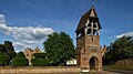 GreatBourton AllSaints and lychgate.jpg 1,280 × 719; 483 KB
-
 GreatBourton AllSaints lychgate south.jpg 1,024 × 1,280; 727 KB
-
 GreatBourton AllSaints lychgate west.jpg 1,280 × 1,214; 694 KB
-
 HamptonPoyle StMary north.jpg 1,280 × 719; 578 KB
-
 HamptonPoyle StMary northeast.jpg 1,280 × 720; 512 KB
-

-
 Kencot, St. George's Church - geograph.org.uk - 381300.jpg 640 × 432; 145 KB
-
 St Phillips, LittleRollright, 2011-04-29.JPG 4,000 × 3,000; 2.5 MB
-
 MinsterLovell MethodistChurch.jpg 2,970 × 1,980; 2.47 MB
-
 NorthLeigh WindmillCottage MasonsArms.jpg 1,280 × 565; 320 KB
-
 Old Milestone by the A361, Shipton Road, Fulbrook (geograph 6072569).jpg 673 × 1,243; 332 KB
-
 Ramsden Methodist Chapel.jpg 913 × 1,280; 581 KB
-
 Ramsden MethodistChapel.JPG 2,680 × 1,915; 2.29 MB
-
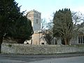
 Salford Church - geograph.org.uk - 1119061.jpg 426 × 640; 64 KB
-
 Holy Trinity Church, Shenington.jpg 640 × 480; 104 KB
-
 SibfordGower LaneHead east.jpg 1,280 × 720; 681 KB
-
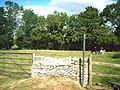
 Western entrance to the Blenheim Estate - geograph.org.uk - 611659.jpg 640 × 480; 179 KB
-
 St. Bartholomew's Church, Yarnton - geograph.org.uk - 91951.jpg 640 × 481; 60 KB
-
 Yarnton OldSchool.JPG 2,610 × 1,740; 2.12 MB
-
 Yarnton StBartholomew SpencerChapel.JPG 2,940 × 1,960; 2.32 MB


.jpg)


.jpg)


.jpg)


.jpg)


