Category:Dreghorn (civil parish)
Jump to navigation
Jump to search
Scottish parish in North Ayrshire, Scotland, UK | |||||
| Upload media | |||||
| Instance of | |||||
|---|---|---|---|---|---|
| Part of |
| ||||
| Named after | |||||
| Location |
| ||||
| Population |
| ||||
| Area |
| ||||
 | |||||
Subcategories
This category has the following 4 subcategories, out of 4 total.
C
D
L
S
Media in category "Dreghorn (civil parish)"
The following 200 files are in this category, out of 318 total.
(previous page) (next page)-
 A71 at East Ayrshire boundary - geograph.org.uk - 3525177.jpg 640 × 481; 55 KB
-
 A71 at Irvine (Greenwood Interchange) - geograph.org.uk - 6342338.jpg 800 × 601; 636 KB
-
 A71 just east of A78 junction - geograph.org.uk - 3475455.jpg 640 × 369; 47 KB
-
 A71 near Dreghorn - geograph.org.uk - 1860429.jpg 640 × 480; 43 KB
-
 A71 near Dreghorn - geograph.org.uk - 5094116.jpg 640 × 481; 49 KB
-
 A71 nears Corsehill Mount Roundabout - geograph.org.uk - 3525172.jpg 640 × 481; 52 KB
-
 A735 north of Kilmaurs - geograph.org.uk - 5486702.jpg 640 × 485; 60 KB
-
 A78 Irvine Bypass - geograph.org.uk - 3663260.jpg 5,184 × 3,456; 6.33 MB
-
-
-
 A814, North Ayrshire - geograph.org.uk - 6377416.jpg 800 × 533; 253 KB
-
 AGB (Industrial) Ltd - Irvine - geograph.org.uk - 6147284.jpg 1,600 × 1,067; 1.34 MB
-
 Andrew Wright - Irvine - geograph.org.uk - 6147606.jpg 1,600 × 1,067; 1.29 MB
-
 Andrew Wright - Irvine - geograph.org.uk - 6147623.jpg 1,600 × 1,067; 1.33 MB
-
 Annick Drive, Dreghorn - geograph.org.uk - 5283267.jpg 2,592 × 1,728; 2.19 MB
-
 Annick Tavern, Dreghorn - geograph.org.uk - 5283270.jpg 2,592 × 1,728; 2 MB
-
 Annick Water - geograph.org.uk - 4733314.jpg 1,600 × 1,067; 883 KB
-
 Annick Water - geograph.org.uk - 5282836.jpg 2,592 × 1,728; 3.94 MB
-
 Annick Water - geograph.org.uk - 5282837.jpg 2,592 × 1,728; 3 MB
-
 Annick Water - geograph.org.uk - 5283331.jpg 2,592 × 1,728; 3.24 MB
-
 Annick Water - geograph.org.uk - 5283333.jpg 2,592 × 1,728; 2.67 MB
-
 Annick Water - geograph.org.uk - 5283348.jpg 2,592 × 1,728; 2.38 MB
-
 Annick Water - geograph.org.uk - 5537158.jpg 1,024 × 684; 564 KB
-
 Annick Water at Dreghorn - geograph.org.uk - 3696306.jpg 1,920 × 1,280; 1.73 MB
-
 Approaching roundabout at Dreghorn - geograph.org.uk - 3475467.jpg 640 × 404; 45 KB
-
 Arco - Irvine - geograph.org.uk - 6147282.jpg 1,600 × 1,067; 1.26 MB
-
 Army Reserve Centre, Dreghorn - geograph.org.uk - 5283291.jpg 2,592 × 1,728; 2.44 MB
-
 Arriving at Dreghorn - geograph.org.uk - 5283138.jpg 2,592 × 1,728; 2.42 MB
-
 Arriving at Dreghorn - geograph.org.uk - 5283345.jpg 2,486 × 1,728; 666 KB
-
 Ashgrove Home Improvements - Irvine - geograph.org.uk - 6147292.jpg 1,600 × 1,067; 1.21 MB
-
 B7080 crossing the River Irvine - geograph.org.uk - 2067625.jpg 3,648 × 2,736; 3.76 MB
-

-
 Bowling Club, Dreghorn - geograph.org.uk - 5283259.jpg 2,592 × 1,728; 1.99 MB
-
 BP Garage, Dreghorn - geograph.org.uk - 5283307.jpg 2,592 × 1,728; 2.04 MB
-
 Buiston Road Kilmaurs - geograph.org.uk - 1867082.jpg 2,272 × 1,704; 890 KB
-
 Bus stop at Townfoot, Dreghorn - geograph.org.uk - 5480336.jpg 1,024 × 682; 124 KB
-
 Bus Stop Closed, Dreghorn - geograph.org.uk - 5283287.jpg 2,592 × 1,728; 1.79 MB
-
 Bus stop on Kilmarnock Road, Springside - geograph.org.uk - 5480344.jpg 1,024 × 682; 171 KB
-
 Bus Stop ^ Shelter, Dreghorn - geograph.org.uk - 5283090.jpg 2,592 × 1,728; 3.5 MB
-
 Bus Stop ^ Shelter, Dreghorn - geograph.org.uk - 5283290.jpg 2,592 × 1,728; 2.05 MB
-
 Campbell Place, Dreghorn - geograph.org.uk - 5283283.jpg 2,592 × 1,728; 2.88 MB
-
 Campbell Place, Dreghorn - geograph.org.uk - 5283284.jpg 2,592 × 1,728; 2.74 MB
-
 Campbell Place, Dreghorn - geograph.org.uk - 5283403.jpg 2,592 × 1,728; 2.25 MB
-
 Campbell Place, Dreghorn - geograph.org.uk - 5283404.jpg 2,592 × 1,728; 1.82 MB
-
 Capringstone - geograph.org.uk - 3663306.jpg 5,184 × 3,456; 7.74 MB
-
 Care Pharmacy - Springside - geograph.org.uk - 6103510.jpg 1,600 × 1,066; 1.09 MB
-
 CEF - Irvine - geograph.org.uk - 6147258.jpg 1,600 × 1,067; 1.06 MB
-
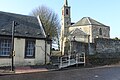
 Clock Tower, Dreghorn and Springside Parish Church - geograph.org.uk - 5282730.jpg 1,728 × 2,592; 2.72 MB
-
 Clock Tower, Dreghorn and Springside Parish Church - geograph.org.uk - 5283075.jpg 2,592 × 1,728; 2.37 MB
-
 Clock Tower, Dreghorn and Springside Parish Church - geograph.org.uk - 5283076.jpg 1,728 × 2,592; 2.01 MB
-
 Converging tracks - geograph.org.uk - 1938573.jpg 640 × 480; 95 KB
-
 Corsehill Mount Road, Dreghorn - geograph.org.uk - 5283292.jpg 2,592 × 1,728; 2.34 MB
-
 Corsehill Mount Road, Dreghorn - geograph.org.uk - 5283293.jpg 2,592 × 1,728; 1.89 MB
-
 Corsehill Mount Road, Dreghorn - geograph.org.uk - 5283312.jpg 2,592 × 1,728; 2.18 MB
-
 Corsehill Mount Road, Dreghorn - geograph.org.uk - 5283313.jpg 2,592 × 1,728; 2.38 MB
-
 Corsehill Mount Road, Dreghorn - geograph.org.uk - 5283351.jpg 2,592 × 1,728; 2.59 MB
-
 Corsehill Mount Roundabout - geograph.org.uk - 4447394.jpg 640 × 439; 42 KB
-
 Corsehill Mount Roundabout, A71 - geograph.org.uk - 2055810.jpg 3,449 × 2,546; 3.14 MB
-
 Corsehill Mount, Dreghorn - geograph.org.uk - 5283154.jpg 1,778 × 1,728; 1,021 KB
-
 Corsehill Mount, Dreghorn - geograph.org.uk - 5283200.jpg 2,592 × 1,728; 1.08 MB
-
 Corsehill Mount, Dreghorn - geograph.org.uk - 5283242.jpg 2,592 × 1,728; 4.4 MB
-
 Corsehill Mount, Dreghorn - geograph.org.uk - 5283243.jpg 2,592 × 1,728; 4.3 MB
-
 Council Offices, Dreghorn - geograph.org.uk - 5282688.jpg 2,592 × 1,728; 2.6 MB
-
 Crossfit Gym - Irvine - geograph.org.uk - 6147519.jpg 1,600 × 1,067; 1.42 MB
-
 Crossing The River Irvine - geograph.org.uk - 4858437.jpg 640 × 426; 105 KB
-
 Crossroads, Lambroughton - geograph.org.uk - 5537163.jpg 1,024 × 684; 317 KB
-
 Crown Decorating Centre - Irvine - geograph.org.uk - 6147301.jpg 1,600 × 1,067; 1.22 MB
-
 Cunninghame Path - geograph.org.uk - 5283370.jpg 2,592 × 1,728; 2.32 MB
-
 Cunninghamhead - geograph.org.uk - 4701160.jpg 800 × 600; 421 KB
-
 CV Labels - Irvine - geograph.org.uk - 6147263.jpg 1,600 × 1,067; 1.24 MB
-
 Cycle and Footpath Signs - geograph.org.uk - 5283363.jpg 2,592 × 1,728; 4.18 MB
-
 Cycle and Footpath to Irvine - geograph.org.uk - 5283381.jpg 2,592 × 1,728; 4.52 MB
-
 Cycle and Footpath to Kilmarnock - geograph.org.uk - 5283375.jpg 2,592 × 1,728; 4.05 MB
-
 Cycle and Footpath, Dreghorn - geograph.org.uk - 5283354.jpg 2,592 × 1,728; 4.27 MB
-
 Cycle Route 7, Dreghorn - geograph.org.uk - 5283357.jpg 2,592 × 1,728; 3.48 MB
-
 Cycle Route 73 - geograph.org.uk - 5283339.jpg 2,592 × 1,728; 3.69 MB
-
 Cycle Route 73, Dreghorn - geograph.org.uk - 5283360.jpg 2,592 × 1,728; 2.95 MB
-
 Delivery Entrance to Greenwood Academy, Dreghorn - geograph.org.uk - 5283298.jpg 2,532 × 1,728; 804 KB
-
 Dreghorn - geograph.org.uk - 4243375.jpg 800 × 600; 364 KB
-
 Dreghorn - geograph.org.uk - 5283215.jpg 2,592 × 1,728; 2.36 MB
-
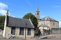 Dreghorn and Perceton Parish Church - geograph.org.uk - 4650813.jpg 1,600 × 1,067; 506 KB
-
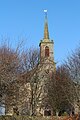
 Dreghorn and Springside Parish Church - geograph.org.uk - 5282696.jpg 2,450 × 1,728; 635 KB
-
 Dreghorn and Springside Parish Church - geograph.org.uk - 5282702.jpg 2,592 × 1,728; 1.98 MB
-
 Dreghorn and Springside Parish Church - geograph.org.uk - 5282707.jpg 2,592 × 1,728; 2.87 MB
-
 Dreghorn and Springside Parish Church - geograph.org.uk - 5282722.jpg 2,592 × 1,728; 3.2 MB
-
 Dreghorn and Springside Parish Church - geograph.org.uk - 5282780.jpg 2,592 × 1,728; 2.19 MB
-
 Dreghorn and Springside Parish Church - geograph.org.uk - 5282808.jpg 2,592 × 1,728; 2.39 MB
-
 Dreghorn and Springside Parish Church - geograph.org.uk - 5283073.jpg 2,592 × 1,728; 1.86 MB
-
 Dreghorn and Springside Parish Church - geograph.org.uk - 5283083.jpg 2,592 × 1,728; 3.54 MB
-
 Dreghorn and Springside Parish Church - geograph.org.uk - 5283084.jpg 1,728 × 2,592; 3.08 MB
-
 Dreghorn and Springside Parish Church - geograph.org.uk - 5283262.jpg 2,592 × 1,728; 2.14 MB
-
 Dreghorn and Springside Parish Church - geograph.org.uk - 5283406.jpg 2,592 × 1,728; 2.81 MB
-
 Dreghorn and Springside Parish Church - geograph.org.uk - 5283408.jpg 1,728 × 2,592; 2.33 MB
-
 Dreghorn and Springside Parish Church Sign - geograph.org.uk - 5282716.jpg 2,592 × 1,728; 2.63 MB
-
 Dreghorn Bridge over Annick Water - geograph.org.uk - 3696311.jpg 1,920 × 1,280; 1.61 MB
-
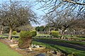
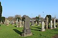
 Dreghorn Cemetery - geograph.org.uk - 5282747.jpg 2,592 × 1,728; 2.67 MB
-
 Dreghorn Cemetery - geograph.org.uk - 5282752.jpg 2,592 × 1,728; 2.57 MB
-
 Dreghorn Cemetery - geograph.org.uk - 5282762.jpg 2,592 × 1,728; 2.32 MB
-
 Dreghorn Cemetery - geograph.org.uk - 5282766.jpg 2,592 × 1,728; 2.42 MB
-
 Dreghorn Cemetery - geograph.org.uk - 5282768.jpg 2,592 × 1,728; 2.14 MB
-
 Dreghorn Cemetery - geograph.org.uk - 5282772.jpg 2,592 × 1,728; 2.76 MB
-
 Dreghorn Cemetery - geograph.org.uk - 5282775.jpg 2,592 × 1,728; 2.54 MB
-
 Dreghorn Cemetery - geograph.org.uk - 5282779.jpg 2,554 × 1,728; 1.29 MB
-
 Dreghorn Cemetery - geograph.org.uk - 5282783.jpg 2,592 × 1,728; 3.7 MB
-
 Dreghorn Cemetery - geograph.org.uk - 5282785.jpg 2,592 × 1,728; 4.29 MB
-
 Dreghorn Cemetery - geograph.org.uk - 5282790.jpg 2,592 × 1,728; 3.56 MB
-
 Dreghorn Cemetery - geograph.org.uk - 5282796.jpg 2,592 × 1,728; 4.06 MB
-
 Dreghorn Cemetery - geograph.org.uk - 5282799.jpg 2,592 × 1,728; 1.43 MB
-
 Dreghorn Cemetery - geograph.org.uk - 5282804.jpg 2,592 × 1,728; 2.82 MB
-
 Dreghorn Cemetery - geograph.org.uk - 5282812.jpg 2,592 × 1,728; 3.18 MB
-
 Dreghorn Cemetery - geograph.org.uk - 5282813.jpg 2,592 × 1,728; 2.32 MB
-
 Dreghorn Cemetery - geograph.org.uk - 5282817.jpg 2,592 × 1,728; 2.96 MB
-
 Dreghorn Cemetery - geograph.org.uk - 5282827.jpg 2,592 × 1,728; 2.74 MB
-
 Dreghorn Church - geograph.org.uk - 3304286.jpg 4,608 × 3,456; 4.67 MB
-
 Dreghorn Church - geograph.org.uk - 4243369.jpg 800 × 600; 374 KB
-
 Dreghorn Inn - geograph.org.uk - 5283115.jpg 2,592 × 1,728; 2.61 MB
-
 Dreghorn Inn - geograph.org.uk - 5283116.jpg 2,592 × 1,728; 2.4 MB
-
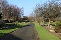
 Dreghorn New Cemetery - geograph.org.uk - 3696272.jpg 1,920 × 1,280; 1.21 MB
-
 Dreghorn New Cemetery - geograph.org.uk - 3696279.jpg 1,920 × 1,280; 1.34 MB
-
 Dreghorn New Cemetery - geograph.org.uk - 5282844.jpg 2,592 × 1,728; 2.58 MB
-
 Dreghorn New Cemetery - geograph.org.uk - 5282847.jpg 2,592 × 1,728; 2.74 MB
-
 Dreghorn New Cemetery - geograph.org.uk - 5282850.jpg 2,592 × 1,728; 3.05 MB
-
 Dreghorn Post Office - geograph.org.uk - 3663302.jpg 5,184 × 3,456; 7.55 MB
-
 Dreghorn Primary School - geograph.org.uk - 6176631.jpg 1,350 × 900; 244 KB
-
 Drummuir Farm Road, Perceton - geograph.org.uk - 2067487.jpg 3,106 × 2,279; 2.63 MB
-
 Dundonald Road, Dreghorn - geograph.org.uk - 5283413.jpg 2,592 × 1,728; 2.26 MB
-
 Dunlop Crescent, Dreghorn - geograph.org.uk - 5283281.jpg 2,592 × 1,728; 2.3 MB
-
 East Lambroughton - geograph.org.uk - 1938553.jpg 640 × 480; 75 KB
-
 East Lambroughton - geograph.org.uk - 5537167.jpg 1,024 × 684; 354 KB
-
 East Lambroughton - geograph.org.uk - 5537169.jpg 1,024 × 684; 435 KB
-
 East Lambroughton - geograph.org.uk - 5537173.jpg 428 × 640; 99 KB
-
-
 Ebenezer Hall, Dreghorn - geograph.org.uk - 5283124.jpg 2,473 × 1,650; 547 KB
-
 Edmundson's - Irvine - geograph.org.uk - 6147614.jpg 1,600 × 1,067; 1.2 MB
-
 Entrance to Dreghorn Cemetery - geograph.org.uk - 5282741.jpg 2,550 × 1,675; 541 KB
-
 ETC Engineering Solutions - Irvine - geograph.org.uk - 6147611.jpg 1,600 × 1,067; 1.09 MB
-
 Eurocell - Irvine - geograph.org.uk - 6147280.jpg 1,600 × 1,067; 1.22 MB
-
 Exit from Dreghorn Cemetery - geograph.org.uk - 5282822.jpg 2,592 × 1,728; 2.45 MB
-
 Exit from Dreghorn New Cemetery - geograph.org.uk - 3696292.jpg 1,920 × 1,280; 1.42 MB
-
 Farmland at Dreghorn - geograph.org.uk - 5283148.jpg 2,592 × 1,728; 2.3 MB
-
 Farmland at Dreghorn - geograph.org.uk - 5283247.jpg 2,592 × 1,728; 2.19 MB
-
 Farmland at Dreghorn - geograph.org.uk - 5283248.jpg 2,592 × 1,728; 2.6 MB
-
 Farmland near Warwickhill - geograph.org.uk - 2066980.jpg 3,648 × 2,736; 4.45 MB
-
 Farmland, Drummuir Farm - geograph.org.uk - 2067498.jpg 3,648 × 2,736; 2.79 MB
-
 Farmland, Overton farm - geograph.org.uk - 2066977.jpg 3,648 × 2,736; 3.13 MB
-
 Field Drainage - geograph.org.uk - 1713685.jpg 3,648 × 2,452; 3.21 MB
-
 Field Tracks - geograph.org.uk - 1713677.jpg 3,648 × 2,056; 2.89 MB
-
 Field, Langlands - geograph.org.uk - 3688808.jpg 640 × 360; 204 KB
-
 Field, Langlands - geograph.org.uk - 3688822.jpg 640 × 360; 261 KB
-
 Fire Station Tower, Dreghorn - geograph.org.uk - 5283297.jpg 2,592 × 1,728; 2.51 MB
-
 Fire Station, Dreghorn - geograph.org.uk - 5283301.jpg 2,592 × 1,728; 2 MB
-
 Floors Farm from the air - geograph.org.uk - 5051974.jpg 640 × 480; 125 KB
-
 Flowerbed, Springside - geograph.org.uk - 2022268.jpg 3,648 × 2,736; 4.33 MB
-
 Footbridge and Path at Dreghorn - geograph.org.uk - 5283392.jpg 2,592 × 1,728; 3.27 MB
-
 Footbridge over the A71 at Dreghorn - geograph.org.uk - 6377293.jpg 800 × 533; 273 KB
-
 Footpath at Dreghorn - geograph.org.uk - 5283387.jpg 2,592 × 1,728; 4.56 MB
-
 Footpath at Dreghorn - geograph.org.uk - 5283400.jpg 2,592 × 1,728; 2.47 MB
-
 Footpath, Dreghorn - geograph.org.uk - 5283264.jpg 2,592 × 1,728; 3.36 MB
-
 Footpath, Dreghorn - geograph.org.uk - 5283265.jpg 2,592 × 1,728; 3.44 MB
-
 Garrier Burn - geograph.org.uk - 3688827.jpg 640 × 360; 205 KB
-
 Glasgow to Kilmarnock railway - geograph.org.uk - 5537989.jpg 1,024 × 1,024; 508 KB
-
 Glasgow to Kilmarnock railway - geograph.org.uk - 5537991.jpg 1,024 × 1,024; 575 KB
-
 Go Vending - Irvine - geograph.org.uk - 6147518.jpg 1,600 × 1,067; 1.22 MB
-
 Graham's - Irvine - geograph.org.uk - 6147287.jpg 1,600 × 1,067; 1.2 MB
-
 Graveyard, Dreghorn and Springside Parish Church - geograph.org.uk - 5282737.jpg 2,592 × 1,728; 3.5 MB
-
 Grazing cattle - geograph.org.uk - 1938562.jpg 640 × 480; 104 KB
-
 Greenwood Academy, Dreghorn - geograph.org.uk - 5283286.jpg 2,592 × 1,728; 1.71 MB
-
 Greenwood Academy, Dreghorn - geograph.org.uk - 5283289.jpg 2,592 × 1,728; 1.69 MB
-
 Greenwood Academy, Dreghorn - geograph.org.uk - 5283295.jpg 2,592 × 1,728; 2.1 MB
-
 Greenwood Academy, Dreghorn - geograph.org.uk - 5283300.jpg 2,506 × 1,649; 823 KB
-
 Greenwood Academy, Dreghorn - geograph.org.uk - 5283396.jpg 2,592 × 1,728; 2.49 MB
-
 Greenwood Academy, Irvine - geograph.org.uk - 3663271.jpg 5,184 × 3,456; 6.28 MB
-
 Hay Bales at Southhook - geograph.org.uk - 3663493.jpg 5,184 × 3,456; 6.58 MB
-
 Hedge and ditch, Titwood - geograph.org.uk - 5537980.jpg 1,024 × 1,024; 596 KB
-
 Holmsford Bridge - geograph.org.uk - 3115040.jpg 640 × 426; 74 KB
-
 Holmsford Bridge Crematorium - Dreghorn - geograph.org.uk - 6176649.jpg 1,350 × 900; 271 KB
-
 Holmsford Bridge Crematorium - geograph.org.uk - 2022333.jpg 3,648 × 2,736; 3.68 MB
-
 Horse Grazing - geograph.org.uk - 1714136.jpg 3,416 × 2,248; 1.93 MB
-
 Horse near Holmsford - geograph.org.uk - 2022307.jpg 3,308 × 2,218; 3.53 MB
-
 Howden's - Irvine - geograph.org.uk - 6147520.jpg 1,600 × 1,067; 1.28 MB
-
 Howden's - Irvine - geograph.org.uk - 6147619.jpg 1,600 × 1,067; 1.35 MB
-
 Irvine and Irvine Bay - geograph.org.uk - 5139203.jpg 3,264 × 2,448; 4.25 MB
-
 Irvine from the air - geograph.org.uk - 4648688.jpg 640 × 480; 190 KB
-
 Irvine New Town Trail - geograph.org.uk - 5283337.jpg 2,592 × 1,728; 2.69 MB
-
 Irvine New Town Trail ^ Cycle Route 73 - geograph.org.uk - 5283343.jpg 2,592 × 1,728; 2.83 MB
-

-
 Irvine, Newmoor Interchange - geograph.org.uk - 6377303.jpg 800 × 533; 224 KB
-
 Ivy Covered Tree - geograph.org.uk - 2066967.jpg 3,648 × 2,736; 4.46 MB
-
 J ^ A Quinn, Dreghorn - geograph.org.uk - 5283120.jpg 2,592 × 1,728; 2.73 MB
-
 Kennedy Park, Dreghorn - geograph.org.uk - 5283276.jpg 2,592 × 1,728; 2.51 MB
-
 Keystore and Post Office, Dreghorn - geograph.org.uk - 5283118.jpg 2,592 × 1,728; 2.05 MB
-
 Kilmarnock bound bus, A735 - geograph.org.uk - 5537994.jpg 1,024 × 1,024; 600 KB
-
 Lay by on A71 near Holmsford Bridge - geograph.org.uk - 3475462.jpg 640 × 413; 49 KB
-
 Layby on the A71 near to Dreghorn - geograph.org.uk - 6377439.jpg 800 × 533; 245 KB
-
 Layby on the Irvine Bypass (A78) - geograph.org.uk - 6359147.jpg 800 × 533; 411 KB
-
 Layby Rubbish - geograph.org.uk - 1713994.jpg 3,648 × 2,736; 4.41 MB
-
 Library, Dreghorn - geograph.org.uk - 5283263.jpg 2,592 × 1,728; 2.68 MB
-
 Mace Convenience Store - Dreghorn - geograph.org.uk - 6176637.jpg 1,350 × 900; 232 KB
-
 Main Street Car Park, Dreghorn - geograph.org.uk - 5282685.jpg 2,592 × 1,728; 2.7 MB
-
 Main Street Car Park, Dreghorn - geograph.org.uk - 5283085.jpg 2,592 × 1,728; 2.43 MB

_-_geograph.org.uk_-_6342338.jpg)


_Ltd_-_Irvine_-_geograph.org.uk_-_6147284.jpg)


_-_geograph.org.uk_-_6359147.jpg)


&filefrom=Main+Street%2C+Dreghorn+-+geograph.org.uk+-+3663298.jpg#mw-category-media)