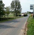
Category:Dingestow
Jump to navigation
Jump to search
village in Monmouthshire, Wales, UK | |||||
| Upload media | |||||
| Instance of | |||||
|---|---|---|---|---|---|
| Location | Mitchel Troy, Monmouthshire, Wales | ||||
 | |||||
Cymraeg: Pentref bychan yn Sir Fynwy yw Llanddingad (hefyd Llandingad; Saesneg: Dingestow). Fe'i lleolir ger ffordd yr A40, rhwng Rhaglan i'r gorllewin a Threfynwy i'r dwyrain, ar lôn fynydd ay'n arwain dros y bryniau i bentref Llandeilo Gresynni.
English: Dingestow is a village in Monmouthshire, Wales. The name is pronounced 'Dinge-Stow' (dinge rhyming with hinge).
Media in category "Dingestow"
The following 68 files are in this category, out of 68 total.
-
A40 - A449 road junction near Raglan - geograph.org.uk - 1456762.jpg 640 × 427; 272 KB
-
Approaching the Monmouth Tunnels - geograph.org.uk - 507777.jpg 640 × 489; 395 KB
-
Brick and stone bridge - geograph.org.uk - 1171816.jpg 480 × 640; 144 KB
-
Bridge Farm - geograph.org.uk - 1171836.jpg 640 × 480; 80 KB
-
Bridge over the River Trothy - geograph.org.uk - 1171813.jpg 640 × 480; 167 KB
-
Caravan site entrance - geograph.org.uk - 1171830.jpg 640 × 480; 73 KB
-
Castle mound at Dingestow - geograph.org.uk - 337201.jpg 640 × 480; 76 KB
-
Charlotte Bosanquet - The Library at Dingestow - Google Art Project.jpg 3,001 × 2,199; 2.26 MB
-
Cwmcarvan junction ahead - geograph.org.uk - 3210667.jpg 640 × 480; 80 KB
-
De-luxe treehouse - geograph.org.uk - 324158.jpg 640 × 480; 82 KB
-
Dingestow Post Office and Stores - geograph.org.uk - 1171848.jpg 640 × 480; 129 KB
-
Dingestow Village Hall - geograph.org.uk - 1171854.jpg 640 × 480; 74 KB
-
Ditch at Dingestow Castle Mound - geograph.org.uk - 1173220.jpg 480 × 640; 159 KB
-
Earthworks at Dingestow - geograph.org.uk - 1173219.jpg 640 × 480; 145 KB
-
Earthworks, Dingestow - geograph.org.uk - 1173108.jpg 640 × 480; 161 KB
-
Farm buildings near Lower Tre-fal-du - geograph.org.uk - 324079.jpg 640 × 480; 81 KB
-
Green Lawns Kennels near Dingestow - geograph.org.uk - 3210898.jpg 640 × 540; 110 KB
-
K6 phonebox at Dingestow - geograph.org.uk - 1171851.jpg 640 × 459; 82 KB
-
Molehills on the castle mound - geograph.org.uk - 1173230.jpg 640 × 480; 162 KB
-
Nant yr Ael-las valley - geograph.org.uk - 324147.jpg 640 × 480; 127 KB
-
North-northeast from the churchyard - geograph.org.uk - 1173093.jpg 640 × 480; 163 KB
-
Northwest view through the village - geograph.org.uk - 1171832.jpg 640 × 480; 87 KB
-
Pale purple crocuses - geograph.org.uk - 1173090.jpg 640 × 518; 109 KB
-
Pasture land, Dingestow - geograph.org.uk - 1173229.jpg 640 × 433; 120 KB
-
River Trothy, upstream to Tre-Owen Wood - geograph.org.uk - 1173145.jpg 640 × 480; 109 KB
-
Road bridges at Dingestow - geograph.org.uk - 1171839.jpg 640 × 480; 108 KB
-
Road junction, Dingestow - geograph.org.uk - 1171855.jpg 640 × 480; 73 KB
-
Road to Cwmcarvan - geograph.org.uk - 3210658.jpg 640 × 480; 68 KB
-
Road to Jingle Street - geograph.org.uk - 1171810.jpg 640 × 480; 109 KB
-
Road to Raglan - geograph.org.uk - 1171846.jpg 640 × 480; 98 KB
-
Road to the church at Dingestow - geograph.org.uk - 1171859.jpg 640 × 480; 102 KB
-
Somerset Arms bus stops, Dingestow - geograph.org.uk - 3210930.jpg 621 × 640; 119 KB
-
Somerset Arms pub sign, Dingestow - geograph.org.uk - 3210925.jpg 640 × 569; 63 KB
-
Somerset Arms, Dingestow - geograph.org.uk - 3210916.jpg 640 × 417; 58 KB
-
St. Dingat's and Craig-y-dorth - geograph.org.uk - 1173140.jpg 474 × 640; 171 KB
-
The Somerset Arms - geograph.org.uk - 324077.jpg 640 × 480; 78 KB
-
There'll be one along in a minute - geograph.org.uk - 1173234.jpg 443 × 640; 124 KB
-
View from earthworks at Dingestow - geograph.org.uk - 1173137.jpg 640 × 480; 171 KB
-
View of the village from the earthworks - geograph.org.uk - 1173223.jpg 640 × 480; 134 KB
-
View Southeast from Dingestow - geograph.org.uk - 1171843.jpg 640 × 480; 136 KB
-
View Southeast to Craig-y-dorth - geograph.org.uk - 1173089.jpg 640 × 480; 113 KB
-
View to The Mill Farm - geograph.org.uk - 1173213.jpg 640 × 480; 132 KB
-
Visitors without dogs permitted - geograph.org.uk - 1173232.jpg 640 × 397; 152 KB
-
Water meadows, Dingestow - geograph.org.uk - 1171820.jpg 640 × 451; 89 KB
-
A40 trunk road west of Mitchel Troy - geograph.org.uk - 607013.jpg 640 × 292; 57 KB
-
Fine oak in profile - geograph.org.uk - 324152.jpg 640 × 480; 116 KB
-
Gwaylodyade - geograph.org.uk - 324074.jpg 640 × 480; 76 KB
-
Large house on the edge of the woods - geograph.org.uk - 324081.jpg 640 × 480; 105 KB
-
Offa's Dyke Path near River Trothy - geograph.org.uk - 167889.jpg 640 × 480; 65 KB
-
Old House Farm - geograph.org.uk - 324142.jpg 640 × 480; 81 KB
-
Over the fields to the A40-A449 - geograph.org.uk - 324089.jpg 640 × 480; 67 KB
-
Road to New House Farm - geograph.org.uk - 324148.jpg 480 × 640; 76 KB
-
Wonastow Road - geograph.org.uk - 337204.jpg 640 × 480; 129 KB


