Category:Demographic maps of Oregon
Jump to navigation
Jump to search
Subcategories
This category has only the following subcategory.
Media in category "Demographic maps of Oregon"
The following 16 files are in this category, out of 16 total.
-
 Eo pop.gif 386 × 635; 11 KB
-
 OR-ind-lingvoj.png 960 × 730; 42 KB
-
 Oregon and Washington2.png 1,796 × 1,038; 252 KB
-
 Oregon Asian population percentage by county.svg 806 × 601; 105 KB
-
 Oregon black population percentage by county.svg 806 × 601; 105 KB
-
 Oregon county pop 2007.png 1,600 × 1,300; 117 KB
-
 Oregon Hispanic population percentage by county.svg 806 × 601; 105 KB
-
 Oregon Population Growth by County.png 800 × 700; 24 KB
-
 Oregon population map 2000.png 700 × 400; 121 KB
-
 Oregon racial and ethnic map.svg 248 × 188; 20 KB
-
 Oregoncartogram.png 403 × 400; 6 KB
-
 OregonPop12.jpg 1,056 × 816; 175 KB
-
 Portland Census Map.pdf 5,404 × 4,800; 3.44 MB
-
 Race and ethnicity Portland (1990).png 3,009 × 3,009; 3.32 MB
-
 Race and ethnicity Portland (2000).png 3,009 × 3,009; 1.39 MB
-
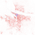
 Race and ethnicity Portland (2010).png 3,009 × 3,009; 3.79 MB


.png)
.png)
.png)