Category:Demographic maps of France
Jump to navigation
Jump to search
Countries of Europe: Albania · Armenia‡ · Austria · Azerbaijan‡ · Belarus · Bosnia and Herzegovina · Bulgaria · Croatia · Cyprus‡ · Czech Republic · Denmark · Estonia · Finland · France‡ · Georgia‡ · Germany · Greece · Hungary · Iceland · Republic of Ireland · Italy · Kazakhstan‡ · Latvia · Lithuania · Luxembourg · Moldova · Montenegro · Netherlands‡ · North Macedonia · Norway · Poland · Portugal‡ · Romania · Russia‡ · Serbia · Slovakia · Slovenia · Spain‡ · Sweden · Switzerland · Turkey‡ · Ukraine · United Kingdom
Limited recognition: Kosovo
‡: partly located in Europe
Limited recognition: Kosovo
‡: partly located in Europe
| NO WIKIDATA ID FOUND! Search for Demographic maps of France on Wikidata | |
| Upload media |

Departments of Metropolitan France: Ain [01] · Aisne [02] · Allier [03] · Alpes-de-Haute-Provence [04] · Hautes-Alpes [05] · Alpes-Maritimes [06] · Ardèche [07] · Ardennes [08] · Ariège [09] · Aube [10] · Aude [11] · Aveyron [12] · Bouches-du-Rhône [13] · Calvados [14] · Cantal [15] · Charente [16] · Charente-Maritime [17] · Cher [18] · Corrèze [19] · Corse-du-Sud [2A]† · Haute-Corse [2B]† · Côte-d’Or [21] · Côtes-d'Armor [22] · Creuse [23] · Dordogne [24] · Doubs [25] · Drôme [26] · Eure [27] · Eure-et-Loir [28] · Finistère [29] · Gard [30] · Haute-Garonne [31] · Gers [32] · Gironde [33] · Hérault [34] · Ille-et-Vilaine [35] · Indre [36] · Indre-et-Loire [37] · Isère [38] · Jura [39] · Landes [40] · Loir-et-Cher [41] · Loire [42] · Haute-Loire [43] · Loire-Atlantique [44] · Loiret [45] · Lot [46] · Lot-et-Garonne [47] · Lozère [48] · Maine-et-Loire [49] · Manche [50] · Marne [51] · Haute-Marne [52] · Mayenne [53] · Meurthe-et-Moselle [54] · Meuse [55] · Morbihan [56] · Moselle [57] · Nièvre [58] · Nord [59] · Oise [60] · Orne [61] · Pas-de-Calais [62] · Pyrénées-Atlantiques [64] · Hautes-Pyrénées [65] · Pyrénées-Orientales [66] · Bas-Rhin [67] · Haut-Rhin [68] · Haute-Saône [70] · Saône-et-Loire [71] · Sarthe [72] · Savoie [73] · Haute-Savoie [74] · Paris [75] · Seine-Maritime [76] · Deux-Sèvres [79] · Tarn [81] · Tarn-et-Garonne [82] · Var [83] · Vaucluse [84] · Vendée [85] · Vienne [86] · Haute-Vienne [87] · Vosges [88] · Yonne [89] · Territoire de Belfort [90] · Essonne [91] · Hauts-de-Seine [92] · Val-de-Marne [94]
Subcategories
This category has the following 8 subcategories, out of 8 total.
Media in category "Demographic maps of France"
The following 38 files are in this category, out of 38 total.
-
 -20 ans par cantons-1999-Aquitaine.jpg 500 × 500; 88 KB
-
 -20 ans par cantons-1999-basse-normandie.jpg 500 × 500; 130 KB
-
 -20 ans par cantons-1999-bretagne.jpg 500 × 500; 102 KB
-
 -20 ans par cantons-1999-Centre.jpg 500 × 500; 130 KB
-
 -20 ans par cantons-1999-Haute-Normandie.jpg 500 × 500; 100 KB
-
 -20 ans par cantons-1999-Pays-de-la-Loire.jpg 500 × 500; 158 KB
-
 -20ans1999-canton legende.jpg 190 × 148; 7 KB
-
 -25ansparcantonPC.jpg 500 × 500; 121 KB
-
 37 of 'Histoire politique, religieuse et littéraire des Landes, etc' (11025953093).jpg 1,474 × 2,486; 637 KB
-
 429 of 'La France Illustrée- géographie générale ... Par F. J' (11291729656).jpg 1,073 × 1,066; 302 KB
-
 60ansleg.png 190 × 148; 3 KB
-
 60anspc.png 500 × 500; 445 KB
-
 Actif-tvl-commune-resid-99-PC.png 696 × 576; 474 KB
-
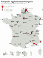 Agglomérations françaises.png 4,401 × 5,891; 2.07 MB
-
 CarteVillesFrance.PNG 598 × 584; 36 KB
-
 CORINE Land Cover 2006 France.png 1,260 × 528; 512 KB
-
 France cities areapop.png 1,802 × 1,796; 4.06 MB
-
 France densité 2009.jpg 1,000 × 960; 394 KB
-
 France ethnic.png 330 × 355; 47 KB
-
 France total fertility rate by region 2014.png 2,000 × 1,922; 729 KB
-
 France urbaine.png 1,363 × 961; 161 KB
-
 FranceNations.PNG 327 × 189; 12 KB
-
 French departments by legal population (2013).png 6,300 × 6,220; 3.56 MB
-
-
-

-
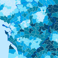
 Population density of France regions.png 5,451 × 5,019; 815 KB
-

-
 Pourcentage de naissances France 2013.JPG 590 × 577; 96 KB
-
 PSM V79 D620 Birth and death rates by department in france.png 1,228 × 1,248; 450 KB
-
 PSM V79 D621 French birth and death rates at the beginning and end of 19th century.png 1,225 × 1,244; 328 KB
-
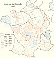
 R-Exemple Taux evolution population departement france 1900-1999.png 847 × 837; 98 KB
-
 Rapport jeunes vieux 99.jpg 3,508 × 4,957; 1.45 MB
-
 Statistique de la Population Francaise by Adolphe d'Angeville, 1836.jpg 1,527 × 1,936; 3.76 MB
-
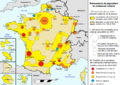
 Typologie des campagnes françaises.png 960 × 2,570; 1.38 MB
-
 Unités urbaines Fra. 2016.png 2,063 × 2,761; 926 KB
-
 Villes du Massif central.png 3,326 × 4,673; 1.67 MB
-
 Yvelines densitéW.svg 2,489 × 3,099; 588 KB


.jpg)
.jpg)


.png)


