Category:Dawley Hamlets
Jump to navigation
Jump to search
English: Dawley Hamlets is a civil parish in the Telford and Wrekin district, in the county of Shropshire, England.
civil parish in Shropshire, United Kingdom | |||||
| Upload media | |||||
| Instance of | |||||
|---|---|---|---|---|---|
| Location | Telford and Wrekin, Shropshire, West Midlands, England | ||||
| Population |
| ||||
 | |||||
Subcategories
This category has the following 5 subcategories, out of 5 total.
Media in category "Dawley Hamlets"
The following 78 files are in this category, out of 78 total.
-
 24, Pool View, Dawley - geograph.org.uk - 6792616.jpg 2,448 × 1,836; 1.83 MB
-
 Anderson Shelter in the garden of a house - geograph.org.uk - 6794526.jpg 1,306 × 979; 772 KB
-
 Approaching a double signal - geograph.org.uk - 3039727.jpg 1,024 × 768; 169 KB
-

-

-
 Cab of "Rocket", Telford Steam Railway - geograph.org.uk - 2055783.jpg 600 × 800; 117 KB
-
 Canal aqueduct over a footpath - geograph.org.uk - 6989549.jpg 2,448 × 3,264; 2.11 MB
-
 Castlefield Island - geograph.org.uk - 1746075.jpg 640 × 480; 415 KB
-
 Cheshire Cheese on Doseley Road - geograph.org.uk - 4897583.jpg 1,200 × 799; 218 KB
-
 Cheshire Cheese on Doseley Road - geograph.org.uk - 4897584.jpg 999 × 1,200; 269 KB
-

-
 Development site - geograph.org.uk - 4280019.jpg 640 × 480; 123 KB
-
 Doseley Halt.png 903 × 508; 987 KB
-
 Doseley Road under the railway bridge - geograph.org.uk - 4921288.jpg 1,142 × 857; 495 KB
-

-
 Former shop on Holly Road, Little Dawley - geograph.org.uk - 4897724.jpg 1,200 × 799; 362 KB
-
 George VI postbox on Holly Road, Little Dawley - geograph.org.uk - 4897731.jpg 799 × 1,200; 340 KB
-
 Griffiths Avenue, Doseley Park - geograph.org.uk - 4897608.jpg 1,200 × 799; 321 KB
-
 Holly Road Benchmark - geograph.org.uk - 6940308.jpg 960 × 540; 119 KB
-
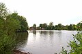 Horsehay Pool - geograph.org.uk - 2053535.jpg 800 × 531; 97 KB
-
 Horsehay Water Pumping Station - geograph.org.uk - 7116603.jpg 875 × 1,024; 394 KB
-
 Horsehay Works Offices - geograph.org.uk - 905905.jpg 640 × 480; 100 KB
-
 Horsehay Works Offices, Dawley - geograph.org.uk - 6794514.jpg 2,938 × 2,203; 1.79 MB
-
 Houses on Holly Road, Little Dawley - geograph.org.uk - 4897726.jpg 1,200 × 799; 372 KB
-
 Housing development - Lightmoor - geograph.org.uk - 1851478.jpg 845 × 634; 184 KB
-
 Junction on the Telford Steam Railway - geograph.org.uk - 3040551.jpg 1,024 × 768; 151 KB
-
 Large hut, Telford Steam Railway - geograph.org.uk - 2055085.jpg 3,039 × 2,004; 524 KB
-
 Lawley Gate Well - geograph.org.uk - 6909942.jpg 1,024 × 683; 257 KB
-
 Lawley Gates Benchmark - geograph.org.uk - 6909953.jpg 1,024 × 683; 145 KB
-
 Level crossing - geograph.org.uk - 4280010.jpg 640 × 480; 98 KB
-
 Lightmoor Platform Bridge.png 910 × 512; 737 KB
-
 Little Dawley Canal Bridge - geograph.org.uk - 292990.jpg 480 × 640; 99 KB
-
 Little Dawley Rivet Benchmark - geograph.org.uk - 7345897.jpg 1,024 × 706; 211 KB
-
 Model railway ^ tea rooms, Fence Road - geograph.org.uk - 2055686.jpg 800 × 600; 173 KB
-
 New private housing in Lawley - geograph.org.uk - 3399964.jpg 3,488 × 2,616; 2.01 MB
-
 New Row Cottages - geograph.org.uk - 6792455.jpg 2,481 × 1,860; 1.92 MB
-
 Old Row Cottages - geograph.org.uk - 6792451.jpg 2,285 × 1,714; 1.8 MB
-
 OS benchmark - Aqueduct, Methodist Hall - geograph.org.uk - 4648482.jpg 857 × 1,142; 598 KB
-

-
 OS benchmark - Horsehay Methodist Chapel - geograph.org.uk - 4362791.jpg 857 × 1,142; 503 KB
-
 OS benchmark - Horsehay, house on Frame Lane - geograph.org.uk - 4888179.jpg 857 × 1,142; 500 KB
-

-
 Outbuilding of Stocking Farm - geograph.org.uk - 1852819.jpg 680 × 510; 173 KB
-
 Private housing in Lawley - geograph.org.uk - 3399968.jpg 3,488 × 2,616; 2.2 MB
-
 Railway bridge ^ platform - geograph.org.uk - 2840482.jpg 2,472 × 1,704; 487 KB
-
 Rear view of Old Row Cottages - geograph.org.uk - 6794506.jpg 2,774 × 2,081; 1.83 MB
-
 Remains of Lightmoor Furnaces - geograph.org.uk - 6426174.jpg 2,285 × 1,714; 2.21 MB
-
 Sculpture and pool at Dawley - geograph.org.uk - 1927345.jpg 717 × 480; 179 KB
-

-
 Single signal, Telford Steam Railway - geograph.org.uk - 3040543.jpg 1,024 × 768; 177 KB
-
 South along Cullis Drive, Lightmoor Village - geograph.org.uk - 6871400.jpg 1,795 × 1,346; 641 KB
-
 St Luke's House, Doseley - geograph.org.uk - 4897603.jpg 1,200 × 799; 588 KB
-
 St Paul's Benchmark, Aqueduct - geograph.org.uk - 6907131.jpg 576 × 1,024; 262 KB
-

-

-
 Steam tramway, Telford Steam Railway - geograph.org.uk - 2055075.jpg 800 × 533; 197 KB
-
 Telford Steam Railway - entrance - geograph.org.uk - 2053820.jpg 800 × 533; 139 KB
-
 Telford Steam Railway - geograph.org.uk - 5649040.jpg 3,323 × 2,209; 2.59 MB
-
 Telford Steam Railway - geograph.org.uk - 6140954.jpg 640 × 480; 64 KB
-
 Telford Steam Railway - geograph.org.uk - 6140967.jpg 640 × 480; 71 KB
-
 Telford Steam Railway - sign at entrance - geograph.org.uk - 2053837.jpg 533 × 800; 124 KB
-

-

-

-
 Telford Steam Railway at Spring Village - geograph.org.uk - 2055114.jpg 800 × 600; 138 KB
-

-
 Telford Steam Railway loco shed - geograph.org.uk - 2053987.jpg 800 × 525; 109 KB
-

-
 Telford Steam Railway tram shed - geograph.org.uk - 2053897.jpg 800 × 532; 128 KB
-
 The byway towards Lawley - geograph.org.uk - 1929288.jpg 767 × 594; 199 KB
-

-

-
 War Memorial at Dawley Parva - geograph.org.uk - 4897641.jpg 799 × 1,200; 413 KB
-
 War Memorial at Dawley Parva - geograph.org.uk - 4897647.jpg 1,200 × 748; 443 KB
-
 War memorial on Holly Road, Little Dawley - geograph.org.uk - 4897711.jpg 1,200 × 799; 411 KB
-
 War memorial on Holly Road, Little Dawley - geograph.org.uk - 4897715.jpg 1,200 × 799; 432 KB
-
 Wesleyan Chapel, Little Dawley.jpg 799 × 1,200; 269 KB
-


,_Telford_Steam_Railway_-_geograph.org.uk_-_2056861.jpg)
,_Telford_Steam_Railway_-_geograph.org.uk_-_2056874.jpg)


