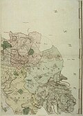
Category:Davis (1797) Map of the County of Oxford
Appearance
18th century map | |||||
| Upload media | |||||
| Instance of | |||||
|---|---|---|---|---|---|
| Depicts | Oxford and Oxfordshire | ||||
| Creator |
| ||||
| Full work available at URL | |||||
| Inception |
| ||||
| Publication date |
| ||||
| |||||
See the gallery page, to view the sheets arranged in order.
Pages in category "Davis (1797) Map of the County of Oxford"
This category contains only the following page.
Media in category "Davis (1797) Map of the County of Oxford"
The following 16 files are in this category, out of 16 total.
-
Bodleian Libraries, Title of Davis' map of Oxfordshire.jpg 571 × 796; 52 KB
-
Bodleian Libraries, A map of the County of Oxford 1.jpg 581 × 800; 76 KB
-
Bodleian Libraries, A map of the County of Oxford 28.jpg 576 × 793; 41 KB
-
Bodleian Libraries, A map of the County of Oxford 19.jpg 579 × 796; 49 KB
-
Bodleian Libraries, A map of the County of Oxford 12.jpg 573 × 812; 94 KB
-
Bodleian Libraries, A map of the County of Oxford 4.jpg 579 × 814; 117 KB
-
Bodleian Libraries, A map of the County of Oxford 5.jpg 577 × 814; 101 KB
-
Bodleian Libraries, A map of the County of Oxford 65.jpg 571 × 809; 41 KB
-
Bodleian Libraries, A map of the County of Oxford 26.jpg 585 × 813; 85 KB
-
Bodleian Libraries, A map of the County of Oxford 51.jpg 579 × 806; 70 KB
-
Bodleian Libraries, A map of the County of Oxford 3.jpg 577 × 810; 93 KB
-
Bodleian Libraries, A map of the County of Oxford 33.jpg 574 × 798; 78 KB
-
Bodleian Libraries, A map of the County of Oxford 10.jpg 568 × 795; 204 KB
-
Bodleian Libraries, A map of the County of Oxford 11.jpg 574 × 796; 86 KB
-
Bodleian Libraries, A map of the County of Oxford 44.jpg 577 × 789; 60 KB
-
Bodleian Libraries, A map of the County of Oxford 30.jpg 582 × 806; 86 KB


