Category:Bodleian Maps Collection
Jump to navigation
Jump to search
Subcategories
This category has the following 8 subcategories, out of 8 total.
Media in category "Bodleian Maps Collection"
The following 200 files are in this category, out of 347 total.
(previous page) (next page)-
 Bodleian Libraries, A Generall Mapp of The County of Oxford.jpg 672 × 1,000; 138 KB
-
 Bodleian Libraries, A Map of Berkshire.jpg 1,000 × 675; 112 KB
-
 Bodleian Libraries, A map of Gageingwell in the County of Oxon.jpg 790 × 1,000; 96 KB
-
 Bodleian Libraries, A Map of Oxfordshire.jpg 900 × 675; 177 KB
-
 Bodleian Libraries, A Map of PortMeadow , 169499.jpg 1,000 × 675; 176 KB
-
 Bodleian Libraries, A map of the County of Oxford.jpg 675 × 992; 120 KB
-
 Bodleian Libraries, A Mapp of Buckinghamshire with its Hundreds.jpg 675 × 992; 150 KB
-
 Bodleian Libraries, A New Exact Survey of the River Dee or ChesterWater.jpg 1,000 × 693; 89 KB
-
 Bodleian Libraries, A New Map of Barkshire.jpg 1,000 × 675; 159 KB
-
 Bodleian Libraries, A New Map of Oxfordshire divided into its Hundreds.jpg 672 × 1,000; 106 KB
-
 Bodleian Libraries, A new map of the County of Oxford by Charles Smith, 1801.jpg 672 × 1,000; 111 KB
-

-

-
 Bodleian Libraries, A Plan of Charlbury and Walcott Estates, 1761.jpg 1,000 × 660; 103 KB
-
 Bodleian Libraries, A plan of the City of Oxford eastern half.jpg 672 × 960; 116 KB
-
 Bodleian Libraries, A plan of the City of Oxford western half.jpg 672 × 960; 143 KB
-
 Bodleian Libraries, A sketch of the soil of Sussex.jpg 976 × 488; 86 KB
-

-
 Bodleian Libraries, Aberdeen.jpg 1,000 × 647; 102 KB
-
 Bodleian Libraries, Abingdon.jpg 1,000 × 675; 160 KB
-
 Bodleian Libraries, Africa 18.jpg 880 × 660; 129 KB
-
 Bodleian Libraries, Africa 24.jpg 1,000 × 675; 155 KB
-
 Bodleian Libraries, Africa 31.jpg 1,000 × 675; 92 KB
-
 Bodleian Libraries, Africa 73.jpg 675 × 992; 85 KB
-
 Bodleian Libraries, Africa.jpg 1,000 × 675; 217 KB
-
 Bodleian Libraries, Agas map of Oxford, 1578.jpg 1,000 × 675; 154 KB
-

-

-

-
 Bodleian Libraries, An Accurate Map of Oxfordshire.jpg 672 × 1,000; 175 KB
-
 Bodleian Libraries, Antwerp- panoramic view, 1594.jpg 794 × 1,000; 141 KB
-
 Bodleian Libraries, Area of the Comes Africae.jpg 672 × 1,000; 119 KB
-
 Bodleian Libraries, Area of the Comes Argentoratensis.jpg 672 × 1,000; 116 KB
-
 Bodleian Libraries, Area of the Comes Britanniae.jpg 672 × 1,000; 109 KB
-
 Bodleian Libraries, Area of the Comes Italiae.jpg 672 × 1,000; 126 KB
-
 Bodleian Libraries, Area of the Comes limitis Aegypti.jpg 672 × 1,000; 118 KB
-
 Bodleian Libraries, Area of the Comes Litoris Saxonici per Britanniam.jpg 672 × 1,000; 121 KB
-
 Bodleian Libraries, Area of the Comes per Isaurium.jpg 672 × 1,000; 116 KB
-
 Bodleian Libraries, Area of the Comes Tingitaniae.jpg 672 × 1,000; 111 KB
-
 Bodleian Libraries, Area of the Ducis et Praesidis provinciae Mauritaniae.jpg 672 × 1,000; 121 KB
-
 Bodleian Libraries, Area of the Dux Arabiae.jpg 672 × 1,000; 115 KB
-
 Bodleian Libraries, Area of the Dux Armeniae.jpg 672 × 1,000; 111 KB
-
 Bodleian Libraries, Area of the Dux Belgicae Secundae.jpg 672 × 1,000; 119 KB
-
 Bodleian Libraries, Area of the Dux Britanniarum.jpg 672 × 1,000; 124 KB
-
 Bodleian Libraries, Area of the Dux Daciae Ripensis.jpg 672 × 1,000; 118 KB
-
 Bodleian Libraries, Area of the Dux Fenicis.jpg 672 × 1,000; 114 KB
-
 Bodleian Libraries, Area of the Dux Mesopotamiae.jpg 672 × 1,000; 120 KB
-
 Bodleian Libraries, Area of the Dux Moesiae Primae.jpg 672 × 1,000; 115 KB
-
 Bodleian Libraries, Area of the Dux Moesiae Secundae.jpg 672 × 1,000; 116 KB
-
 Bodleian Libraries, Area of the Dux Mogonciacensis.jpg 672 × 1,000; 125 KB
-
 Bodleian Libraries, Area of the Dux Osrhoenae.jpg 672 × 1,000; 110 KB
-
 Bodleian Libraries, Area of the Dux Palestinae.jpg 672 × 1,000; 117 KB
-
 Bodleian Libraries, Area of the Dux Pannoniae primae, et Norici ripensis.jpg 672 × 1,000; 116 KB
-

-
 Bodleian Libraries, Area of the Dux Provinciae Sequanaci.jpg 672 × 1,000; 107 KB
-
 Bodleian Libraries, Area of the Dux Provinciae Tripolitanae.jpg 672 × 1,000; 119 KB
-
 Bodleian Libraries, Area of the Dux provinciae Valeriae ripensis.jpg 672 × 1,000; 126 KB
-
 Bodleian Libraries, Area of the Dux Raetiae.jpg 672 × 1,000; 117 KB
-
 Bodleian Libraries, Area of the Dux Scythiae.jpg 672 × 1,000; 112 KB
-
 Bodleian Libraries, Area of the Dux Syriae.jpg 672 × 1,000; 110 KB
-
 Bodleian Libraries, Area of the Dux Thebaidos.jpg 672 × 1,000; 116 KB
-
 Bodleian Libraries, Area of the Dux tractus Armoricani.jpg 672 × 1,000; 115 KB
-
 Bodleian Libraries, Area of the Vicarii Britanniarum.jpg 672 × 1,000; 119 KB
-
 Bodleian Libraries, Barkeshire.jpg 1,000 × 675; 149 KB
-
 Bodleian Libraries, Basic TO map 60.jpg 672 × 1,000; 165 KB
-
 Bodleian Libraries, Basic TO map 64.jpg 672 × 1,000; 151 KB
-
 Bodleian Libraries, Basic TO map and a schematic map.jpg 672 × 1,000; 171 KB
-
 Bodleian Libraries, Basic TO map and a slightly more elaborate TO map.jpg 1,000 × 675; 136 KB
-
 Bodleian Libraries, Basic TO map.jpg 672 × 1,000; 140 KB
-
 Bodleian Libraries, Bedfordiensis comitatvs anglis Bedfordshire.jpg 1,000 × 675; 160 KB
-

-
 Bodleian Libraries, Berwick upon Tweed.jpg 1,000 × 680; 92 KB
-
 Bodleian Libraries, Blenheim and Woodstock.jpg 1,000 × 654; 108 KB
-
 Bodleian Libraries, Bononia Docet Mater Studiorum.jpg 1,000 × 675; 189 KB
-
 Bodleian Libraries, Bristol Channel.jpg 1,000 × 689; 112 KB
-
 Bodleian Libraries, Buckingham area map 45.jpg 992 × 672; 150 KB
-
 Bodleian Libraries, Buckingham area map.jpg 992 × 672; 152 KB
-
 Bodleian Libraries, Buckingham Both Shyre and Shiretowne describ.jpg 992 × 672; 155 KB
-
 Bodleian Libraries, Buckingham.jpg 992 × 672; 139 KB
-
 Bodleian Libraries, Buckinghamshire by Herman Moll.jpg 672 × 1,000; 142 KB
-

-
 Bodleian Libraries, Carryingcase for portolan codex.jpg 1,000 × 675; 154 KB
-
 Bodleian Libraries, Carta quinta generale di Europa.jpg 1,000 × 675; 114 KB
-
 Bodleian Libraries, Cary's Improved map of England.jpg 992 × 672; 171 KB
-
 Bodleian Libraries, Central Scotland.jpg 672 × 1,000; 139 KB
-

-
 Bodleian Libraries, Chart of Land's End, The Lizard and the Scilly Isles.jpg 1,000 × 708; 119 KB
-
 Bodleian Libraries, Chester.jpg 1,000 × 808; 123 KB
-
 Bodleian Libraries, Circular World zoned map.jpg 1,000 × 675; 113 KB
-
 Bodleian Libraries, City of Oxford, 19401941, lower half of map.jpg 1,000 × 675; 145 KB
-
 Bodleian Libraries, City of Oxford, 19401941, upper half of map.jpg 1,000 × 675; 152 KB
-
-
 Bodleian Libraries, City of Oxford- closeup of the city centre from the west.jpg 672 × 1,000; 136 KB
-
-

-
 Bodleian Libraries, Crawley.jpg 1,000 × 675; 180 KB
-
 Bodleian Libraries, Description of Poole Harbour and its tides.jpg 672 × 992; 84 KB
-
 Bodleian Libraries, Diagram of elements and climates.jpg 672 × 1,000; 189 KB
-
 Bodleian Libraries, Drink Map of Oxford 1883.jpg 1,000 × 675; 77 KB
-
 Bodleian Libraries, Dungeness.jpg 1,000 × 685; 91 KB
-
 Bodleian Libraries, East China Sea and Formosa Strait by John Thornton, 1701.jpg 672 × 1,000; 115 KB
-
 Bodleian Libraries, Edward Wright, Chart of the World.jpg 1,000 × 675; 171 KB
-
 Bodleian Libraries, Elaborate TO map.jpg 672 × 1,000; 162 KB
-
 Bodleian Libraries, England, Wales and Ireland.jpg 1,000 × 675; 174 KB
-

-

-

-

-

-

-
 Bodleian Libraries, Falmouth with Pendennis Castle seen from the sea.jpg 1,000 × 660; 94 KB
-
 Bodleian Libraries, Firth of Forth.jpg 703 × 1,000; 116 KB
-
 Bodleian Libraries, Formosa Strait by Anon Dutch, early 18th century.jpg 1,000 × 675; 126 KB
-
 Bodleian Libraries, Front cover of a Venetian illuminated portolan codex.jpg 1,000 × 675; 106 KB
-
 Bodleian Libraries, Geological Survey of England and Wales- Oxford.jpg 1,000 × 675; 142 KB
-

-

-
 Bodleian Libraries, Gulf of Guinea 23.jpg 1,000 × 675; 138 KB
-
 Bodleian Libraries, Gulf of Guinea 32.jpg 1,000 × 675; 117 KB
-
 Bodleian Libraries, Gulf of Guinea 8.jpg 1,000 × 675; 91 KB
-
 Bodleian Libraries, Gulf of Guinea 9.jpg 992 × 672; 93 KB
-
 Bodleian Libraries, Gulf of Guinea.jpg 1,000 × 675; 153 KB
-

-
 Bodleian Libraries, Horsham from the Ordnance Survey.jpg 672 × 1,000; 98 KB
-
 Bodleian Libraries, How these severall lands show at sea.jpg 1,000 × 704; 89 KB
-
 Bodleian Libraries, Hungaria Regnum.jpg 1,000 × 781; 127 KB
-
 Bodleian Libraries, Island of Rhodes.jpg 1,000 × 675; 105 KB
-
 Bodleian Libraries, Isola de Candia Map of Crete.jpg 1,000 × 675; 119 KB
-
 Bodleian Libraries, Johannes Hevelius, the surface of the Moon.jpg 1,000 × 675; 156 KB
-
 Bodleian Libraries, John White, Americae pars, Nunc Virginia dicta.jpg 1,000 × 675; 176 KB
-

-
 Bodleian Libraries, Leighton Buzzard.jpg 1,000 × 675; 169 KB
-
-
 Bodleian Libraries, Lion, unicorn and garter above sea battle.jpg 1,000 × 753; 113 KB
-
 Bodleian Libraries, Loggan's map of Oxford after the Civil War.jpg 1,000 × 675; 173 KB
-
 Bodleian Libraries, Mandorla Mappa Mundi.jpg 1,000 × 675; 170 KB
-
 Bodleian Libraries, Map of Acre.jpg 1,000 × 675; 115 KB
-
 Bodleian Libraries, Map of Africa as Matthias Quaden's Aphrica.jpg 1,000 × 675; 240 KB
-

-
 Bodleian Libraries, Map of Crete- detail with Citta de Canea.jpg 1,000 × 675; 111 KB
-
 Bodleian Libraries, Map of Crete- detail with Citta di Rettimo.jpg 1,000 × 675; 114 KB
-
 Bodleian Libraries, Map of Crete- detail with Citta Vecchia.jpg 1,000 × 675; 116 KB
-
 Bodleian Libraries, Map of Crete- detail with Fortezza delle Garabuse.jpg 1,000 × 675; 102 KB
-
 Bodleian Libraries, Map of Crete- detail with Fortezza di Paleocastro.jpg 1,000 × 675; 100 KB
-
 Bodleian Libraries, Map of Crete- detail with Fortezza di Spinalunga.jpg 1,000 × 675; 118 KB
-
 Bodleian Libraries, Map of Crete- detail with Scoglio di S Todero.jpg 1,000 × 675; 105 KB
-
 Bodleian Libraries, Map of England and Wales.jpg 675 × 992; 150 KB
-

-
 Bodleian Libraries, Map of Hamburg as Matthias Merian's Hamburgum.jpg 1,000 × 675; 182 KB
-
 Bodleian Libraries, Map of Ireland.jpg 1,000 × 675; 144 KB
-
 Bodleian Libraries, Map of Laxton- central area.jpg 1,000 × 675; 118 KB
-

-
 Bodleian Libraries, Map of Laxton- Kneesall Mill Field.jpg 1,000 × 675; 120 KB
-
 Bodleian Libraries, Map of Laxton- land southeast of Kneesall village.jpg 1,000 × 675; 111 KB
-
 Bodleian Libraries, Map of Laxton- northwest corner.jpg 1,000 × 675; 116 KB
-
 Bodleian Libraries, Map of Laxton- Owld Park (south of Kneesall).jpg 1,000 × 675; 126 KB
-
 Bodleian Libraries, Map of Laxton- southwest corner.jpg 1,000 × 675; 130 KB
-
 Bodleian Libraries, Map of Laxton- western edge of map.jpg 1,000 × 675; 105 KB
-
 Bodleian Libraries, Map of Oxford.jpg 1,000 × 675; 100 KB
-
-

-

-
 Bodleian Libraries, Map of Palestine.jpg 1,000 × 675; 153 KB
-
 Bodleian Libraries, Map of the Bay of Biscay.jpg 1,000 × 675; 168 KB
-
 Bodleian Libraries, Map of the County of Buckingham.jpg 672 × 1,000; 138 KB
-
 Bodleian Libraries, Map of the Middle East.jpg 1,000 × 675; 125 KB
-

-

-
 Bodleian Libraries, Map of the north coast of France.jpg 672 × 1,000; 167 KB
-

-

-
 Bodleian Libraries, Map of the World in two hemispheres.jpg 936 × 780; 121 KB
-
 Bodleian Libraries, Map of the World.jpg 1,000 × 675; 149 KB
-
 Bodleian Libraries, Map- æThe Countie Palatine of ChesterÆ.jpg 1,000 × 770; 147 KB
-
 Bodleian Libraries, Mappa Mundi and text.jpg 687 × 1,000; 116 KB
-
 Bodleian Libraries, Mappa Mundi by Petrus Vesconte.jpg 1,818 × 1,228; 641 KB
-
 Bodleian Libraries, Mappa Mundi.jpg 1,000 × 675; 124 KB
-
 Bodleian Libraries, Mappemonde de Merino Sanuto.jpg 1,000 × 675; 108 KB
-
Bodleian Libraries, Mappemonde(KenBurns).webm 4.0 s, 1,000 × 675; 860 KB
-
 Bodleian Libraries, Mappemonde.jpg 1,000 × 675; 142 KB
-
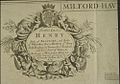 Bodleian Libraries, MilfordHaven.jpg 1,000 × 697; 103 KB
-

-
 Bodleian Libraries, North east Oxford, 1876.jpg 1,000 × 675; 163 KB
-
 Bodleian Libraries, North east Oxford, with River Cherwell.jpg 1,000 × 675; 106 KB
-
-
 Bodleian Libraries, Northamptoniae comitatvs descriptio.jpg 1,000 × 675; 185 KB
-
 Bodleian Libraries, Northern celestial hemisphere.jpg 936 × 780; 115 KB
-
-
 Bodleian Libraries, Oksford.jpg 765 × 1,000; 96 KB
-
 Bodleian Libraries, Orkneys.jpg 1,000 × 701; 102 KB
-
 Bodleian Libraries, Oxford 72.jpg 1,000 × 675; 120 KB
-

-
 Bodleian Libraries, Oxford area map.jpg 1,000 × 675; 167 KB
-

-
 Bodleian Libraries, Oxford city plan.jpg 1,000 × 675; 172 KB
-
 Bodleian Libraries, Oxford From the Ordnance Survey.jpg 1,000 × 675; 111 KB
-
 Bodleian Libraries, Oxford Local Board Plan of Main and Street Drainage.jpg 1,000 × 675; 81 KB
-
 Bodleian Libraries, Oxford Shire By Robt Morden.jpg 672 × 1,000; 148 KB
-
 Bodleian Libraries, Oxford.jpg 914 × 1,000; 181 KB
-


.jpg)


_to_Caiphas_(Haifa)_the_River_Jordan_running_from_the_Sea_of_G.jpg)


ties_forces,_an_1644.jpg)